Settala
| Settala | |
|---|---|
| Comune | |
| Comune di Settala | |
 Settala Location of Settala in Italy | |
| Coordinates: 45°27′N 9°23′E / 45.450°N 9.383°ECoordinates: 45°27′N 9°23′E / 45.450°N 9.383°E | |
| Country | Italy |
| Region | Lombardy |
| Metropolitan city | Milan (MI) |
| Frazioni | Premenugo, Caleppio |
| Area | |
| • Total | 17.5 km2 (6.8 sq mi) |
| Population (Dec. 2004) | |
| • Total | 6,460 |
| • Density | 370/km2 (960/sq mi) |
| Demonym(s) | Settalesi |
| Time zone | UTC+1 (CET) |
| • Summer (DST) | UTC+2 (CEST) |
| Postal code | 20090 |
| Dialing code | 02 |
| Website | Official website |
Settala (Lombard: Settara [seˈtɑːra]) is a comune (municipality) in the Province of Milan in the Italian region Lombardy, located about 15 kilometres (9 mi) east of Milan. As of 31 December 2004, it had a population of 6,460 and an area of 17.5 square kilometres (6.8 sq mi).[1]
The municipality of Settala contains the frazioni (subdivisions, mainly villages and hamlets) Premenugo and Caleppio.
Settala borders the following municipalities: Vignate, Rodano, Liscate, Comazzo, Merlino, Pantigliate, Paullo, Mediglia.
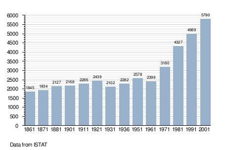
Demographic evolution
References
External links

This article is issued from
Wikipedia.
The text is licensed under Creative Commons - Attribution - Sharealike.
Additional terms may apply for the media files.