Sesvenna Alps
| Sesvenna Alps | |
|---|---|
 Piz Sesvenna (right) | |
| Highest point | |
| Peak | Piz Sesvenna |
| Elevation | 3,221 m (10,568 ft) |
| Coordinates | 46°42′21″N 10°24′10″E / 46.70583°N 10.40278°ECoordinates: 46°42′21″N 10°24′10″E / 46.70583°N 10.40278°E |
| Geography | |
.jpg) Location of the Sesvenna Alps.
The borders of the range according to Alpine Club classification of the Eastern Alps | |
| Countries | Switzerland, Italy and Austria |
| States | Graubünden, South Tyrol and Tyrol (state) |
| Parent range | Central Eastern Alps |
The Sesvenna Alps are a mountain range located in the Alps of eastern Switzerland, northern Italy and western Austria. They are considered to be part of the Central Eastern Alps.
The Sesvenna Alps are separated from the Silvretta Alps in the north and the Albula Alps in the west by the Lower Engadin valley; from the Livigno Alps in the south-west by the Ofen Pass and Val Müstair; from the Ötztal Alps in the east by the upper Adige valley and the Reschen Pass.
Peaks
The main peaks of the Sesvenna Alps are:
| Peak | Elevation | |
|---|---|---|
| m | ft | |
| Piz Sesvenna | 3221 | 10,568 |
| Piz Pisoc | 3178 | 10,427 |
| Piz Plavna Dadaint | 3168 | 10,394 |
| Piz Plavna Dadaint | 3166 | 10,387 |
| Piz Nuna | 3124 | 10,249 |
| Piz Minger | 3114 | 10,217 |
| Piz Lischana | 3110 | 10,204 |
| Piz Madlain | 3099 | 10,167 |
| Piz Cristanas | 3092 | 10,144 |
| Piz Laschadurella | 3046 | 9,993 |
| Piz d'Arpiglias | 3027 | 9,931 |
| Piz Terza | 2909 | 9,544 |
| Piz Macun | 2889 | 9,478 |
| Piz Lad | 2808 | 9,213 |
Passes
The main passes of the Sesvenna Alps are:
| Mountain pass | location 1 | type | Elevation | |
|---|---|---|---|---|
| m | ft | |||
| Fuorcla Sesvenna | S-charl to Mals | foot path | 2824 | 9265 |
| Schlinig Pass | Sent to Mals | bridle path | 2301 | 7549 |
| S-charl Pass | S-charl to Taufers | bridle path | 2296 | 7532 |
| Ofen Pass | Zernez to Val Müstair | road | 2155 | 7070 |
Gallery
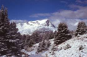 Piz Lad
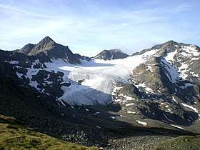
 Pasture below Fuorcla Sesvenna
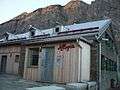 Lischanahütte near Piz Lischana
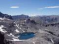
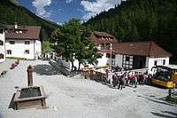 The village of S-charl
See also

This article is issued from
Wikipedia.
The text is licensed under Creative Commons - Attribution - Sharealike.
Additional terms may apply for the media files.