Ötztal Alps
| Ötztal Alps | |
|---|---|
 | |
| Highest point | |
| Peak | Wildspitze |
| Elevation | 3,774 m (12,382 ft) |
| Coordinates | 46°53′49″N 10°52′31″E / 46.89694°N 10.87528°E |
| Geography | |
.png) Location of Ötztal Alps (highlighted in red).
| |
| Countries | Austria and Italy |
| Range coordinates | 46°45′N 10°55′E / 46.750°N 10.917°ECoordinates: 46°45′N 10°55′E / 46.750°N 10.917°E |
| Parent range | Central Eastern Alps |
| Borders on | Stubai Alps |
The Ötztal Alps (Italian: Alpi Venoste, German: Ötztaler Alpen) are a mountain range in the Central Eastern Alps, in the State of Tyrol in southern Austria and the Province of South Tyrol in northern Italy.
Geography
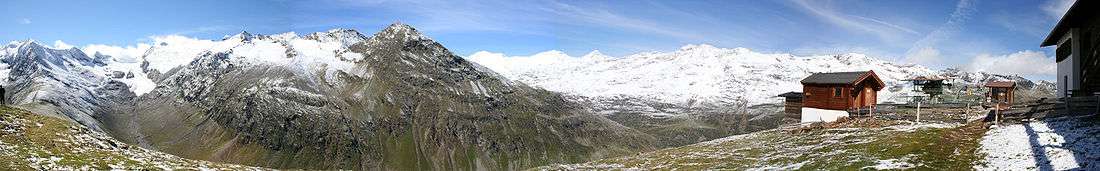
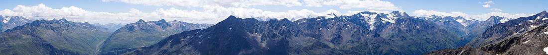
The Ötztal Alps are arrayed at the head of the Ötztal valley, a side valley of the Inn river southwest of Innsbruck, Austria. One line of summits forms part of the border between Austria and Italy.
The Ötztal Alps are bordered by the Reschen Pass (1504 m) in the west and the Inn river in the northwest and north. In the east the range is separated from the Stubai Alps by the Ötztaler Ache in the Ötztal, the Timmelsjoch (2474 m) and the Passer river in the Passeier Valley. On the south and southwest, the range is limited by the deep valley of the Etsch river, here known as the Vinschgau.
In September 1991, Ötzi the so-called "Iceman" was found on the Hauslabjoch between the peaks Fineilspitze and Similaun.
Peaks
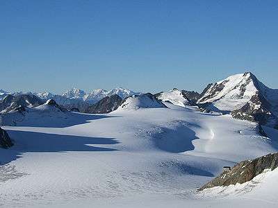
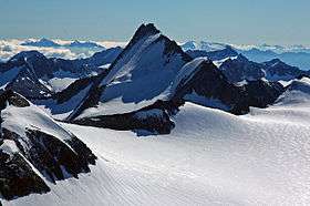
The highest point of the Ötztal Alps is Wildspitze 3,774 metres (12,382 ft), which is also the second highest mountain in Austria (after Großglockner). Wildspitze is on one of several arms that extend north and northeast from the main ridge.
Some of the main peaks of the Ötztal Alps are:
| Peak | Elevation | |
|---|---|---|
| m | ft | |
| Wildspitze | 3,774 | 12,382 |
| Weißkugel | 3,739 | 12,267 |
| Hintere Schwärze | 3,628 | 11,903 |
| Similaun | 3,603 | 11,821 |
| Ramolkogel | 3,551 | 11,651 |
| Schalfkogel | 3,540 | 11,614 |
| Hochvernagtspitze | 3,535 | 11,598 |
| Watzespitze | 3,533 | 11,591 |
| Weißseespitze | 3,518 | 11,542 |
| Fineilspitze | 3,514 | 11,529 |
| Hochwilde | 3,480 | 11,417 |
| Hinterer Seelenkogel | 3,472 | 11,391 |
| Bliggspitze | 3,454 | 11,332 |
| Lagaunspitze | 3,439 | 11,283 |
| Hochfirst | 3,403 | 11,237 |
| Verpeilspitze | 3,425 | 11,165 |
| Hohe Geige | 3,395 | 11,138 |
| Glockturm | 3,355 | 11,007 |
| Rofelewand | 3,353 | 11,001 |
Passes
The main mountain passes of the Ötztal Alps are:
| Mountain pass | location | type | elevation (m/ft) | |
|---|---|---|---|---|
| Gepatschjoch | Vent to the Kaunertal | snow | 3243 | 10,640 |
| Ramoljoch | Vent to Gurgl | snow | 3194 | 10,479 |
| Langtaufererjoch | Vent to the Reschen Pass | snow | 3167 | 10,391 |
| Gurgler Eisjoch | Gurgl to Schnals | snow | 3137 | 10,292 |
| Langthalerjoch | Gurgl to Pfelders-Plan | snow | 3058 | 10,033 |
| Niederjoch | Vent to Schnals | snow | 3017 | 9899 |
| Pitztalerjöchl | Mittelberg (Pitztal) to Sölden | snow | 2995 | 9826 |
| Eisjöchl am Bild | Pfelders to Schnals | snow | 2908 | 9541 |
| Venter Hochjoch | Vent to Kurzras | snow | 2885 | 9465 |
| Timmelsjoch (Passo del Rombo) | Sölden to Meran | road | 2509 | 8232 |
| Reschen Pass (Passo di Resia) | Landeck to Meran | road | 1494 | 4902 |
See also
| Wikimedia Commons has media related to Ötztal Alps. |
