Santana do Ipanema
| Santana do Ipanema | |||
|---|---|---|---|
| Municipality | |||
| |||
| Nickname(s): Princesinha do Sertão (Little Princess of the Sertão) | |||
 Location of Santana do Ipanema in the State of Alagoas | |||
 Santana do Ipanema Location in Brazil | |||
| Coordinates: 09°22′40″S 37°14′42″W / 9.37778°S 37.24500°WCoordinates: 09°22′40″S 37°14′42″W / 9.37778°S 37.24500°W | |||
| Country | Brazil | ||
| State | Alagoas | ||
| Founded | April 24, 1875 | ||
| Government | |||
| • Mayor | Isnaldo Bulhoes Barros (PMDB) | ||
| Area | |||
| • Total | 437.847 km2 (169.054 sq mi) | ||
| Population (2010) | |||
| • Total | 45,453 | ||
| • Density | 103.81/km2 (268.9/sq mi) | ||
| Demonym(s) | santanense | ||
| Website | Official website | ||


Santana do Ipanema is a municipality in the western half of the Brazilian state of Alagoas. It was founded in 1875 on the banks of the Ipanema river.
Its population was 44,866 (2005) and its area is 438 km².[1]
References
Capital: Maceió | ||
| Arapiraca | 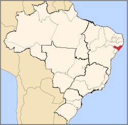 | |
| Palmeira dos Índios | ||
| Traipu | ||
| Litoral Norte Alagoano | ||
| Maceió | ||
| Mata Alagoana | ||
| Penedo | ||
| São Miguel dos Campos | ||
| Serrana dos Quilombos | ||
| Alagoana do Sertão do São Francisco | ||
| Batalha | ||
| Santana do Ipanema | ||
| Serrana do Sertão Alagoano | ||
This article is issued from
Wikipedia.
The text is licensed under Creative Commons - Attribution - Sharealike.
Additional terms may apply for the media files.