Murici
| Murici | ||
|---|---|---|
| ||
 | ||
 Murici Location in Brazil | ||
| Coordinates: 9°18′25″S 35°56′34″W / 9.30694°S 35.94278°W | ||
| Country |
| |
| State | Alagoas | |
| Government | ||
| • Prefect | Remí Vasconcelos Calheiros | |
| Area | ||
| • Total | 163.701 sq mi (423.983 km2) | |
| Elevation | 269 ft (82 m) | |
| Population (2010) | ||
| • Total | 26,706[1] | |
| Time zone | UTC-3 | |

- For the tree and its fruit, see Nance.
Murici is a municipality located in the west of the Brazilian state of Alagoas. Its population is 22,132 (2005) and its area is 424 km².[2] According to the Veja magazine,[3] despite receiving generous public transfers, the city still lags behind most municipalities in Brazil in human development. 30.6% of its inhabitants are illiterate and 65% rely on Federal funds to survive, which contribute for an HDI of just 0.58, slightly below Iraq's HDI of 0.59.[4]
The municipality contains 61% of the 6,116 hectares (15,110 acres) Murici Ecological Station, created in 2001.[5]
References
- ↑ "Censo Populacional 2010". Censo Populacional 2010. Instituto Brasileiro de Geografia e Estatística (IBGE). 29 November 2010. Retrieved 11 December 2010.
- ↑ IBGE -
- ↑ Jimenez, Gabriele (2013), "Parada no Tempo". Abril press, April 17th, 2013, pg. 88.
- ↑ http://veja.abril.com.br/noticia/brasil/murici-a-cidade-onde-a-familia-calheiros-se-reveza-no-poder
- ↑ ESEC de Murici (ESEC) (in Portuguese), ISA: Instituto Socioambiental, retrieved 2016-11-06
Capital: Maceió | ||
| Arapiraca | 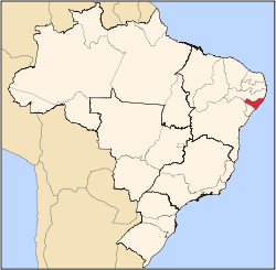 | |
| Palmeira dos Índios | ||
| Traipu | ||
| Litoral Norte Alagoano | ||
| Maceió | ||
| Mata Alagoana | ||
| Penedo | ||
| São Miguel dos Campos | ||
| Serrana dos Quilombos | ||
| Alagoana do Sertão do São Francisco | ||
| Batalha | ||
| Santana do Ipanema | ||
| Serrana do Sertão Alagoano | ||
This article is issued from
Wikipedia.
The text is licensed under Creative Commons - Attribution - Sharealike.
Additional terms may apply for the media files.