Sainyabuli
| Sainyabuli ເມືອງໄຊຍະບູລີ | |
|---|---|
| Muang (district) | |
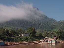 Ferry berth in Xaignabouli | |
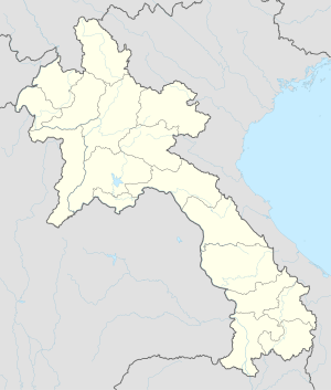 Sainyabuli Location in Laos | |
| Coordinates: 19°15′N 101°45′E / 19.250°N 101.750°E | |
| Country |
|
| Admin. division | Xaignabouli Province |
| Population | |
| • Total | 16,200 |
| Time zone | UTC+7 (ICT) |
Sainyabuli, Xaignabouli, Xayaburi or Xayaboury (Lao: ໄຊຍະບູລີ) is the capital of Sainyabuli Province, Laos. It lies along Route 4 which along with Route 13 connects it to Luang Prabang, roughly 80 kilometres northeast by road and to the Thai border across the Luang Prabang Range in the southwest. A passport control point is located in the area. Sainyabuli Airport lies in the southwest of the town.
The capital stands on the banks of the Nam Hung, a tributary of the Mekong river towards the northern end of the province. The area is allegedly a heartland for military involvement in illegal timber trade.[1]
Landmarks
Wat Si Bun Huang, a Buddhist temple of over 500 years vintage lies in the southern part of the town. Also of note is Wat Si Phan Don, noted for its diamond-shaped stupa and Wat Sisavang Vong, reputedly erected by King Sisavang Vong himself on the site of a former temple.[2] The town contains a museum and library and two bus terminals each of which are about 2 kilometres north and south of the town respectively.[2]
References
- ↑ Walker, Andrew (1999). The legend of the golden boat: regulation, trade and traders in the borderlands of Laos, Thailand, China, and Burma. University of Hawaii Press. p. 179. ISBN 978-0-8248-2256-9. Retrieved 27 June 2011.
- 1 2 Burke, Andrew; Vaisutis, Justine (15 August 2007). Laos. Lonely Planet. p. 223. ISBN 978-1-74104-568-0. Retrieved 27 June 2011.
External links

Coordinates: 19°15′N 101°45′E / 19.250°N 101.750°E
| Attapeu | |
|---|---|
| Bokeo | |
| Bolikhamsai | |
| Champasak | |
| Houaphanh | |
| Khammouane | |
| Luang Namtha | |
| Luang Prabang | |
| Oudomxay | |
| Phongsaly | |
| Salavan | |
| Savannakhet | |
| Sekong | |
| Vientiane |
|
| Vientiane (Viengchan) |
|
| Xaignabouli |
|
| Xaisomboun |
|
| Xiangkhouang | |