Luang Namtha
| Luang Namtha ຫລວງນໍ້າທາ | |
|---|---|
| City | |
 | |
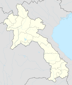 Luang Namtha Location in Laos | |
| Coordinates: 20°57′N 101°24′E / 20.950°N 101.400°E | |
| Country |
|
| Admin. division | Luang Namtha Province |
| Population (2015) | |
| • Total | 28,551 |
| • Religions | Buddhism |
| Time zone | UTC+7 (ICT) |
Coordinates: 20°57′N 101°24′E / 20.950°N 101.400°E
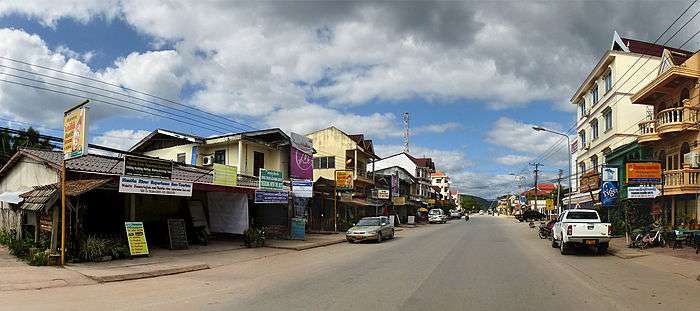
Louang Namtha, M. Luang Nam Tha (Lao: ມ. ຫລວງນໍ້າທາ) is the capital of Luang Namtha Province in northern Laos. The city lies on the Tha River (Nam Tha).
Luang Namtha is the largest settlement in northwest Laos, north of Luang Prabang. It is a popular tourist destination, and a base for treks, biking to the surrounding hilltribe villages. The Luang Namtha Museum is in the town.
History
From January through May 1962, troops from the Royal Lao Army fought the Pathet Lao and People's Army of Vietnam in the Battle of Luang Namtha. The battle ended with the RLA's headlong retreat southward 150 kilometers across the Mekong River.[1]
Administrative divisions
The province includes five districts:
- Long (3-03)
- Nalae (3-05)
- Namtha (3-01)
- Sing (3-02)
- Viangphoukha (3-04)
Transportation
In the rainy season, Luang Namtha can be reached by boat from the Mekong River. It is connected by Highway 3 to both the Thai border at Huay Xai/Chiang Khong (197 km (122 mi)) and the Chinese border at Boten/Mengla (60 km (37 mi)). Luang Namtha is also served by Luangnamtha Airport, 6 km (3.7 mi) south of the city.
Gallery
 Day market
 Night market
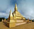 Luang Namtha stupa
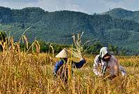 Harvesting rice
 Riverside guesthouse
Endnotes
- ↑ Conboy, Morrision, pp. 67-73.
References
- Conboy, Kenneth and James Morrison (1995). Shadow War: The CIA's Secret War in Laos. Paladin Press. ISBN 0-87364-825-0.
External links

- Biodiversity Profile for Luang Namtha Province, 2003
- Ethnic diversity in Luang Namtha - Laos
- Facebook photo gallery
![]()
| Attapeu | |
|---|---|
| Bokeo | |
| Bolikhamsai | |
| Champasak | |
| Houaphanh | |
| Khammouane | |
| Luang Namtha | |
| Luang Prabang | |
| Oudomxay | |
| Phongsaly | |
| Salavan | |
| Savannakhet | |
| Sekong | |
| Vientiane |
|
| Vientiane (Viengchan) |
|
| Xaignabouli |
|
| Xaisomboun |
|
| Xiangkhouang | |