Notre-Dame-de-Lourdes, Lanaudière, Quebec
| Notre-Dame-de-Lourdes | |
|---|---|
| Municipality | |
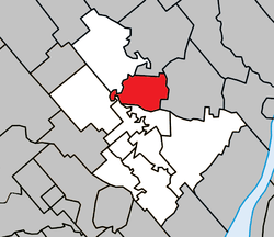 Location within Joliette RCM. | |
 Notre-Dame-de-Lourdes Location in central Quebec. | |
| Coordinates: 46°06′N 73°26′W / 46.100°N 73.433°WCoordinates: 46°06′N 73°26′W / 46.100°N 73.433°W[1] | |
| Country |
|
| Province |
|
| Region | Lanaudière |
| RCM | Joliette |
| Constituted | October 28, 1925 |
| Government[2] | |
| • Mayor | Céline Geoffroy |
| • Federal riding | Joliette |
| • Prov. riding | Joliette |
| Area[2][3] | |
| • Total | 36.10 km2 (13.94 sq mi) |
| • Land | 35.76 km2 (13.81 sq mi) |
| Population (2011)[3] | |
| • Total | 2,595 |
| • Density | 72.6/km2 (188/sq mi) |
| • Pop 2006-2011 |
|
| • Dwellings | 1,170 |
| Time zone | UTC−5 (EST) |
| • Summer (DST) | UTC−4 (EDT) |
| Postal code(s) | J0K 1K0 |
| Area code(s) | 450 and 579 |
| Highways |
|
| Website |
www |
Notre-Dame-de-Lourdes is a municipality in the Lanaudière region of Quebec, Canada, part of the Joliette Regional County Municipality. It is located along the eastern shores of the L'Assomption River.
Demographics
Population trend:[4]
- Population in 2011: 2595 (2006 to 2011 population change: 17.9%)
- Population in 2006: 2201 (2001 to 2006 population change: 1.1%)
- Population in 2001: 2176
- Population in 1996: 2087
- Population in 1991: 2060
Private dwellings occupied by usual residents: 1094 (total dwellings: 1170)
Mother tongue:
- English as first language: 0%
- French as first language: 98.4%
- English and French as first language: 0%
- Other as first language: 1.6%
Education
Commission scolaire des Samares operates francophone public schools, including:
- École Sainte-Bernadette[5]
The Sir Wilfrid Laurier School Board operates anglophone public schools, including:
- Joliette Elementary School in Saint-Charles-Borromée[6]
- Joliette High School in Joliette[7]
See also
References
- ↑ Reference number 389235 of the Commission de toponymie du Québec (in French)
- 1 2 Geographic code 61045 in the official Répertoire des municipalités (in French)
- 1 2 Statistics Canada 2011 Census - Notre-Dame-de-Lourdes census profile
- ↑ Statistics Canada: 1996, 2001, 2006, 2011 census
- ↑ "Sainte-Bernadette." Commission scolaire des Samares. Retrieved on September 23, 2017.
- ↑ "JOLIETTE ELEMENTARY ZONE." Sir Wilfrid Laurier School Board. Retrieved on September 17, 2017.
- ↑ "Joliette High School Zone Sec 1-5." Sir Wilfrid Laurier School Board. Retrieved on September 5, 2017.
Adjacent Municipal Subdivisions | |
|---|---|
| Cities & Towns | |
|---|---|
| Municipalities | |
| Parishes | |
| Villages | |
| |
This article is issued from
Wikipedia.
The text is licensed under Creative Commons - Attribution - Sharealike.
Additional terms may apply for the media files.