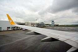
Saint-Étienne–Bouthéon Airport
| Saint-Étienne–Bouthéon Airport Aéroport de Saint-Étienne – Bouthéon | |||||||||||
|---|---|---|---|---|---|---|---|---|---|---|---|
 | |||||||||||
| Summary | |||||||||||
| Airport type | Public | ||||||||||
| Serves | Saint-Étienne, France | ||||||||||
| Location | Andrézieux-Bouthéon | ||||||||||
| Elevation AMSL | 1,325 ft / 404 m | ||||||||||
| Coordinates | 45°32′26″N 004°17′47″E / 45.54056°N 4.29639°E | ||||||||||
| Website | saint-etienne.aeroport.fr | ||||||||||
| Map | |||||||||||
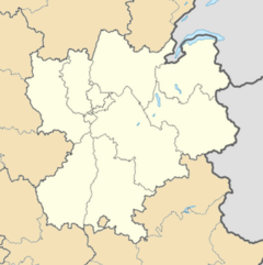 LFMH Location of airport in Rhône-Alpes region | |||||||||||
| Runways | |||||||||||
| |||||||||||
|
Source: French AIP[1] | |||||||||||
Saint-Étienne–Bouthéon Airport or Aéroport de Saint-Étienne–Bouthéon (IATA: EBU, ICAO: LFMH) is an international airport serving the French city of Saint-Étienne. It is located in Andrézieux-Bouthéon, 12 km north-northwest of Saint-Étienne,[1] within the département of Loire in the Rhône-Alpes région and mainly used by low-cost airlines. In February 2017, the airport decided to cancel all subsidies towards low cost carriers serving the airport which will likely lead to Ryanair and Pegasus Airlines cancelling all services to Saint-Étienne by 2018.[2] As of April 2018, the airport website mentions no scheduled services, but there are holiday charters, mainly to Mediterranean destinations.
References
- 1 2 LFMH – SAINT-ÉTIENNE BOUTHÉON. AIP from French Service d'information aéronautique, effective 11 October 2018.
- ↑ http://ch-aviation.com/portal/news/53321-st-etienne-airport-cancels-subsidies-to-ryanair-pegasus
External links
![]()
- Saint-Étienne Bouthéon Airport (official site) (in English)
- Aéroport de Saint-Etienne – Bouthéon (Union des Aéroports Français) (in French)
- Airport information for LFMH at World Aero Data. Data current as of October 2006.
- Accident history for EBU at Aviation Safety Network