Le Puy – Loudes Airport
| Le Puy - Loudes Airport Aéroport de Le Puy-en-Velay - Loudes | |||||||||||||||
|---|---|---|---|---|---|---|---|---|---|---|---|---|---|---|---|
| Summary | |||||||||||||||
| Airport type | Public | ||||||||||||||
| Operator | Association de l'aérodrome départemental Le Puy en Velay | ||||||||||||||
| Serves | Le Puy-en-Velay, France | ||||||||||||||
| Location | Loudes, France | ||||||||||||||
| Elevation AMSL | 2,731 ft / 832 m | ||||||||||||||
| Coordinates | 45°04′47″N 03°45′48″E / 45.07972°N 3.76333°ECoordinates: 45°04′47″N 03°45′48″E / 45.07972°N 3.76333°E | ||||||||||||||
| Maps | |||||||||||||||
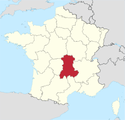 Location of Auvergne region in France | |||||||||||||||
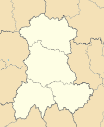 LFMH Location of airport in Auvergne region | |||||||||||||||
| Runways | |||||||||||||||
| |||||||||||||||
|
Source: French AIP[1] | |||||||||||||||
Le Puy – Loudes Airport (IATA: LPY, ICAO: LFHP) is an airport located in Loudes and 10 km west-northwest of Le Puy-en-Velay,[1] both communes of the Haute-Loire département in the Auvergne région of France.
Airlines and destinations
| Airlines | Destinations |
|---|---|
| Twin Jet | Paris-Orly |
References
- 1 2 LFHP – Le Puy Loudes. AIP from French Service d'information aéronautique, effective 11 October 2018.
External links
- Aéroport Le Puy-en-Velay - Loudes (in French)
- Airport information for LFHP at World Aero Data. Data current as of October 2006.
- Current weather for LFHP at NOAA/NWS
- Accident history for LPY at Aviation Safety Network
This article is issued from
Wikipedia.
The text is licensed under Creative Commons - Attribution - Sharealike.
Additional terms may apply for the media files.