Rutledge Township, DeWitt County, Illinois
| Rutledge Township | |
|---|---|
| Township | |
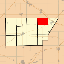 Location in DeWitt County | |
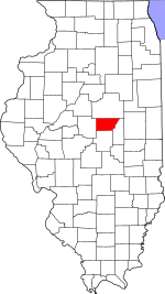 DeWitt County's location in Illinois | |
| Coordinates: 40°15′32″N 88°45′34″W / 40.25889°N 88.75944°WCoordinates: 40°15′32″N 88°45′34″W / 40.25889°N 88.75944°W | |
| Country |
|
| State |
|
| County | DeWitt |
| Established | November 2, 1858 |
| Area | |
| • Total | 24.43 sq mi (63.3 km2) |
| • Land | 24.41 sq mi (63.2 km2) |
| • Water | 0.02 sq mi (0.05 km2) 0.08% |
| Elevation | 751 ft (229 m) |
| Population (2010) | |
| • Total | 177 |
| • Density | 7.3/sq mi (2.8/km2) |
| Time zone | UTC-6 (CST) |
| • Summer (DST) | UTC-5 (CDT) |
| ZIP codes | 61735, 61752, 61842 |
| GNIS feature ID | 0429689 |
Rutledge Township is one of thirteen townships in DeWitt County, Illinois, USA. As of the 2010 census, its population was 177 and it contained 64 housing units.[1] Rutledge Township changed its name from Douglas Township on June 7, 1859.
Geography
According to the 2010 census, the township has a total area of 24.43 square miles (63.3 km2), of which 24.41 square miles (63.2 km2) (or 99.92%) is land and 0.02 square miles (0.052 km2) (or 0.08%) is water.[1]
Cemeteries
The township contains the Johnson Cemetery.
School districts
- Blue Ridge Community Unit School District 18
- Clinton Community Unit School District 15
- Le Roy Community Unit School District 2
Political districts
- Illinois's 15th congressional district
- State House District 87
- State Senate District 44
References
- "Rutledge Township, DeWitt County, Illinois". Geographic Names Information System. United States Geological Survey. Retrieved 2010-07-06.
- United States Census Bureau 2009 TIGER/Line Shapefiles
- United States National Atlas
- 1 2 "Population, Housing Units, Area, and Density: 2010 - County -- County Subdivision and Place -- 2010 Census Summary File 1". United States Census. Retrieved 2013-05-28.
External links
Places adjacent to Rutledge Township, DeWitt County, Illinois | |
|---|---|
Municipalities and communities of DeWitt County, Illinois, United States | ||
|---|---|---|
| Cities | ||
| Villages | ||
| Townships | ||
| Unincorporated communities | ||
| Footnotes | ‡This populated place also has portions in an adjacent county or counties | |
This article is issued from
Wikipedia.
The text is licensed under Creative Commons - Attribution - Sharealike.
Additional terms may apply for the media files.