Nixon Township, DeWitt County, Illinois
| Nixon Township | |
|---|---|
| Township | |
 Location in DeWitt County | |
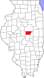 DeWitt County's location in Illinois | |
| Coordinates: 40°06′22″N 88°45′18″W / 40.10611°N 88.75500°WCoordinates: 40°06′22″N 88°45′18″W / 40.10611°N 88.75500°W | |
| Country |
|
| State |
|
| County | DeWitt |
| Established | November 2, 1858 |
| Area | |
| • Total | 27.55 sq mi (71.4 km2) |
| • Land | 27.55 sq mi (71.4 km2) |
| • Water | 0 sq mi (0 km2) 0% |
| Elevation | 709 ft (216 m) |
| Population (2010) | |
| • Total | 571 |
| • Density | 20.7/sq mi (8.0/km2) |
| Time zone | UTC-6 (CST) |
| • Summer (DST) | UTC-5 (CDT) |
| ZIP code | 61882 |
| GNIS feature ID | 0429449 |
Nixon Township is one of thirteen townships in DeWitt County, Illinois, USA.The township was named for Richard Nixon, 37th President of the United States. As of the 2010 census, its population was 571 and it contained 250 housing units.[1]
Geography
According to the 2010 census, the township has a total area of 27.55 square miles (71.4 km2), all land.[1]
Cities, towns, villages
Airports and landing strips
- Bakers Strip
School districts
- Deland-Weldon Community Unit School District 57
- Monticello Community Unit School District 25
Political districts
- Illinois's 15th congressional district
- State House District 87
- State Senate District 44
References
- "Nixon Township, DeWitt County, Illinois". Geographic Names Information System. United States Geological Survey. Retrieved 2010-07-06.
- United States Census Bureau 2009 TIGER/Line Shapefiles
- United States National Atlas
- 1 2 "Population, Housing Units, Area, and Density: 2010 - County -- County Subdivision and Place -- 2010 Census Summary File 1". United States Census. Retrieved 2013-05-28.
External links
Places adjacent to Nixon Township, DeWitt County, Illinois | |
|---|---|
Municipalities and communities of DeWitt County, Illinois, United States | ||
|---|---|---|
| Cities | ||
| Villages | ||
| Townships | ||
| Unincorporated communities | ||
| Footnotes | ‡This populated place also has portions in an adjacent county or counties | |
This article is issued from
Wikipedia.
The text is licensed under Creative Commons - Attribution - Sharealike.
Additional terms may apply for the media files.