Rosebud, Alabama
| Rosebud | |
|---|---|
| Unincorporated community | |
 Rosebud Location within the state of Alabama | |
| Coordinates: 31°56′29″N 87°8′13″W / 31.94139°N 87.13694°WCoordinates: 31°56′29″N 87°8′13″W / 31.94139°N 87.13694°W | |
| Country | United States |
| State | Alabama |
| County | Wilcox |
| Elevation | 253 ft (77 m) |
| Time zone | UTC-5 (Eastern (EST)) |
| • Summer (DST) | UTC-4 (EDT) |
| GNIS feature ID | 125940[1] |
Rosebud is an unincorporated community located in Wilcox County, Alabama, United States.
References
Municipalities and communities of Wilcox County, Alabama, United States | ||
|---|---|---|
| City | 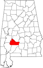 | |
| Towns | ||
| CDPs | ||
| Unincorporated communities | ||
| Ghost towns | ||
This article is issued from
Wikipedia.
The text is licensed under Creative Commons - Attribution - Sharealike.
Additional terms may apply for the media files.