Millers Ferry, Alabama
| Millers Ferry, Alabama | |
|---|---|
| Unincorporated community | |
 Millers Ferry, Alabama Location within the state of Alabama  Millers Ferry, Alabama Millers Ferry, Alabama (the US) | |
| Coordinates: 32°5′58.52″N 87°22′2.98″W / 32.0995889°N 87.3674944°W | |
| Country | United States |
| State | Alabama |
| County | Wilcox |
| Elevation | 131 ft (40 m) |
| Time zone | UTC-6 (Central (CST)) |
| • Summer (DST) | UTC-5 (CDT) |
| Area code(s) | 334 |
Millers Ferry is an unincorporated community in Wilcox County, Alabama, United States.[1] The Millers Ferry Lock and Dam is located near the community on the Alabama River.
Geography
Millers Ferry is located at 32°05′58″N 87°22′03″W / 32.09958°N 87.36749°WCoordinates: 32°05′58″N 87°22′03″W / 32.09958°N 87.36749°W and its elevation is 131 feet (40 m).[1]
History
Tornadoes
On March 1, 2007, Millers Ferry was struck by a deadly tornado. One person was killed, two injured, and over 70 houses were damaged or destroyed. The tornado caused well over $2 million in damage.[2]
Gallery
Below are photographs taken in Millers Ferry as part of the Historic American Buildings Survey:
- Rosemary House and Plantation
- Old store, Rosemary House and Plantation
- Sellers-Henderson House
References
Municipalities and communities of Wilcox County, Alabama, United States | ||
|---|---|---|
| City | 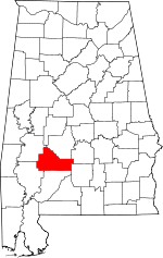 | |
| Towns | ||
| CDPs | ||
| Unincorporated communities | ||
| Ghost towns | ||
This article is issued from
Wikipedia.
The text is licensed under Creative Commons - Attribution - Sharealike.
Additional terms may apply for the media files.