Kimbrough, Alabama
| Kimbrough, Alabama | |
|---|---|
| Unincorporated community | |
 Kimbrough, Alabama Location within the state of Alabama  Kimbrough, Alabama Kimbrough, Alabama (the US) | |
| Coordinates: 32°2′0″N 87°33′54″W / 32.03333°N 87.56500°WCoordinates: 32°2′0″N 87°33′54″W / 32.03333°N 87.56500°W | |
| Country | United States |
| State | Alabama |
| County | Wilcox |
| Elevation | 92 ft (28 m) |
| Time zone | UTC-6 (Central (CST)) |
| • Summer (DST) | UTC-5 (CDT) |
| ZIP code | 36722, 36769 |
| Area code(s) | 334 |
Kimbrough is an unincorporated community in Wilcox County, Alabama, United States,[1] located near Pine Hill on State Route 5.
Geography
Kimbrough is located at 32°02′01″N 87°33′55″W / 32.03348°N 87.56527°W and has an elevation of 92 feet (28 m).[1]
References
Municipalities and communities of Wilcox County, Alabama, United States | ||
|---|---|---|
| City | 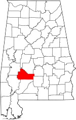 | |
| Towns | ||
| CDPs | ||
| Unincorporated communities | ||
| Ghost towns | ||
This article is issued from
Wikipedia.
The text is licensed under Creative Commons - Attribution - Sharealike.
Additional terms may apply for the media files.