Rosebery, Victoria
| Rosebery Victoria | |
|---|---|
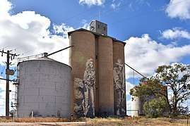 Silo art at Rosebery, 2018 | |
 Rosebery | |
| Coordinates | 35°49′48″S 142°25′12″E / 35.83000°S 142.42000°ECoordinates: 35°49′48″S 142°25′12″E / 35.83000°S 142.42000°E |
| Population | 5 (2016 census)[1] |
| Postcode(s) | 3395 |
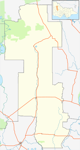
| Location |
|
| LGA(s) | Shire of Yarriambiack |
| State electorate(s) | Mildura |
| Federal Division(s) | Mallee |
Rosebery is a locality in western Victoria, Australia. The locality is in the Shire of Yarriambiack local government area, 325 kilometres (202 mi) west north west of the state capital, Melbourne on the Henty Highway.
At the 2016 census, Rosebery had a population of 5.[1]
References
- 1 2 Australian Bureau of Statistics (27 June 2017). "Rosebery (Vic)". 2016 Census QuickStats. Retrieved 13 March 2018.

External links
![]()
This article is issued from
Wikipedia.
The text is licensed under Creative Commons - Attribution - Sharealike.
Additional terms may apply for the media files.