Riverdale, Edmonton
| Riverdale | |
|---|---|
| Neighbourhood | |
|
Riverdale Location of Riverdale in Edmonton | |
| Coordinates: 53°32′35″N 113°28′23″W / 53.543°N 113.473°W | |
| Country |
|
| Province |
|
| City | Edmonton |
| Quadrant[1] | NW |
| Ward | 6 |
| Sector[2] | Mature area |
| Area[3] | Central core |
| Government[4] | |
| • Administrative body | Edmonton City Council |
| • Councillor | Scott McKeen |
| Area[5] | |
| • Total | 1.04 km2 (0.40 sq mi) |
| Elevation | 647 m (2,123 ft) |
| Population (2012)[6] | |
| • Total | 1,980 |
| • Density | 1,903.8/km2 (4,931/sq mi) |
| • Change (2009–12) |
|
| • Dwellings | 1,022 |
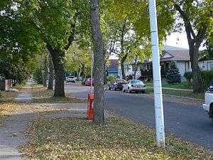
Riverdale is a river valley neighbourhood located just east of the downtown core in the city of Edmonton, Alberta, Canada. Its boundaries on the east and south are the North Saskatchewan River. Immediately across the river to the south is another Edmonton river valley neighbourhood--Cloverdale. Riverdale shares the approaches to the Low Level Bridge with a third river valley neighbourhood, Rossdale. To the north, is the neighbourhood of Boyle Street. Riverdale's boundary with the downtown core runs approximately along Grierson Hill Road.
The community is represented by the Riverdale Community League, established in 1920, which maintains a community hall and outdoor rink located at 92 Street and 100 Avenue.[7][8]
Demographics
In the City of Edmonton's 2012 municipal census, Riverdale had a population of 1,980 living in 1,022 dwellings,[6] a -2.7% change from its 2009 population of 2,034.[9] With a land area of 1.04 km2 (0.40 sq mi),[10] it had a population density of 1,903.8 people/km2 in 2012.[5][6]
Residential development
The neighbourhood was a popular site with early residents of the city of Edmonton, and soon had both a lumbermill and brickyard with fuel supplied by coal mined from nearby cliffs in the river valley.[11]
Today, approximately one residential dwelling in four dates from before 1946. Most of the rest of the homes were built over the next 40 years, with only one dwelling in ten dating from 1985 or later.
There is one school, Riverdale School, located in the neighbourhood.
The neighbourhood also has several parks: Allan Stein Park, Dawson Park, and Louise McKinney Riverfront Park.
See also
- Edmonton Federation of Community Leagues
- Edmonton's historic river valley neighbourhoods:
References
- ↑ "City of Edmonton Wards & Standard Neighbourhoods" (PDF). City of Edmonton. Archived from the original (PDF) on May 7, 2015. Retrieved February 13, 2013.
- ↑ "Edmonton Developing and Planned Neighbourhoods, 2011" (PDF). City of Edmonton. Archived from the original (PDF) on October 6, 2014. Retrieved February 13, 2013.
- ↑ "The Way We Grow: Municipal Development Plan Bylaw 15100" (PDF). City of Edmonton. 2010-05-26. Archived from the original (PDF) on May 2, 2015. Retrieved February 13, 2013.
- ↑ "City Councillors". City of Edmonton. Retrieved August 4, 2015.
- 1 2 "Neighbourhoods (data plus kml file)". City of Edmonton. Retrieved February 13, 2013.
- 1 2 3 "Municipal Census Results – Edmonton 2012 Census". City of Edmonton. Retrieved February 22, 2013.
- ↑ "Riverdale Community League". Riverdale Community League. Retrieved October 13, 2017.
- ↑ Kuban, Ron (2005). Edmonton's Urban Villages: The Community League Movement. University of Alberta Press. ISBN 9781459303249.
- ↑ "2009 Municipal Census Results". City of Edmonton. Retrieved February 22, 2013.
- ↑ "Neighbourhoods (data plus kml file)". City of Edmonton. Retrieved February 22, 2013.
- ↑ See the neighbourhood description in the [maps.edmonton.ca map utility] on the City of Edmonton web site.