Leger, Edmonton
| Leger | |
|---|---|
| Neighbourhood | |
|
Leger Location of Leger in Edmonton | |
| Coordinates: 53°27′32″N 113°34′34″W / 53.459°N 113.576°W | |
| Country |
|
| Province |
|
| City | Edmonton |
| Quadrant[1] | NW |
| Ward[1] | 9 |
| Sector[2] | Southwest |
| Area[3][4] | Terwillegar Heights |
| Government[5] | |
| • Administrative body | Edmonton City Council |
| • Councillor | Bryan Anderson |
| Area[6] | |
| • Total | 1.06 km2 (0.41 sq mi) |
| Elevation | 694 m (2,277 ft) |
| Population (2012)[7] | |
| • Total | 2,564 |
| • Density | 2,418.9/km2 (6,265/sq mi) |
| • Change (2009–12) |
|
| • Dwellings | 805 |
Leger is a newer neighbourhood in the Terwillegar Heights area of south west Edmonton, Alberta, Canada.
According to the 2005 municipal census, approximately four out of five homes (82%) are single-family dwellings. Another 14% are duplexes[8] and 4% are row houses. Substantially all (97%) of residences are owner-occupied.[9]
The neighbourhood is bounded on the south by 23 Avenue, on the west by Terwillegar Drive, on the east by Rabbit Hill Road, and on the north by a utility corridor located just north of 29 Avenue.
Demographics
In the City of Edmonton's 2012 municipal census, Leger had a population of 2,564 living in 805 dwellings,[7] a 7.7% change from its 2009 population of 2,380.[10] With a land area of 1.06 km2 (0.41 sq mi), it had a population density of 2,418.9 people/km2 in 2012.[6][7]
Recreation
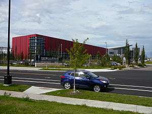
The Terwillegar Community Recreation Centre is located in the neighbourhood.[11] The facility has an aquatic centre, a fitness centre and track, a flexi-hall with three full size gymnasiums, an arena with four NHL size ice sheets, a children's wing, and commercial spaces.
Education
There is a kindergarten to junior high (K-8) school in the neighbourhood, Archbishop Joseph MacNeil School, operated by the Edmonton Catholic School System. Also a Senior High (10-12), Lillian Osborne has been built in the area by the Edmonton Public Schools
A catholic high school was scheduled to be complete early 2011.
Leger Transit Centre
Leger Transit Centre | |
|---|---|
| Platforms | 15 bus bays[12] |
| Construction | |
| Parking | No |
| Bicycle facilities | Yes |
| Disabled access | Yes |
| Other information | |
| Website | Leger Transit Centre |
| History | |
| Opened | April 26, 2009[13] |
The Leger Transit Centre, opened on April 26, 2009[13], is located along Leger Road and 23 Avenue next to the Terwillegar Recreation Centre and Lillian Osborne High School. This transit centre has no park & ride or public washrooms but does have a large shelter, a drop off area and vending machines.[14]
The following bus routes serve the transit centre:[15]
| Destination | Routes |
|---|---|
| Ambleside | 24, 25 |
| Brookside | 38 |
| Century Park Transit Centre | 23, 24, 25, 30, 35, 36, 37 |
| Mill Woods Transit Centre | 23 |
| South Campus/Fort Edmonton Park Transit Centre | 30, 36 |
| Southgate Transit Centre | 31, 34, 38 |
| South Terwillegar | 35, 37 |
| West Edmonton Mall Transit Centre | 23 |
| Windermere | 25, 26, 325 |
School special routes that arrive/depart from Leger Transit Centre include routes: 697, 723, 726, 729, 738, 799, 826, 829, 896, 922, 967, 968, 969 and 976.[16]
Surrounding neighbourhoods
Places adjacent to Leger, Edmonton | |
|---|---|
See also
References
- 1 2 "City of Edmonton Wards & Standard Neighbourhoods" (PDF). City of Edmonton. Archived from the original (PDF) on May 3, 2014. Retrieved February 13, 2013.
- ↑ "Edmonton Developing and Planned Neighbourhoods, 2011" (PDF). City of Edmonton. Archived from the original (PDF) on September 4, 2013. Retrieved February 13, 2013.
- ↑ "The Way We Grow: Municipal Development Plan Bylaw 15100" (PDF). City of Edmonton. 2010-05-26. Archived from the original (PDF) on May 2, 2015. Retrieved February 13, 2013.
- ↑ "City of Edmonton Plans in Effect" (PDF). City of Edmonton. November 2011. Archived from the original (PDF) on October 17, 2013. Retrieved February 13, 2013.
- ↑ "City Councillors". City of Edmonton. Retrieved February 13, 2013.
- 1 2 "Neighbourhoods (data plus kml file)". City of Edmonton. Retrieved February 13, 2013.
- 1 2 3 "Municipal Census Results – Edmonton 2012 Census". City of Edmonton. Retrieved February 22, 2013.
- ↑ Duplexes include triplexes and quadruplexes.
- ↑ http://censusdocs.edmonton.ca/C05002/MUNICIPAL%202005/Neighbourhood/LEGER.pdf
- ↑ "2009 Municipal Census Results". City of Edmonton. Retrieved February 22, 2013.
- ↑ http://www.edmonton.ca/attractions_recreation/sport_recreation/terwillegar-about.aspx
- ↑ "Leger Transit Centre Map" (PDF). City of Edmonton. Retrieved October 1, 2017.
- 1 2 Gordon, Kent (25 April 2009). "LRT grows towards future; Two more reasons to use public transit". Edmonton Journal. p. B.1.
- ↑ "Leger Transit Centre". City of Edmonton. Retrieved October 1, 2017.
- ↑ "Brochures in PDF". City of Edmonton. Retrieved October 1, 2017.
- ↑ "School Service: ETS Trip Planner". City of Edmonton. Retrieved September 28, 2017.