Loing
| Loing | |
|---|---|
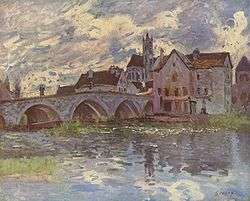 Loing River; painted by Alfred Sisley | |
| Country | France |
| Physical characteristics | |
| Main source |
Burgundy 320 m (1,050 ft) 47°33′13″N 3°13′51″E / 47.55361°N 3.23083°E |
| River mouth |
Seine 45 m (148 ft) 48°23′13″N 2°48′9″E / 48.38694°N 2.80250°ECoordinates: 48°23′13″N 2°48′9″E / 48.38694°N 2.80250°E |
| Length | 142 km (88 mi) |
| Discharge |
|
| Basin features | |
| Progression | Seine→ English Channel |
| Basin size | 4,150 km2 (1,600 sq mi) |
The Loing is a 142-kilometre (88 mi) long river in central France, a left tributary of the Seine. Its source is in Sainte-Colombe-sur-Loing, in the south of the Yonne département.
The Loing flows into the Seine in Saint-Mammès, near Moret-sur-Loing. The part of the Briare Canal between Rogny-les-Sept-Écluses and Montargis runs parallel to the Loing. Its main tributaries are the Ouanne, the Aveyron, the Puiseaux, the Solin and the Lunain.
Départements and communes it runs through
- Yonne: Sainte-Colombe-sur-Loing, Saint-Sauveur-en-Puisaye, Moutiers-en-Puisaye, Saint-Fargeau, Saint-Martin-des-Champs, Saint-Privé, Bléneau, Rogny-les-Sept-Écluses
- Loiret: Dammarie-sur-Loing, Sainte-Geneviève-des-Bois, Châtillon-Coligny, Montbouy, Montcresson, Conflans-sur-Loing, Amilly, Montargis, Châlette-sur-Loing, Cepoy, Girolles, Fontenay-sur-Loing, Nargis, Dordives
- Seine-et-Marne: Château-Landon, Souppes-sur-Loing, La Madeleine-sur-Loing, Poligny, Bagneaux-sur-Loing, Saint-Pierre-lès-Nemours, Nemours, Montcourt-Fromonville, Grez-sur-Loing, Bourron-Marlotte, Montigny-sur-Loing, La Genevraye, Épisy, Écuelles, Moret-sur-Loing, Saint-Mammès, Veneux-les-Sablons
Tributaries
References
| Wikimedia Commons has media related to Loing. |
This article is issued from
Wikipedia.
The text is licensed under Creative Commons - Attribution - Sharealike.
Additional terms may apply for the media files.