List of Sites of Special Scientific Interest in Surrey

Surrey is a county in South East England. It has an area of 642 square miles (1,660 square kilometres)[1] and an estimated population of 1.1 million as of 2017.[2] It is bordered by Greater London, Kent, East Sussex, West Sussex, Hampshire and Berkshire.[3]

As of October 2018, there are 62 Sites of Special Scientific Interest in the county, 52 of which have been designated for their biological interest, 8 for their geological interest, and 2 for both biological and geological interest.[4]

Key

Sites

Site name Photograph B G Area[lower-alpha 1] Public access Location[lower-alpha 1] Other classifications
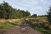
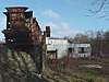
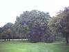
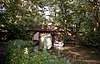
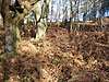
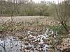
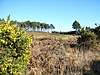
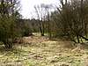
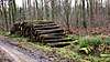
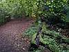
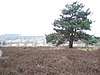
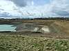
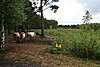
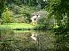
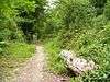
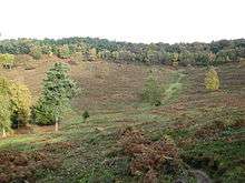
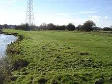
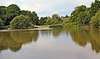
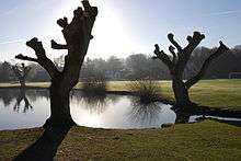
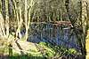
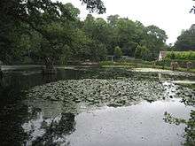
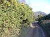
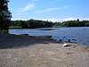
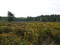
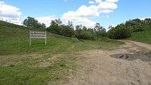
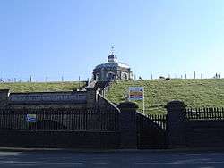
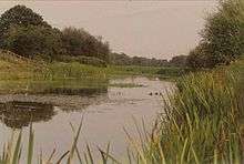
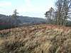
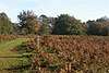
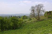
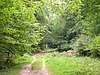
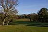
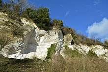
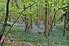
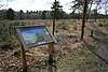
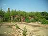
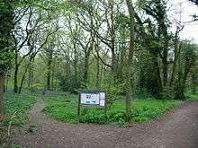
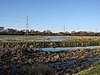
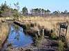
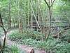
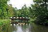
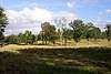
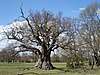
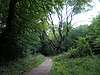
 Map[lower-alpha 2] Citation[lower-alpha 3] Description
Ash to Brookwood Heaths Ash to Brookwood Heaths Green tick 11,576.3 hectares
(28,606 acres)
[5]
Woking
52°16′37″N 0°41′13″W / 52.277°N 0.687°W / 52.277; -0.687 (Ash to Brookwood Heaths)
SU 917 539
[5]
SAC,[6] SPA[7] Map Citation
Auclaye Auclaye Green tick 0.6 hectares
(1.5 acres)
[8]
Dorking
51°08′13″N 0°19′55″W / 51.137°N 0.332°W / 51.137; -0.332 (Auclaye)
TQ 168 388
[8]
Map Citation
Banstead Downs Banstead Downs Green tick 126.7 hectares
(313 acres)
[9]
Sutton
51°20′02″N 0°12′14″W / 51.334°N 0.204°W / 51.334; -0.204 (Banstead Downs)
TQ 252 610
[9]
Map Citation
Basingstoke Canal Basingstoke Canal Green tick 101.3 hectares
(250 acres)
[10]
Farnborough
51°16′37″N 0°46′41″W / 51.277°N 0.778°W / 51.277; -0.778 (Basingstoke Canal)
SU 855 538
[10]
Map Citation
Blackheath Blackheath Green tick 141.6 hectares
(350 acres)
[11]
Guildford
51°12′14″N 0°30′58″W / 51.204°N 0.516°W / 51.204; -0.516 (Blackheath)
TQ 038 460
[11]
Map Citation
Blindley Heath Green tick 26.3 hectares
(65 acres)
[12]
Lingfield
51°11′10″N 0°02′46″W / 51.186°N 0.046°W / 51.186; -0.046 (Blindley Heath)
TQ 367 448
[12]
Map Citation
Bookham Commons Bookham Common Green tick 154.7 hectares
(382 acres)
[13]
Leatherhead
51°17′46″N 0°23′02″W / 51.296°N 0.384°W / 51.296; -0.384 (Bookham Commons)
TQ 128 564
[13]
Map Citation
Broadmoor to Bagshot Woods and Heaths Bagshot Heath Green tick 1,696.3 hectares
(4,192 acres)
[14]
Camberley
51°23′10″N 0°44′31″W / 51.386°N 0.742°W / 51.386; -0.742 (Broadmoor to Bagshot Woods and Heaths)
SU 877 640
[14]
SPA[7] Map Citation
Brook Brick Pit Green tick 0.9 hectares
(2.2 acres)
[15]
Godalming
51°07′55″N 0°40′19″W / 51.132°N 0.672°W / 51.132; -0.672 (Brook Brick Pit)
SU 930 378
[15]
Map Citation
Charleshill Green tick 10.1 hectares
(25 acres)
[16]
Godalming
51°11′17″N 0°43′16″W / 51.188°N 0.721°W / 51.188; -0.721 (Charleshill)
SU 895 440
[16]
Map Citation
Charterhouse to Eashing Charterhouse to Eashing Green tick 68.4 hectares
(169 acres)
[17]
Godalming
51°11′24″N 0°38′28″W / 51.190°N 0.641°W / 51.190; -0.641 (Charterhouse to Eashing)
SU 951 443
[17]
Map Citation
Chiddingfold Forest Chiddingfold Forest Green tick 542.5 hectares
(1,341 acres)
[18]
Billingshurst
51°05′20″N 0°34′52″W / 51.089°N 0.581°W / 51.089; -0.581 (Chiddingfold Forest)
SU 995 332
[18]
Map Citation
Chipstead Downs Chipstead Downs Green tick 157.4 hectares
(389 acres)
[19]
Banstead
51°18′18″N 0°11′06″W / 51.305°N 0.185°W / 51.305; -0.185 (Chipstead Downs)
TQ 266 578
[19]
Map Citation
Chobham Common Chobham Common Green tick 655.7 hectares
(1,620 acres)
[20]
Chobham
51°22′23″N 0°36′14″W / 51.373°N 0.604°W / 51.373; -0.604 (Chobham Common)
SU 973 647
[20]
SAC,[6] SPA[7] Map Citation
Clock House Brickworks Clock House Brickworks Green tick 35.9 hectares
(89 acres)
[21]
Dorking
51°08′06″N 0°19′16″W / 51.135°N 0.321°W / 51.135; -0.321 (Clock House Brickworks)
TQ 176 386
[21]
Map Citation
Colony Bog and Bagshot Heath Colony Bog and Bagshot Heath Green tick 1,130.5 hectares
(2,794 acres)
[22]
Woking
51°19′34″N 0°22′03″W / 51.326°N 0.3674°W / 51.326; -0.3674 (Colony Bog and Bagshot Heath)
SU 925 594
[22]
SAC,[6] SPA[7] Map Citation
Colyers Hanger Colyers Hanger Green tick 26.6 hectares
(66 acres)
[23]
Guildford
51°13′26″N 0°31′05″W / 51.224°N 0.518°W / 51.224; -0.518 (Colyers Hanger)
TQ 036 482
[23]
Map Citation
Combe Bottom Combe Bottom Green tick 42.1 hectares
(104 acres)
[24]
Guildford
51°13′44″N 0°28′12″W / 51.229°N 0.470°W / 51.229; -0.470 (Combe Bottom)
TQ 069 489
[24]
Map Citation
Devil's Punch Bowl Devil's Punch Bowl Green tick 282.2 hectares
(697 acres)
[25]
Hindhead
51°07′12″N 0°43′37″W / 51.120°N 0.727°W / 51.120; -0.727 (Devil's Punch Bowl)
SU 892 364
[25]
Map Citation
Dumsey Meadow Dumsey Meadow Green tick 9.6 hectares
(24 acres)
[26]
Chertsey
51°23′17″N 0°29′02″W / 51.388°N 0.484°W / 51.388; -0.484 (Dumsey Meadow)
TQ 056 665
[26]
Map Citation
Epsom and Ashtead Commons Epsom Common Green tick 360.4 hectares
(891 acres)
[27]
Ashtead
51°19′37″N 0°18′29″W / 51.327°N 0.308°W / 51.327; -0.308 (Epsom and Ashtead Commons)
TQ 180 600
[27]
Map Citation
Esher Commons Esher Commons Green tick 360.8 hectares
(892 acres)
[28]
Esher
51°20′53″N 0°22′34″W / 51.348°N 0.376°W / 51.348; -0.376 (Esher Commons)
TQ 132 622
[28]
Map Citation
Glover's Wood Glover's Wood Green tick 74.5 hectares
(184 acres)
[29]
Horley
51°09′07″N 0°14′46″W / 51.152°N 0.246°W / 51.152; -0.246 (Glover's Wood)
TQ 228 407
[29]
Map Citation
Godstone Ponds Godstone Ponds Green tick 123.6 hectares
(305 acres)
[30]
Godstone
51°14′38″N 0°03′32″W / 51.244°N 0.059°W / 51.244; -0.059 (Godstone Ponds)
TQ 356 512
[30]
Map Citation
Gong Hill Green tick 5.9 hectares
(15 acres)
[31]
Farnham
51°10′59″N 0°47′17″W / 51.183°N 0.788°W / 51.183; -0.788 (Gong Hill)
SU 848 433
[31]
Map Citation
Hackhurst and White Downs Hackhurst Downs Green tick 185.1 hectares
(457 acres)
[32]
Dorking
51°13′48″N 0°24′07″W / 51.230°N 0.402°W / 51.230; -0.402 (Hackhurst and White Downs)
TQ 117 491
[32]
Map Citation
Hankley Farm Green tick 2.4 hectares
(5.9 acres)
[33]
Godalming
51°11′02″N 0°43′41″W / 51.184°N 0.728°W / 51.184; -0.728 (Hankley Farm)
SU 890 435
[33]
Map Citation
Hedgecourt Hedgecourt Green tick 33.6 hectares
(83 acres)
[34]
East Grinstead
51°08′46″N 0°03′50″W / 51.146°N 0.064°W / 51.146; -0.064 (Hedgecourt)
TQ 355 403
[34]
Map Citation
Horsell Common Horsell Common Green tick 152.0 hectares
(376 acres)
[35]
Woking
51°20′10″N 0°33′47″W / 51.336°N 0.563°W / 51.336; -0.563 (Horsell Common)
TQ 002 606
[35]
SPA[7] Map Citation
Kempton Park Reservoirs  Kempton Park Reservoirs Green tick 25.3 hectares
(63 acres)
[36]
Feltham
51°25′23″N 0°23′31″W / 51.423°N 0.392°W / 51.423; -0.392 (Kempton Park Reservoirs)
TQ 119 706
[36]
Map Citation Waders that breed regularly include northern lapwing, common redshank, ringed plover and little ringed plover. The first successful inland breeding in the British Isles of pied avocet was at this reservoir. Other birds recorded include smew, garganey, Temminck's stint, spotted crake and red-necked phalarope.[37]
Knight and Bessborough Reservoirs Bessborough Reservoir Green tick 63.4 hectares
(157 acres)
[38]
West Molesey
51°24′00″N 0°23′35″W / 51.400°N 0.393°W / 51.400; -0.393 (Knight and Bessborough Reservoirs)
TQ 119 680
[38]
Map Citation
Langham Pond Langham Pond Green tick 26.7 hectares
(66 acres)
[39]
Egham
51°26′17″N 0°33′36″W / 51.438°N 0.560°W / 51.438; -0.560 (Langham Pond)
TQ 002 720
[39]
Map Citation
Leith Hill Leith Hill Green tick 337.9 hectares
(835 acres)
[40]
Dorking
51°11′06″N 0°22′44″W / 51.185°N 0.379°W / 51.185; -0.379 (Leith Hill)
TQ 134 441
[40]
Map Citation
Lingfield Cernes Green tick 10.3 hectares
(25 acres)
[41]
Edenbridge
51°06′30″N 0°01′55″W / 51.1084°N 0.032°W / 51.1084; -0.032 (Lingfield Cernes)
TQ 421 447
[41]
Map Citation
Mole Gap to Reigate Escarpment Mole Gap to Reigate Escarpment Green tick Green tick 1,016.4 hectares
(2,512 acres)
[42]
Tadworth
51°15′36″N 0°17′24″W / 51.260°N 0.290°W / 51.260; -0.290 (Mole Gap to Reigate Escarpment)
TQ 194 526
[42]
Map Citation
Moor Park Moor Park Green tick 6.7 hectares
(17 acres)
[43]
Farnham
51°12′18″N 0°45′32″W / 51.205°N 0.759°W / 51.205; -0.759 (Moor Park)
SU 868 458
[43]
Map Citation
Netherside Stream Outcrops Green tick 2.9 hectares
(7.2 acres)
[44]
Haslemere
51°05′53″N 0°39′22″W / 51.098°N 0.656°W / 51.098; -0.656 (Netherside Stream Outcrops)
SU 942 341
[44]
Map Citation
Ockham and Wisley Commons [Ockham and Wisley Commons Green tick 256.0 hectares
(633 acres)
[45]
Cobham
51°19′05″N 0°27′22″W / 51.318°N 0.456°W / 51.318; -0.456 (Ockham and Wisley Commons)
TQ 077 588
[45]
SPA[7] Map Citation
Papercourt Papercourt Green tick 70.0 hectares
(173 acres)
[46]
Woking
51°17′56″N 0°30′54″W / 51.299°N 0.515°W / 51.299; -0.515 (Papercourt)
TQ 036 566
[46]
Map Citation
Puttenham & Crooksbury Commons Puttenham Common Green tick 113.8 hectares
(281 acres)
[47]
Guildford
51°12′25″N 0°41′49″W / 51.207°N 0.697°W / 51.207; -0.697 (Puttenham & Crooksbury Commons)
SU 911 461
[47]
Map Citation
Quarry Hangers Quarry Hangers Green tick 28.5 hectares
(70 acres)
[48]
Redhill
51°16′01″N 0°06′43″W / 51.267°N 0.112°W / 51.267; -0.112 (Quarry Hangers)
TQ 318 537
[48]
Map Citation
Ranmore Common Ranmore Common Green tick 224.3 hectares
(554 acres)
[49]
Dorking
51°14′49″N 0°21′50″W / 51.247°N 0.364°W / 51.247; -0.364 (Ranmore Common)
TQ 143 510
[49]
Map Citation
Reigate Heath Reigate Heath Green tick 61.7 hectares
(152 acres)
[50]
Reigate
51°14′13″N 0°13′52″W / 51.237°N 0.231°W / 51.237; -0.231 (Reigate Heath)
TQ 236 501
[50]
Map Citation
Seale Chalk Pit Seale Chalk Pit Green tick 1.2 hectares
(3.0 acres)
[51]
Farnham
51°13′30″N 0°42′50″W / 51.225°N 0.714°W / 51.225; -0.714 (Seale Chalk Pit)
SU 899 481
[51]
Map Citation
Sheepleas heepleas Green tick Green tick 99.9 hectares
(247 acres)
[52]
Leatherhead
51°15′11″N 0°26′28″W / 51.253°N 0.441°W / 51.253; -0.441 (Sheepleas)
TQ 089 516
[52]
Map Citation
Smart's and Prey Heaths Smart's Heath Green tick 39.0 hectares
(96 acres)
[53]
Woking
51°17′31″N 0°35′10″W / 51.292°N 0.586°W / 51.292; -0.586 (Smart's and Prey Heaths)
SU 987 557
[53]
Map Citation
Smokejack Clay Pit Smokejack Clay Pit Green tick 56.0 hectares
(138 acres)
[54]
Cranleigh
51°07′30″N 0°24′54″W / 51.125°N 0.415°W / 51.125; -0.415 (Smokejack Clay Pit)
TQ 110 374
[54]
Map Citation
Staffhurst Wood Staffhurst Wood Green tick 51.0 hectares
(126 acres)
[55]
Edenbridge
51°13′08″N 0°01′12″W / 51.219°N 0.020°W / 51.219; -0.020 (Staffhurst Wood)
TQ 412 486
[55]
Map Citation
Staines Moor Staines Moor Green tick 510.8 hectares
(1,262 acres)
[56]
Staines-upon-Thames
51°26′49″N 0°30′04″W / 51.447°N 0.501°W / 51.447; -0.501 (Staines Moor)
TQ 043 731
[56]
Map Citation
Stockstone Quarry Green tick 3.9 hectares
(9.6 acres)
[57]
Farnham
51°08′06″N 0°44′56″W / 51.135°N 0.749°W / 51.135; -0.749 (Stockstone Quarry)
SU 876 381
[57]
Map Citation
Stones Road Pond Green tick 0.5 hectares
(1.2 acres)
[58]
Epsom
51°20′24″N 0°15′40″W / 51.340°N 0.261°W / 51.340; -0.261 (Stones Road Pond)
TQ 212 615
[58]
Map Citation
Thorpe Hay Meadow Thorpe Hay Meadow Green tick 6.4 hectares
(16 acres)
[59]
Egham
51°25′12″N 0°31′19″W / 51.420°N 0.522°W / 51.420; -0.522 (Thorpe Hay Meadow)
TQ 029 700
[59]
Map Citation
Thorpe Park No 1 Gravel Pit Green tick 42.5 hectares
(105 acres)
[60]
Chertsey
51°24′11″N 0°31′30″W / 51.403°N 0.525°W / 51.403; -0.525 (Thorpe Park No 1 Gravel Pit)
TQ 027 681
[60]
Map Citation
Thursley, Hankley and Frensham Commons Thursley Commo Green tick 1,878.5 hectares
(4,642 acres)
[61]
Godalming
51°09′36″N 0°43′34″W / 51.160°N 0.726°W / 51.160; -0.726 (Thursley, Hankley and Frensham Commons)
SU 892 409
[61]
SAC[6] Map Citation
Titsey Woods Green tick 45.3 hectares
(112 acres)
[62]
Oxted
51°16′08″N 0°02′02″W / 51.269°N 0.034°W / 51.269; -0.034 (Titsey Woods)
TQ 420 542
[62]
Map Citation
Upper Common Pits Green tick 3.0 hectares
(7.4 acres)
[63]
Leatherhead
51°14′17″N 0°27′00″W / 51.238°N 0.450°W / 51.238; -0.450 (Upper Common Pits)
TQ 083 499
[63]
Map Citation
Vann Lake and Ockley Woods Vann Lake and Ockley Woods Green tick 57.8 hectares
(143 acres)
[64]
Dorking
51°08′17″N 0°21′11″W / 51.138°N 0.353°W / 51.138; -0.353 (Vann Lake and Ockley Woods)
TQ 153 389
[64]
Map Citation
Wey Valley Meadows Wey Valley Meadows Green tick 94.1 hectares
(233 acres)
[65]
Guildford
51°12′22″N 0°34′48″W / 51.206°N 0.580°W / 51.206; -0.580 (Wey Valley Meadows)
SU 993 462
[65]
Map Citation
Whitmoor Common Whitmoor Common Green tick 166.0 hectares
(410 acres)
[66]
Guildford
51°16′23″N 0°35′28″W / 51.273°N 0.591°W / 51.273; -0.591 (Whitmoor Common)
SU 984 536
[66]
SPA[7] Map Citation
Windsor Forest and Great Park Windsor Great Park Green tick 1,778.9 hectares
(4,396 acres)
[67]
Windsor
51°26′38″N 0°37′55″W / 51.444°N 0.632°W / 51.444; -0.632 (Windsor Forest and Great Park)
SU 952 725
[67]
Map Citation
Woldingham & Oxted Downs Woldingham & Oxted Downs Green tick 128.4 hectares
(317 acres)
[68]
Godstone
51°16′12″N 0°02′17″W / 51.270°N 0.038°W / 51.270; -0.038 (Woldingham & Oxted Downs)
TQ 370 542
[68]
Map Citation
Wraysbury Reservoir Wraysbury Reservoir Green tick 205.6 hectares
(508 acres)
[69]
Staines-upon-Thames
51°27′36″N 0°31′34″W / 51.460°N 0.526°W / 51.460; -0.526 (Wraysbury Reservoir)
TQ 025 745
[69]
Map Citation

Notes

  1. 1 2 The area and grid reference are taken from the "Details" page for each site on the Natural England database.
  2. The maps are provided by Natural England on the Magic Map website.
  3. Citations are provided for each site by Natural England.

References

  1. "Surrey". Encyclopedia Britannica. Retrieved 3 October 2018.
  2. "How is the population of Surrey changing?". Surrey County Council. Retrieved 3 October 2018.
  3. "The County of Surrey". Visit Surrey. Retrieved 3 October 2018.
  4. "Search results for Surrey". Natural England. Retrieved 3 October 2018.
  5. 1 2 "Designated Sites View: Ash to Brookwood Heaths". Sites of Special Scientific Interest. Natural England. Retrieved 28 September 2018.
  6. 1 2 3 4 "Designated Sites View: Thursley, Ash, Pirbright & Chobham". Special Areas of Conservation. Natural England. Retrieved 28 September 2018.
  7. 1 2 3 4 5 6 7 "Designated Sites View: Thames Basin Heaths". Special Protection Areas. Natural England. Retrieved 28 September 2018.
  8. 1 2 "Designated Sites View: Auclaye". Sites of Special Scientific Interest. Natural England. Retrieved 28 September 2018.
  9. 1 2 "Designated Sites View: Banstead Downs". Sites of Special Scientific Interest. Natural England. Retrieved 28 September 2018.
  10. 1 2 "Designated Sites View: Basingstoke Canal". Sites of Special Scientific Interest. Natural England. Retrieved 28 September 2018.
  11. 1 2 "Designated Sites View: Blackheath". Sites of Special Scientific Interest. Natural England. Retrieved 30 September 2018.
  12. 1 2 "Designated Sites View: Blindley Heath". Sites of Special Scientific Interest. Natural England. Retrieved 30 September 2018.
  13. 1 2 "Designated Sites View: Bookham Commons". Sites of Special Scientific Interest. Natural England. Retrieved 30 September 2018.
  14. 1 2 "Designated Sites View: Broadmoor to Bagshot Woods and Heaths". Sites of Special Scientific Interest. Natural England. Retrieved 30 September 2018.
  15. 1 2 "Designated Sites View: Brook Brick Pit". Sites of Special Scientific Interest. Natural England. Retrieved 30 September 2018.
  16. 1 2 "Designated Sites View: Charleshill". Sites of Special Scientific Interest. Natural England. Retrieved 30 September 2018.
  17. 1 2 "Designated Sites View: Charterhouse to Eashing". Sites of Special Scientific Interest. Natural England. Retrieved 30 September 2018.
  18. 1 2 "Designated Sites View: Chiddingfold Forest". Sites of Special Scientific Interest. Natural England. Retrieved 30 September 2018.
  19. 1 2 "Designated Sites View: Chipstead Downs". Sites of Special Scientific Interest. Natural England. Retrieved 30 September 2018.
  20. 1 2 "Designated Sites View: Chobham Common". Sites of Special Scientific Interest. Natural England. Retrieved 30 September 2018.
  21. 1 2 "Designated Sites View: Clock House Brickworks". Sites of Special Scientific Interest. Natural England. Retrieved 30 September 2018.
  22. 1 2 "Designated Sites View: Colony Bog and Bagshot Heath". Sites of Special Scientific Interest. Natural England. Retrieved 30 September 2018.
  23. 1 2 "Designated Sites View: Colyers Hanger". Sites of Special Scientific Interest. Natural England. Retrieved 30 September 2018.
  24. 1 2 "Designated Sites View: Combe Bottom". Sites of Special Scientific Interest. Natural England. Retrieved 30 September 2018.
  25. 1 2 "Designated Sites View: Devil's Punch Bowl". Sites of Special Scientific Interest. Natural England. Retrieved 30 September 2018.
  26. 1 2 "Designated Sites View: Dumsey Meadow". Sites of Special Scientific Interest. Natural England. Retrieved 30 September 2018.
  27. 1 2 "Designated Sites View: Epsom and Ashtead Commons". Sites of Special Scientific Interest. Natural England. Retrieved 30 September 2018.
  28. 1 2 "Designated Sites View: Esher Commons". Sites of Special Scientific Interest. Natural England. Retrieved 30 September 2018.
  29. 1 2 "Designated Sites View: Glover's Wood". Sites of Special Scientific Interest. Natural England. Retrieved 30 September 2018.
  30. 1 2 "Designated Sites View: Godstone Ponds". Sites of Special Scientific Interest. Natural England. Retrieved 30 September 2018.
  31. 1 2 "Designated Sites View: Gong Hill". Sites of Special Scientific Interest. Natural England. Retrieved 30 September 2018.
  32. 1 2 "Designated Sites View: Hackhurst and White Downs". Sites of Special Scientific Interest. Natural England. Retrieved 28 September 2018.
  33. 1 2 "Designated Sites View: Hankley Farm". Sites of Special Scientific Interest. Natural England. Retrieved 30 September 2018.
  34. 1 2 "Designated Sites View: Hedgecourt". Sites of Special Scientific Interest. Natural England. Retrieved 30 September 2018.
  35. 1 2 "Designated Sites View: Horsell Common". Sites of Special Scientific Interest. Natural England. Retrieved 30 September 2018.
  36. 1 2 "Designated Sites View: Kempton Park Reservoirs". Sites of Special Scientific Interest. Natural England. Retrieved 30 September 2018.
  37. "Kempton Park Reservoirs citation" (PDF). Sites of Special Scientific Interest. Natural England. Archived from the original (PDF) on 24 October 2012. Retrieved 16 January 2016.
  38. 1 2 "Designated Sites View: Knight and Bessborough Reservoirs". Sites of Special Scientific Interest. Natural England. Retrieved 30 September 2018.
  39. 1 2 "Designated Sites View: Langham Pond". Sites of Special Scientific Interest. Natural England. Retrieved 30 September 2018.
  40. 1 2 "Designated Sites View: Leith Hill". Sites of Special Scientific Interest. Natural England. Retrieved 30 September 2018.
  41. 1 2 "Designated Sites View: Lingfield Cernes". Sites of Special Scientific Interest. Natural England. Retrieved 30 September 2018.
  42. 1 2 "Designated Sites View: Mole Gap to Reigate Escarpment". Sites of Special Scientific Interest. Natural England. Retrieved 30 September 2018.
  43. 1 2 "Designated Sites View: Moor Park". Sites of Special Scientific Interest. Natural England. Retrieved 30 September 2018.
  44. 1 2 "Designated Sites View: Netherside Stream Outcrops". Sites of Special Scientific Interest. Natural England. Retrieved 30 September 2018.
  45. 1 2 "Designated Sites View: Ockham and Wisley Commons". Sites of Special Scientific Interest. Natural England. Retrieved 30 September 2018.
  46. 1 2 "Designated Sites View: Papercourt". Sites of Special Scientific Interest. Natural England. Retrieved 30 September 2018.
  47. 1 2 "Designated Sites View: Puttenham & Crooksbury Commons". Sites of Special Scientific Interest. Natural England. Retrieved 30 September 2018.
  48. 1 2 "Designated Sites View: Quarry Hangers". Sites of Special Scientific Interest. Natural England. Retrieved 30 September 2018.
  49. 1 2 "Designated Sites View: Ranmore Common". Sites of Special Scientific Interest. Natural England. Retrieved 30 September 2018.
  50. 1 2 "Designated Sites View: Reigate Heath". Sites of Special Scientific Interest. Natural England. Retrieved 30 September 2018.
  51. 1 2 "Designated Sites View: Seale Chalk Pit". Sites of Special Scientific Interest. Natural England. Retrieved 30 September 2018.
  52. 1 2 "Designated Sites View: Sheepleas". Sites of Special Scientific Interest. Natural England. Retrieved 30 September 2018.
  53. 1 2 "Designated Sites View: Smart's and Prey Heaths". Sites of Special Scientific Interest. Natural England. Retrieved 30 September 2018.
  54. 1 2 "Designated Sites View: Smokejack Clay Pit". Sites of Special Scientific Interest. Natural England. Retrieved 30 September 2018.
  55. 1 2 "Designated Sites View: Staffhurst Wood". Sites of Special Scientific Interest. Natural England. Retrieved 30 September 2018.
  56. 1 2 "Designated Sites View: Staines Moor". Sites of Special Scientific Interest. Natural England. Retrieved 30 September 2018.
  57. 1 2 "Designated Sites View: Stockstone Quarry". Sites of Special Scientific Interest. Natural England. Retrieved 30 September 2018.
  58. 1 2 "Designated Sites View: Stones Road Pond". Sites of Special Scientific Interest. Natural England. Retrieved 30 September 2018.
  59. 1 2 "Designated Sites View: Thorpe Hay Meadow". Sites of Special Scientific Interest. Natural England. Retrieved 30 September 2018.
  60. 1 2 "Designated Sites View: Thorpe Park No 1 Gravel Pit". Sites of Special Scientific Interest. Natural England. Retrieved 30 September 2018.
  61. 1 2 "Designated Sites View: Thursley, Hankley and Frensham Commons". Sites of Special Scientific Interest. Natural England. Retrieved 30 September 2018.
  62. 1 2 "Designated Sites View: Titsey Woods". Sites of Special Scientific Interest. Natural England. Retrieved 30 September 2018.
  63. 1 2 "Designated Sites View: Upper Common Pits". Sites of Special Scientific Interest. Natural England. Retrieved 30 September 2018.
  64. 1 2 "Designated Sites View: Vann Lake and Ockley Woods". Sites of Special Scientific Interest. Natural England. Retrieved 30 September 2018.
  65. 1 2 "Designated Sites View: Wey Valley Meadows". Sites of Special Scientific Interest. Natural England. Retrieved 30 September 2018.
  66. 1 2 "Designated Sites View: Whitmoor Common". Sites of Special Scientific Interest. Natural England. Retrieved 30 September 2018.
  67. 1 2 "Designated Sites View: Windsor Forest and Great Park". Sites of Special Scientific Interest. Natural England. Retrieved 30 September 2018.
  68. 1 2 "Designated Sites View: Woldingham & Oxted Downs". Sites of Special Scientific Interest. Natural England. Retrieved 30 September 2018.
  69. 1 2 "Designated Sites View: Wraysbury Reservoir". Sites of Special Scientific Interest. Natural England. Retrieved 30 September 2018.
This article is issued from Wikipedia. The text is licensed under Creative Commons - Attribution - Sharealike. Additional terms may apply for the media files.