River Anton
Coordinates: 51°13′08″N 1°29′02″W / 51.219°N 1.484°W
The River Anton is a river in the English county of Hampshire. It is a tributary of the River Test. Pillhill Brook joins it at Upper Clatford.[1]
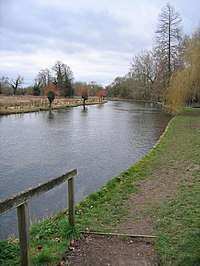
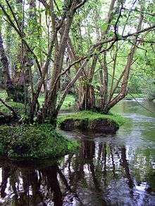
The river rises just to the north of the town of Andover, just below King Arthur's Way, and flows through the centre of the town. It then flows in a southerly direction through the villages of Upper Clatford, Goodworth Clatford and Cottonworth before joining with the River Test just below Chilbolton.[2] It is a chalk stream with high quality water and supports a wide variety of wildlife. The river is the subject of the "River Anton Enhancement Strategy",[3] a partnership with several agencies and local organisations to improve the river.
The Anton has some of the very best trout fishing in Hampshire, with fly fishing being the only method allowed. The fishing rights are private; however, day or season rights may be purchased.
Created as part of the River Anton Enhancement Scheme, the River Anton Way was originally a scenic 3.8 mile walk along the River Anton from Charlton Lakes in the north, via the town centre to Rooksbury Mill Local Nature Reserve in the south.
In 2015, proposed by the Andover Ramblers and sponsored by Test Valley Borough Council, the original River Anton Way was extended by 5.5 miles through the parishes of Upper Clatford, Goodworth Clatford, Wherwell and Chilbolton.[4]
References
| Main rivers |
|  |
|---|---|---|
| Canals and Navigations | ||
| Ordinary watercourses |
| |
| Lakes, ponds and wetlands | ||
| Coast | ||
Categories: Rivers, Canals | ||