Right Of Way/Liberty station
Liberty | |||||||||||
|---|---|---|---|---|---|---|---|---|---|---|---|
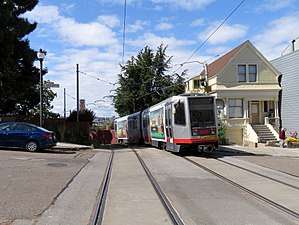 Inbound train at Right Of Way/Liberty in 2018 | |||||||||||
| Location |
Muni ROW at Liberty Street San Francisco, California | ||||||||||
| Coordinates | 37°45′26″N 122°25′37″W / 37.75723°N 122.42686°WCoordinates: 37°45′26″N 122°25′37″W / 37.75723°N 122.42686°W | ||||||||||
| Owned by | Muni | ||||||||||
| Line(s) | |||||||||||
| Construction | |||||||||||
| Disabled access | No | ||||||||||
| History | |||||||||||
| Opened | August 11, 1917[1] | ||||||||||
| Services | |||||||||||
| |||||||||||
Right Of Way/Liberty is a light rail stop on the Muni Metro J Church line, located in the Dolores Heights neighborhood of San Francisco, California. The stop, which opened with the line on August 11, 1917, is located on a short rail-only right of way that allows the line to avoid the steep hill on Church Street to the west. The stop does not have platforms; passengers board from Liberty Street.
In March 2014, Muni released details of the proposed implementation of their Transit Effectiveness Project (later rebranded MuniForward), which included a variety of stop changes for the J Church line. The stop at Liberty Street would be closed due to its proximity to the 20th Street and 21st Street stops.[2]
References
- ↑ Perles, Anthony (1981). The People's Railway: The History of the Municipal Railway of San Francisco. Interurban Press. p. 61. ISBN 0916374424.
- ↑ "Chapter 3: Proposals by Route". Transit Effectiveness Project Implementation Workbook (PDF). San Francisco Municipal Transportation Agency. March 24, 2014. pp. 52–56.
External links
![]()
- SFMTA - Right Of Way/Liberty St: inbound, outbound
- SF Bay Transit (unofficial): Right Of Way/Liberty St
| Muni Metro | |||||||
|---|---|---|---|---|---|---|---|
| Muni Metro system features | |||||||
| Heritage streetcar services | |||||||
| Other Muni services | |||||||
| Projects |
| ||||||
| Connecting services | |||||||
| Miscellaneous |
| ||||||