Rembang Regency
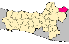
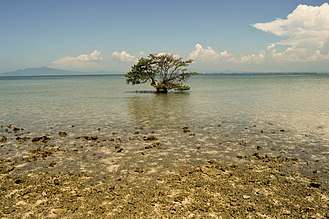
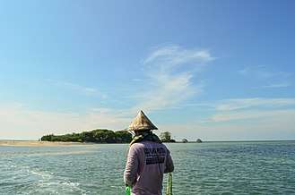
Rembang Regency is a regency (Indonesian: kabupaten) on the extreme northeast coast of Central Java Province, on the island of Java at the Java Sea, in Indonesia.
Geography
The regency covers an area of 887.13 km2 on Java. Its capital city is Rembang.
It is a lowland, with a maximum elevation of about 70 metres (230 ft) above sea level.
The Solo River flows through its inland section.
The regency is crossed by the North Coast Road, an inter-province main road on the island.
Borders
Rembang Regency is bordered by:[1]
- North : Java Sea
- East : Tuban Regency in East Java Province
- South : Blora Regency
- West : Pati Regency
Population

At the 2010 Census it had a population of 591,359 people.[2] The 2014 official estimate gave a population of 598,612.
Lasem
During the colonial Dutch East Indies period, the area was known as Lasem.
The Han family of Lasem was a prominent Chinese immigrant family of colonial government bureaucrats and landlords in the area.[3]

References
- ↑ http://www.javatourism.com/index.php?Page=610
- ↑ Biro Pusat Statistik, Jakerta, 2011.
- ↑ Lombard-Salmon, Claudine (1991). "The Han Family of East Java. Entrepreneurship and Politics (18th-19th Centuries)". Archipel. 41 (1): 53–87. doi:10.3406/arch.1991.2711. Retrieved 16 January 2017.
External links
| Wikimedia Commons has media related to Rembang Regency. |
Regencies and cities of Central Java | ||
|---|---|---|
Capital: Semarang | ||
| Regencies |  | |
| Cities | ||
Coordinates: 6°43′00″S 111°21′00″E / 6.71667°S 111.35000°E