Red Cliff, Wisconsin
| Red Cliff, Wisconsin | |
|---|---|
| Unincorporated community | |
 Downtown Red Cliff | |
 Red Cliff, Wisconsin  Red Cliff, Wisconsin | |
| Coordinates: 46°51′20″N 90°47′17″W / 46.85556°N 90.78806°WCoordinates: 46°51′20″N 90°47′17″W / 46.85556°N 90.78806°W | |
| Country | United States |
| State | Wisconsin |
| County | Bayfield |
| Elevation | 640 ft (200 m) |
| Time zone | UTC-6 (Central (CST)) |
| • Summer (DST) | UTC-5 (CDT) |
| Area code(s) | 715 and 534 |
| GNIS feature ID | 1572135[1] |
Red Cliff, also known as Miskwabiikong, is an unincorporated community in the town of Russell, Bayfield County, Wisconsin, United States.[1] Red Cliff is the administrative center of the Red Cliff Band of Lake Superior Chippewa.[2] The reservation population is 924, primarily Native American.
The Red Cliff Reservation
The Red Cliff Reservation was created through a series of treaties between the U.S. Government and the Red Cliff Band of Lake Superior Chippewa Indians (Red Cliff Band), the most recent being the treaty of 1854. The reservation is approximately one mile wide and 14 miles long, located at the top of the Bayfield Peninsula, on the shores of Lake Superior in northern Wisconsin.
The community of Red Cliff, the location of tribal offices and businesses, is three miles north of the city of Bayfield, a popular tourist community adjacent to the Apostle Islands National Lakeshore.[3]
Transportation
Wisconsin Highway 13 serves as a main arterial route in the community.
Images
 Sign on WIS 13
 Legendary Waters Resort and Casino
References
| Wikimedia Commons has media related to Red Cliff Indian Reservation. |
| Communities | 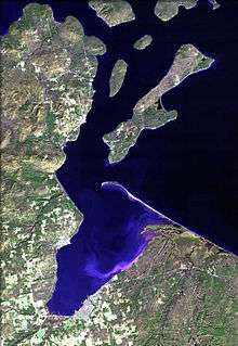 | |
|---|---|---|
| Related Geographic Aspects | ||
| Local Native American Tribes | ||
Municipalities and communities of Bayfield County, Wisconsin, United States | ||
|---|---|---|
| Cities | 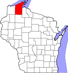 | |
| Village | ||
| Towns | ||
| CDPs | ||
| Unincorporated communities | ||
| Indian reservation | ||
| Footnotes | ‡This populated place also has portions in an adjacent county or counties | |