Cable (CDP), Wisconsin
| Cable, Wisconsin | |
|---|---|
| Census-designated place | |
 Cable | |
| Coordinates: 46°12′29″N 91°17′32″W / 46.20806°N 91.29222°WCoordinates: 46°12′29″N 91°17′32″W / 46.20806°N 91.29222°W | |
| Country | United States |
| State | Wisconsin |
| County | Bayfield |
| Town | Cable |
| Area | |
| • Total | 1.043 sq mi (2.70 km2) |
| • Land | 1.043 sq mi (2.70 km2) |
| • Water | 0 sq mi (0 km2) |
| Elevation | 1,368 ft (417 m) |
| Population (2010) | |
| • Total | 206 |
| • Density | 200/sq mi (76/km2) |
| Time zone | UTC-6 (Central (CST)) |
| • Summer (DST) | UTC-5 (CDT) |
| ZIP code | 54821 |
| Area code(s) | 715 and 534 |
| GNIS feature ID | 1578909[1] |
Cable is an unincorporated, census-designated place located in the town of Cable, Bayfield County, Wisconsin, United States.
The community is located 16 miles (26 km) northeast of the city of Hayward on U.S. Highway 63.
Cable has a post office with ZIP code 54821.[2] As of the 2010 census, its population was 206.[3]
History
Cable was laid out in 1878.[4] It was named for R. Cable, a local hotel owner.[4] A post office called Cable has been in operation since 1882.[5]
References
- ↑ U.S. Geological Survey Geographic Names Information System: Cable (CDP), Wisconsin
- ↑ ZIP Code Lookup
- ↑ "American FactFinder". U.S. Census Bureau. Retrieved 29 March 2011.
- 1 2 Chicago and North Western Railway Company (1908). A History of the Origin of the Place Names Connected with the Chicago & North Western and Chicago, St. Paul, Minneapolis & Omaha Railways. p. 170.
- ↑ "Bayfield County". Jim Forte Postal History. Archived from the original on 6 April 2015. Retrieved 3 April 2015.
Municipalities and communities of Bayfield County, Wisconsin, United States | ||
|---|---|---|
| Cities | 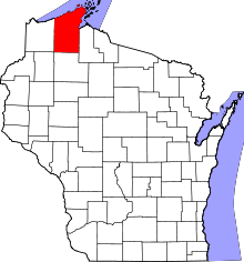 | |
| Village | ||
| Towns | ||
| CDPs | ||
| Unincorporated communities | ||
| Indian reservation | ||
| Footnotes | ‡This populated place also has portions in an adjacent county or counties | |
This article is issued from
Wikipedia.
The text is licensed under Creative Commons - Attribution - Sharealike.
Additional terms may apply for the media files.