Rawdat Rashed
| Rawdat Rashed روضة راشد | |
|---|---|
| Village | |
 Rawdat Rashed | |
| Coordinates: 25°19′10″N 51°21′12″E / 25.31944°N 51.35333°ECoordinates: 25°19′10″N 51°21′12″E / 25.31944°N 51.35333°E | |
| Country | Qatar |
| Municipality | Al-Shahaniya |
| Area | |
| • Total | 454.1 km2 (175.3 sq mi) |
| Population (2015)[1] | |
| • Total | 26,258 |
| • Density | 58/km2 (150/sq mi) |
Rawdat Rashed (Arabic: روضة راشد) is a village[2] in Qatar, located in the municipality of Al-Shahaniya.[3] It was demarcated in 1988.[2] It used to be part of the Jariyan al Batnah municipality before the municipality was incorporated into Al Rayyan.[4] In 2014, the village was incorporated into the newly-created Al-Shahaniya Municipality.[5] The Dhal Al Misfir cave is located in the area.
Etymology
In Arabic, rawdat refers to a depression where rainfall runoff accumulates. The second part of the name, "Rashed", was given in honor of a man named Rashed who died in the rawdat.[6]
Geography
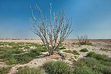
Rawdat Rashed is situated in central Qatar. The villages of Wadi Al Jamal Al Shamali and Umm Wishah are nearby.[7]
Industry
The area contains the most substantial supply of fresh groundwater in the southern zone of the country.[8] A government wellfield is found in the area, and was previously used as a water source for Umm Bab's cement industry.[9]
Rawdat Rashed is also one of five sites for the government-sponsored project to develop reservoirs in the country.[10] Once completed, the reservoirs are expected to be the largest in the world in their category,[11] with a total length of 650 km and constructed at a cost of QR 14.5 billion. Rawdat Rashed's water reservoir is built at 50 ft above sea level, and will be used as the main water supply for the capital of Doha in the scenario of an electricity outage at the other stations. In June 2018, the first phase of the project was completed.[12]
Rawdat Rashed is one of the three major landfill sites in the country, being used mainly for construction and demolition waste.[13]
Transport
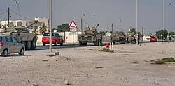
Rawdat Rashed Interchange, a 33 km road stretching through the city and connecting Dukhan and Doha, is known locally as the 'road of death' due to the large number of fatal accidents which occur on the road.[14] After announcing a redevelopment plan for the road in 2014, the Public Works Authority commenced redevelopment work in 2015.[15][14]
Demographics
As of the 2010 census, the settlement comprised 702 housing units[16] and 456 establishments.[17] There were 6,046 people living in the settlement, of which 88% were male and 12% were female. Out of the 6,046 inhabitants, 91% were 20 years of age or older and 9% were under the age of 20. The literacy rate was 90.1%.[18]
Employed persons made up 88% of the total population. Females accounted for 6% of the working population, while males accounted for 94% of the working population.[18]
| Year | Population |
|---|---|
| 1986[19] | 970 |
| 1997[20] | 2,640 |
| 2004[4] | 4,762 |
| 2010[3] | 6,046 |
| 2015[1] | 26,258 |
References
- 1 2 "2015 Population census" (PDF). Ministry of Development Planning and Statistics. April 2015. Retrieved 8 August 2017.
- 1 2 "قانون رقم (32) لسنة 1988 بتعيين حدود قرية روضة راشد". almeezan.qa. Retrieved 6 July 2015.
- 1 2 "2010 population census" (PDF). Qatar Statistics Authority. Archived from the original (PDF) on 2 April 2015. Retrieved 29 June 2015.
- 1 2 "2004 population census". Qatar Statistics Authority. Retrieved 1 July 2015.
- ↑ Hisham Yassin (16 January 2014). "بلدية الشحانية تضم %35 من مساحة الريان الحالية" (in Arabic). Al Arab. Retrieved 7 August 2017.
- ↑ "District map". The Centre for Geographic Information Systems of Qatar. Retrieved 25 May 2018.
- ↑ "Qatar Socio-Economic Atlas". Ministry of Development Planning and Statistics. Retrieved 8 August 2017.
- ↑ Llamas, M. Ramon; Custodio, E. (2002). Intensive Use of Groundwater: Challenges and Opportunities. CRC Press. p. 369. ISBN 978-9058093905.
- ↑ Al-Kubaisi, Mohammed Ali M. (1984). Industrial development in Qatar: a geographical assessment (PDF). Durham E-Theses, Durham University. p. 152.
- ↑ "رئيس الوزراء: يطلق مشروع الخزانات الاستراتيجية الكبرى لتأمين المياه". Qatar Government. 13 May 2015. Retrieved 17 December 2015.
- ↑ Amery, Hussain A. (15 June 2015). Arab Water Security: Threats and Opportunities in the Gulf States. Cambridge University Press. p. 121. ISBN 9781316381069.
- ↑ Sanaullah Ataullah (29 June 2018). "PM opens first phase of QR14.5bn reservoirs project". The Peninsula. Retrieved 29 June 2018.
- ↑ Salman Zafar (3 June 2015). "Solid Waste Management in Qatar". EcoMENA. Retrieved 2 August 2015.
- 1 2 "Ashghal commences redevelopment work on Qatar's 'road of death'". Doha News. 19 April 2015. Retrieved 1 July 2015.
- ↑ "Latest stretch of upgraded Dukhan Highway opens". Doha News. 14 July 2014. Retrieved 1 July 2015.
- ↑ "Housing units, by type of unit and zone (April 2010)" (PDF). Qatar Statistics Authority. Archived from the original (PDF) on 8 July 2015. Retrieved 7 August 2015.
- ↑ "Establishments by status of establishment and zone (April 2010)" (PDF). Qatar Statistics Authority. Archived from the original (PDF) on 8 July 2015. Retrieved 7 August 2015.
- 1 2 "Geo Statistics Application". Ministry of Development Planning and Statistics. Archived from the original on 11 September 2012. Retrieved 7 August 2015.
- ↑ "1986 population census" (PDF). Qatar Statistics Authority. Archived from the original (PDF) on 3 July 2015. Retrieved 2 July 2015.
- ↑ "1997 population census" (PDF). Qatar Statistics Authority. Archived from the original (PDF) on 29 May 2015. Retrieved 2 July 2015.
| Administrative zones | |
|---|---|
| Districts |
|
| Landmarks |
|