Rattanawapi District
| Rattanawapi รัตนวาปี | |
|---|---|
| Amphoe | |
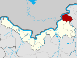 Amphoe location in Nong Khai Province | |
| Coordinates: 18°13′12″N 103°10′48″E / 18.22000°N 103.18000°ECoordinates: 18°13′12″N 103°10′48″E / 18.22000°N 103.18000°E | |
| Country | Thailand |
| Province | Nong Khai |
| Seat | Rattanawapi |
| Area | |
| • Total | 204.007 km2 (78.768 sq mi) |
| Population (2005) | |
| • Total | 36,920 |
| • Density | 181.0/km2 (469/sq mi) |
| Time zone | UTC+7 (ICT) |
| Postal code | 43120 |
| Geocode | 4316 |
Rattanawapi (Thai: รัตนวาปี) is a district (amphoe) of Nong Khai Province, northeastern Thailand.
Geography
Neighboring districts are (from the east clockwise) Pak Khat and So Phisai of Bueng Kan Province, Fao Rai and Phon Phisai of Nong Khai Province, and Bolikhamxai Province of Laos.
History
The minor district (king amphoe) was split off from Phon Phisai District on 1 April 1995.[1]
On 15 May 2007, all 81 minor districts were upgraded to full districts.[2] On 24 August the upgrade became official.[3]
Administration
The district is divided into five sub-districts (tambon), which are further subdivided into 61 villages (muban). There are no municipal (thesaban) areas. There are five tambon administrative organizations (TAO).
| No. | Name | Thai name | Villages | Pop. | |
|---|---|---|---|---|---|
| 1. | Rattanawapi | รัตนวาปี | 12 | 7,699 | |
| 2. | Na Thap Hai | นาทับไฮ | 10 | 8,219 | |
| 3. | Ban Ton | บ้านต้อน | 9 | 3,775 | |
| 4. | Phra Bat Na Sing | พระบาทนาสิงห์ | 17 | 11,044 | |
| 5. | Phon Phaeng | โพนแพง | 13 | 6,183 |
References
- ↑ ประกาศกระทรวงมหาดไทย เรื่อง แบ่งเขตท้องที่อำเภอโพนพิสัย จังหวัดหนองคายตั้งเป็นกิ่งอำเภอรัตนวาปี (PDF). Royal Gazette (in Thai). 112 (Special 9 ง): 51. March 22, 1995.
- ↑ แถลงผลการประชุม ครม. ประจำวันที่ 15 พ.ค. 2550 (in Thai). Manager Online.
- ↑ พระราชกฤษฎีกาตั้งอำเภอฆ้องชัย...และอำเภอเหล่าเสือโก้ก พ.ศ. ๒๕๕๐ (PDF). Royal Gazette (in Thai). 124 (46 ก): 14–21. August 24, 2007.
External links
This article is issued from
Wikipedia.
The text is licensed under Creative Commons - Attribution - Sharealike.
Additional terms may apply for the media files.