Fao Rai District
| Fao Rai เฝ้าไร่ | |
|---|---|
| Amphoe | |
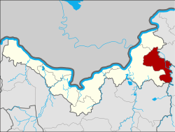 Amphoe location in Nong Khai Province | |
| Coordinates: 18°1′8″N 103°18′14″E / 18.01889°N 103.30389°ECoordinates: 18°1′8″N 103°18′14″E / 18.01889°N 103.30389°E | |
| Country | Thailand |
| Province | Nong Khai |
| Seat | Fao Rai |
| Area | |
| • Total | 255.9 km2 (98.8 sq mi) |
| Population (2005) | |
| • Total | 50,481 |
| • Density | 197.3/km2 (511/sq mi) |
| Time zone | UTC+7 (ICT) |
| Postal code | 43120 |
| Geocode | 4315 |
Fao Rai (Thai: เฝ้าไร่, pronounced [fâw râj]) is a district (amphoe) of Nong Khai Province, northeastern Thailand.
Geography
Neighboring districts are (from the west clockwise) Phon Phisai and Rattanawapi of Nong Khai Province, So Phisai of Bueng Kan Province, Ban Muang of Sakon Nakhon Province, and Ban Dung of Udon Thani Province.
History
The minor district (king amphoe) was split off from Phon Phisai District on 1 April 1995.[1]
On 15 May 2007, all 81 minor districts were upgraded to full districts.[2] With publication in the Royal Gazette on 24 August the upgrade became official.[3]
Administration
The district is divided into five sub-districts (tambon), which are further subdivided into 69 villages (muban). There are no municipal (thesaban) areas. There are five tambon administrative organizations (TAO).
| No. | Name | Thai name | Villages | Pop. | |
|---|---|---|---|---|---|
| 1. | Fao Rai | เฝ้าไร่ | 17 | 10,689 | |
| 2. | Na Di | นาดี | 7 | 3,884 | |
| 3. | Nong Luang | หนองหลวง | 18 | 15,301 | |
| 4. | Wang Luang | วังหลวง | 14 | 12,962 | |
| 5. | Udom Phon | อุดมพร | 13 | 7,645 |
References
- ↑ ประกาศกระทรวงมหาดไทย เรื่อง แบ่งเขตท้องที่อำเภอโพนพิสัย จังหวัดหนองคายตั้งเป็นกิ่งอำเภอเฝ้าไร่ (PDF). Royal Gazette (in Thai). 112 (Special 9 ง): 50. March 22, 1995.
- ↑ แถลงผลการประชุม ครม. ประจำวันที่ 15 พ.ค. 2550 (in Thai). Manager Online.
- ↑ พระราชกฤษฎีกาตั้งอำเภอฆ้องชัย...และอำเภอเหล่าเสือโก้ก พ.ศ. ๒๕๕๐ (PDF). Royal Gazette (in Thai). 124 (46 ก): 14–21. August 24, 2007.
External links