Rasht Airport
| Rasht Airport فرودگاه رشت | |||||||||||
|---|---|---|---|---|---|---|---|---|---|---|---|
 | |||||||||||
| Summary | |||||||||||
| Airport type | Public | ||||||||||
| Owner | Government of Iran | ||||||||||
| Operator | Iran Airports Company | ||||||||||
| Serves | Rasht, Gilan | ||||||||||
| Location | Rasht, Iran | ||||||||||
| Elevation AMSL | -40 ft / -12 m | ||||||||||
| Coordinates | 37°19′31.13″N 49°36′20.94″E / 37.3253139°N 49.6058167°ECoordinates: 37°19′31.13″N 49°36′20.94″E / 37.3253139°N 49.6058167°E | ||||||||||
| Website |
rasht | ||||||||||
| Map | |||||||||||
 RAS Location of airport in Iran | |||||||||||
| Runways | |||||||||||
| |||||||||||
| Statistics (2017) | |||||||||||
| |||||||||||
|
Source: Iran Airports Company[1] | |||||||||||
Rasht Airport (IATA: RAS, ICAO: OIGG) (Persian: فرودگاه بین المللی رشت) is an international airport located in 10 kilometers north of the city of Rasht, Gilan Province, in north of Iran. It also known as Sardar Jangal Airport. The airport has flight connections to different parts of Iran, and about 446.000 passengers passed through it in 2017.
Airlines and destinations
| Airlines | Destinations |
|---|---|
| Caspian Airlines | Asalouyeh, Mashhad |
| Georgian Airways | Seasonal charter: Tbilisi |
| Iran Air | Ahwaz, Ardabil, Isfahan, Mashhad, Tabriz, Tehran-Mehrabad, Urmia Seasonal: Baghdad, Jeddah |
| Iran Aseman Airlines | Bandar-Abbas, Shiraz, Tehran-Mehrabad Charter: Tbilisi |
| Karun Airlines | Tehran-Mehrabad, Ahvaz, Isfahan |
| Kish Air | Kish Island, Mashhad, Asalouyeh |
| Qeshm Airlines | Qeshm Island |
| Taban Air | Mashhad |
| Tailwind Airlines | Seasonal charter: Antalya |
| Zagros Airlines | Mashhad |
^a According to Iranian laws direct passenger flights to Antalya are banned[2], So Tailwind Airlines's seasonal charter flight from Rasht to Antalya have a stopover in Adana. However, Tailwind Airlines does not carry local traffic between Rasht and Adana. The return flights are direct. This law applies only to passenger flights and does not include VIP, Cargo or ferry flights.
Gallery
 Saudia Airbus A330-200, Rasht Airport(2014)
 An Iran Air MD-82, Rasht Airport(2015)
 Sepahan Air An-140 Landing at Rasht Airport(2014)
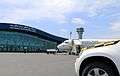


See also
References
- ↑ "Traffic Figures". Retrieved 14 February 2018.
- ↑ https://twitter.com/aviationirancom/status/975789946987597824
This article is issued from
Wikipedia.
The text is licensed under Creative Commons - Attribution - Sharealike.
Additional terms may apply for the media files.