Antalya
| Antalya | ||
|---|---|---|
| Metropolitan municipality | ||
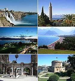 Clockwise from top left: Düden Waterfalls, Yivliminare Mosque, Konyaaltı, Hıdırlık Tower, Hadrian's Gate and Falez Park at night. | ||
| ||
 Antalya Location of Antalya | ||
| Coordinates: 36°53′15″N 30°42′27″E / 36.8874°N 30.7075°ECoordinates: 36°53′15″N 30°42′27″E / 36.8874°N 30.7075°E | ||
| Country |
| |
| Region | Mediterranean | |
| Province | Antalya Province | |
| Government | ||
| • Type | Metropolitan municipality | |
| • Mayor | Menderes Türel (AKP) | |
| Area | ||
| • Urban | 1,417 km2 (547 sq mi) | |
| Elevation | 30 m (100 ft) | |
| Population (2014)[1] | ||
| • Density | 478/km2 (1,240/sq mi) | |
| • Urban | 1,203,994 | |
| • Metro | 2,222,562 | |
| Time zone | UTC+3 (FET) | |
| Postal code | 07x xx | |
| Area code(s) | 0242 | |
| Licence plate | 07 | |
| Website |
www www | |

Antalya (Turkish pronunciation: [ɑnˈtɑljɑ]) is the fifth-most populous city in Turkey and the capital of its eponymous province. Located on Anatolia's southwest coast bordered by the Taurus Mountains, Antalya is the largest Turkish city on the Mediterranean coast with over one million people in its metropolitan area.[2][3]
The city that is now Antalya was first settled around 200 BC by the Attalid dynasty of Pergamon, which was soon subdued by the Romans. Roman rule saw Antalya thrive, including the construction of several new monuments, such as Hadrian's Gate, and the proliferation of neighboring cities. The city has changed hands several times, including to the Seljuk Sultanate in 1207 and an expanding Ottoman Empire in 1391.[4] Ottoman rule brought relative peace and stability for the next five hundred years. The city was transferred to Italian suzerainty in the aftermath of World War I, but was recaptured by a newly independent Turkey in the War of Independence.
Antalya is Turkey's biggest international sea resort, located on the Turkish Riviera. Large-scale development and governmental funding has promoted tourism. A record 12.5 million tourists passed through the city in 2014.[5]
Etymology
The city was founded as "Attaleia" (Ancient Greek: Ἀττάλεια), named after its founder Attalos II, king of Pergamon.[6] This name, still in use in Greek, was later evolved in Turkish as Adalia and then Antalya.[7] Attaleia was also the name of a festival at Delphi and Attalis (Greek: Ἀτταλίς) was the name of an old Greek tribe at Athens.[8][9] Despite the close similarity, there is no connection with the name Anatolia.
History
King Attalus II of Pergamon is looked on as founder of the city in about 150 BC, during the Hellenistic period. It was named Attaleia or Attalia in his honour. The city served as a naval base for Attalus's powerful fleet. Excavations in 2008, in the Doğu Garajı plot, uncovered remains dating to the 3rd century BC, suggesting that Attalea was a rebuilding and expansion of an earlier town.
Attalea became part of the Roman Republic in 133 BC when Attalus III, a nephew of Attalus II bequeathed his kingdom to Rome at his death in 133 BC. The city grew and prospered during the Ancient Roman period and was part of the Roman province of Pamphylia Secunda, whose capital was Perga.
Christianity started to spread to the region even in the 1st century: Antalya was visited by Paul of Tarsus and Barnabas, as recorded in the Acts of the Apostles: "Then they passed through Pisidia and came to Pamphylia. And when they had spoken the word in Perga, they went down to Attalia, and from there they sailed to Antioch".[10] Some of the bishops attributed to the episcopal see of Attalea in Pamphylia may instead have been bishops of Attalea in Lydia (Yanantepe), since Lequien lists them under both sees.[11][12] No longer a residential bishopric, Attalea in Pamphylia is today listed by the Catholic Church as a titular see.[13]
The 13th-century Seljuk mosque at Attalea, now in ruins, had been a Christian Byzantine basilica from the 7th century. The Great Mosque had also been a Christian basilica and the Kesik Minare Mosque had been the 5th-century Christian Church of the Panaghia or Virgin and was decorated with finely carved marble. The archaeological museum at Attalia houses some sarcophagi and mosaics from nearby Perga and a casket of bones reputed to be those of St. Nicholas, the bishop of Myra, further down the Turquoise coast.
Antalya was a major city in the Byzantine Empire. It was the capital of the Byzantine Theme of the Cibyrrhaeots, which occupied the southern coasts of Anatolia. According to the research of Speros Vryonis, it was the major naval station on the southern Anatolian coast, a major commercial center, and the most convenient harbor between the Aegean Sea and Cyprus and points further east. Besides the local merchants, "one could expect to see Armenians, Saracens, Jews, and Italians."[14]
At the time of the accession of John II Comnenus in 1118 Antalya was an isolated outpost surrounded by Turkish beyliks, accessible only by sea.[15] Following the fall of Constantinople in 1204, Niketas Choniates records that one Aldebrandus, "an Italian by birth who was strictly raised according to Roman tradition" controlled Antalya as his own fief. When Kaykhusraw, sultan of the Seljuk Turks attempted to capture the city in 1206, Aldebrandus sent to Cyprus for help and received 200 Latin infantry who defeated the attackers after a siege of less than 16 days.[16] Kaykhusraw would take Antalya the following year and build its first mosque.[17][18]
The city and the surrounding region were conquered by the Seljuk Turks in the early 13th century. Antalya was the capital of the Turkish beylik of Teke (1321–1423) until its conquest by the Ottomans, except for a period of Cypriot rule between 1361 and 1373. The Arabic traveler Ibn Battuta, who visited the city in 1335–1340, noted:[19]
From Alanya I went to Antaliya [Adalia], a most beautiful city. It covers an immense area, and though of vast bulk is one of the most attractive towns to be seen anywhere, besides being exceedingly populous and well laid out. Each section of the inhabitants lives in a separate quarter. The Christian merchants live in a quarter of the town known as the Mina [the Port], and are surrounded by a wall, the gates of which are shut upon them from without at night and during the Friday service. The Greeks, who were its former inhabitants, live by themselves in another quarter, the Jews in another, and the king and his court and Mamluks in another, each of these quarters being walled off likewise. The rest of the Muslims live in the main city. Round the whole town and all the quarters mentioned there is another great wall. The town contains orchards and produces fine fruits, including an admirable kind of apricot, called by them Qamar ad-Din, which has a sweet almond in its kernel. This fruit is dried and exported to Egypt, where it is regarded as a great luxury.
In the second half of the 17th century Evliya Çelebi wrote of a city of narrow streets containing 3,000 houses in 20 Turkish and four Greek neighborhoods. The town had grown beyond the city walls and the port was reported to hold up to 200 boats.
In the 19th century, in common with most of Anatolia, its sovereign was a "dere bey" (landlord or landowner). The family of Tekke Oğlu, domiciled near Perge had been reduced to submission in 1812 by Mahmud II, but continued to be a rival power to the Ottoman governor until the early 20th century, surviving by many years the fall of the other great beys of Anatolia. The records of the Levant (Turkey) Company, which maintained an agency in Antalya until 1825, documented the local dere beys.[20]
In the early 20th century, Antalya had two factories spinning and weaving cotton. As of 1920, the factories had 15,000 spindles and over 200 looms. A German-owned mill baled cotton. There were gin mills.[21]
In the 20th century the population of Antalya increased as Turks from the Caucasus and the Balkans moved into Anatolia. The economy was centered on its port that served the inland areas, particularly Konya. Antalya (then Adalia) was picturesque rather than modern. The chief attraction for visitors was the city wall, and outside a promenade, a portion of which survives. The government offices and the houses of the higher classes were outside the walls.[20]
As of 1920, Antalya was reported as having a population of approximately 30,000. The harbor was described as small, and unsafe for vessels to visit in the winter. Antalya was exporting wheat, flour, sesame seeds, livestock, timber and charcoal. The latter two were often exported to Egypt and other goods to Italy or other Greek islands, who received mainly flour. In 1920, the city had seven flour mills. Wheat was imported, and then processed in town before exportation. Antalya imported manufactured items, mainly from the United Kingdom.[22]
The city was occupied by the Italians from the end of the First World War until the founding of the Turkish Republic in 1923. Large-scale development beginning in the 1970s transformed Antalya from a pastoral town into one of Turkey's largest metropolitan areas. Much of this has been due to tourism, which expanded in the 21st century. In the 1985 singing diva Dalida held her last concert in Antalya.
Antalya was the host city for the 2015 G-20 summit and the EXPO 2016. Five countries have their consular missions in Antalya including Germany, Great Britain, Russia, Belgium and Serbia.[23]
Geography
Climate
The area is shielded from the northerly winds by the Taurus Mountains. Antalya has a hot-summer Mediterranean climate (Köppen: Csa) with hot and dry summers and mild and rainy winters. Around 300 days of the year are sunny, with nearly 3,000 hours of sunlight per year. The mean sea temperature ranges between 16 °C (61 °F) in winter and 27 °C (81 °F) in summer.[24] The highest record air temperature reached 45.4 °C (113.7 °F) on 1 July 2017 which normally averages as high as 34.4 °C (93.9 °F) and the lowest record dropped to −4.6 °C (23.7 °F) in February, when the low average is as low as 6.1 °C (43 °F).
| Climate data for Antalya | |||||||||||||
|---|---|---|---|---|---|---|---|---|---|---|---|---|---|
| Month | Jan | Feb | Mar | Apr | May | Jun | Jul | Aug | Sep | Oct | Nov | Dec | Year |
| Record high °C (°F) | 23.9 (75) |
25.9 (78.6) |
28.6 (83.5) |
36.4 (97.5) |
38.0 (100.4) |
44.8 (112.6) |
45.4 (113.7) |
44.6 (112.3) |
42.1 (107.8) |
37.7 (99.9) |
33.0 (91.4) |
25.4 (77.7) |
45.4 (113.7) |
| Average high °C (°F) | 14.9 (58.8) |
15.5 (59.9) |
18.0 (64.4) |
21.3 (70.3) |
25.5 (77.9) |
30.9 (87.6) |
34.2 (93.6) |
34.2 (93.6) |
31.2 (88.2) |
26.6 (79.9) |
21.1 (70) |
16.6 (61.9) |
24.2 (75.5) |
| Daily mean °C (°F) | 9.9 (49.8) |
10.4 (50.7) |
12.7 (54.9) |
16.2 (61.2) |
20.5 (68.9) |
25.4 (77.7) |
28.4 (83.1) |
28.2 (82.8) |
24.8 (76.6) |
20.0 (68) |
14.9 (58.8) |
11.4 (52.5) |
18.6 (65.4) |
| Average low °C (°F) | 5.9 (42.6) |
6.2 (43.2) |
8.0 (46.4) |
11.2 (52.2) |
15.0 (59) |
19.6 (67.3) |
22.7 (72.9) |
22.7 (72.9) |
19.3 (66.7) |
15.2 (59.4) |
10.6 (51.1) |
7.5 (45.5) |
13.7 (56.6) |
| Record low °C (°F) | −3.4 (25.9) |
−4.6 (23.7) |
−1.6 (29.1) |
1.4 (34.5) |
6.7 (44.1) |
11.1 (52) |
14.8 (58.6) |
15.3 (59.5) |
10.6 (51.1) |
4.9 (40.8) |
0.8 (33.4) |
−1.9 (28.6) |
−4.6 (23.7) |
| Average precipitation mm (inches) | 234.2 (9.22) |
160.7 (6.327) |
96.8 (3.811) |
46.2 (1.819) |
30.0 (1.181) |
9.6 (0.378) |
2.2 (0.087) |
2.5 (0.098) |
12.3 (0.484) |
67.7 (2.665) |
131.9 (5.193) |
263.3 (10.366) |
1,057.4 (41.629) |
| Average rainy days | 12.3 | 10.8 | 9.0 | 7.2 | 5.6 | 2.9 | 1.4 | 1.4 | 2.3 | 5.8 | 7.5 | 12.0 | 78.2 |
| Mean monthly sunshine hours | 139.5 | 156.8 | 204.6 | 219.0 | 288.3 | 297.0 | 310.0 | 279.0 | 237.0 | 213.9 | 162.0 | 133.3 | 2,640.4 |
| Source #1: Turkish State Meteorological Service[25] | |||||||||||||
| Source #2: World Meteorological Organization (precipitation data)[26] | |||||||||||||
| Jan | Feb | Mar | Apr | May | Jun | Jul | Aug | Sep | Oct | Nov | Dec | Year |
|---|---|---|---|---|---|---|---|---|---|---|---|---|
| 18 °C (64 °F) | 17 °C (63 °F) | 17 °C (63 °F) | 18 °C (64 °F) | 21 °C (70 °F) | 25 °C (77 °F) | 28 °C (82 °F) | 29 °C (84 °F) | 27 °C (81 °F) | 25 °C (77 °F) | 21 °C (70 °F) | 19 °C (66 °F) | 22 °C (72 °F) |
Demographics
In 2010, the Address-Based Birth Recording System showed a metropolitan population of 1,001,318 (502,491 male; 498,827 female).[28] Source for 1530–1889[29]
| Historical population | ||
|---|---|---|
| Year | Pop. | ±% |
| 1530 | 3,450 | — |
| 1811 | 8,000 | +131.9% |
| 1870 | 11,000 | +37.5% |
| 1889 | 25,000 | +127.3% |
| 1911 | 25,000 | +0.0% |
| 1927 | 17,000 | −32.0% |
| 1935 | 23,000 | +35.3% |
| 1940 | 25,000 | +8.7% |
| 1945 | 26,000 | +4.0% |
| 1950 | 28,000 | +7.7% |
| 1955 | 36,000 | +28.6% |
| 1960 | 51,000 | +41.7% |
| 1965 | 72,000 | +41.2% |
| 1970 | 95,000 | +31.9% |
| 1985 | 258,139 | +171.7% |
| 1990 | 378,208 | +46.5% |
| 2000 | 603,190 | +59.5% |
| 2007 | 775,157 | +28.5% |
| 2010 | 1,001,318 | +29.2% |
Economy
Agricultural production includes citrus fruits, cotton, cut flowers, olives, olive oil and bananas. Antalya Metropolitan Municipality’s covered wholesale food market complex meets 65% of the fresh fruit and vegetable demand of the province.[30]
Since 2000, shipyards have been opened in Antalya Free Zone,[31] specialized in building pleasure yachts. Some of these yards have advanced in composites boat building technology.
Corendon Airlines and SunExpress are headquartered in Antalya.[32][33]
Cityscape
Despite having architectural heritage dating back up to Hellenistic times, most historical architecture in Antalya date to the medieval Ottoman period, with a number of mosques, madrasahs, masjids, caravanserais, Turkish baths and tombs giving the city a Turkish-Islamic character.[34][35] Historical architecture is concentrated in the walled city, Kaleiçi; ancient structures are not well-preserved in the rest of the city of Antalya as the modern city was built on the ancient city.[36] Kaleiçi, with its narrow cobbled streets of historic Ottoman era houses, is the old center of Antalya. With its hotels, bars, clubs, restaurants, and shopping, it has been restored to retain much of its historical character.[36][37] It is surrounded by two walls in the shape of a horsenail, one of which is along the seafront, built in a continuous process from Hellenistic to Ottoman times. The historical harbour is located in this part of the city; narrow streets extend from the harbour and branch off into the old city, surrounded by wooden historical houses.[35] Cumhuriyet Square, the main square of the city and a spot very popular for tourists and locals, is surrounded by shopping and business centres and public buildings.[38] There are sites with traces of Hellenistic, Roman, Byzantine, and Seljuk architecture and cultures.[36] There are also examples of the local Greek architecture in the city, with five Greek Orthodox churches in the old city.[39]
The walled city is surrounded by a large metropolitan area. With high rates of immigration since the 1970s, this area contains large gecekondu neighborhoods that are not well-integrated into the fabric of the city and suffer from poor economic conditions and insufficient education. Gecekondu areas are concentrated in the Kepez district, where an estimated 70% of the houses were gecekondus in 2008.[40] In 2011, it was estimated that there were 50-60,000 gecekondus in Antalya, housing around 250,000 people.[41]
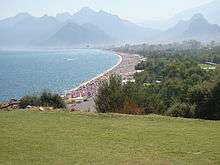
Antalya has beaches including Konyaaltı, Lara and Karpuzkaldıran. Beydağları and Saklikent are used for winter sports.
Historic sites in the city center
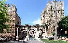
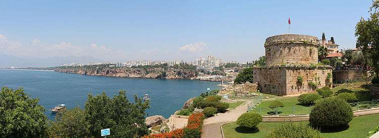
- Ancient monuments include the City Walls, Hıdırlık Tower, Hadrian's Gate (also known as Triple Gate), and the Clock Tower.
- Hadrian's Gate: constructed in the 2nd century by the Romans in honor of the Emperor Hadrian.
- İskele Mosque: A 19th-century Mosque near the marina.
- Karatay Medrese: A Medrese (Islamic theological seminary) built in 1250 by Emir Celaleddin Karatay.
- Kesik Minare (Broken Minaret) Mosque: Once a Roman temple then converted to a Byzantine Panayia church and finally into a mosque.
- Tekeli Mehmet Paşa Mosque: An 18th-century Mosque built in honor of Tekeli Mehmet Paşa.
- Yat Limanı: the harbour dating to Roman era.
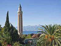
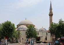
- Yivli Minare (Fluted Minaret) Mosque: Built by the Seljuks and decorated with dark blue and turquoise tiles. This minaret eventually became the symbol of the city.
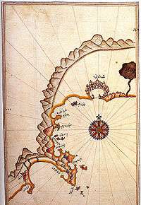
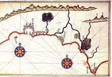
.JPG)
.jpg)
Main sights
- Tünek Hill
- Karaalioglu Park
- Arapsu Bridge
- Antalya Aquarium
- Aqualand Antalya
- Akdeniz Kent Parkı
- Hasan Subaşı Kültür Parkı
- Ataturk Culture Park (Turkish: Atatürk Kültür Parkı)[42]
- Bademağacı
- Düden Parkı
- TerraCity
- Laura
- SheMall
- Snow World
- Wildpark Antalya
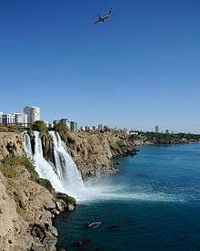
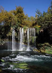
- Düden Waterfalls
- Kurşunlu Waterfalls
- MarkAntalya
- The Land of Legends
- Kecili Park[43]
Government
Antalya district Municipalities Turkish local elections, 2014 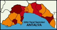 | |
|---|---|
| AKP |
11 / 19
|
| CHP |
5 / 19
|
| MHP |
4 / 19
|
Members of Parliament for Antalya Turkish general election, 2011 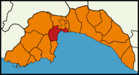 | |
|---|---|
| AKP |
6 / 14
|
| CHP |
5 / 14
|
| MHP |
3 / 14
|
The mayor of the Antalya Metropolitan Municipality is Menderes Türel of the AKP, in office since 2014. For general elections, Antalya elects 14 Members of Parliament to the Turkish Grand National Assembly.
Elections
Antalya has traditionally been seen as a stronghold for the Kemalist centre-left party Republican People's Party (CHP). Being the capital of the fifth most populous province in Turkey, Antalya is politically strategic and has been a target for the governing center-right Justice and Development Party (AKP). The AKP unexpectedly won control of the Antalya Metropolitan Municipality in the 2004 local election. The AKP won a plurality in Antalya in the 2007 general election, symbolising the city's political transformation from a CHP stronghold to a CHP-AKP marginal battleground in the 21st century. The loss of Antalya was a major political setback for the CHP not only because of its significance as a centre for tourism, but also because the CHP's former leader Deniz Baykal is a Member of Parliament for the province. The province is divided into 19 districts.
The CHP regained control of the Metropolitan Municipality in the 2009 local elections, though the AKP won a plurality in the 2011 general election. The Nationalist Movement Party (MHP) also have a strong political base in Antalya, winning approximately between 15 and 25% of the vote in elections since 2007. The city voted in favour of the AKP government's proposed constitutional reforms in the 2007 referendum, but voted against the reforms proposed in 2010.
In the 2014 local elections, Antalya once again voted for the AKP, with the MHP taking support away from the CHP by winning a record 24.3% of the vote. The CHP subsequently accused the AKP of systematic electoral fraud, and the presence of government minister Mevlüt Çavuşoğlu at one of the vote counting centres drew strong condemnation.[44][45][46][47][48] In the 2014 presidential election, the CHP and MHP's joint candidate Ekmeleddin İhsanoğlu won 53.08% of the vote. The AKP's candidate Recep Tayyip Erdoğan won 41.63% of the vote, and the HDP democratic socialist candidate Selahattin Demirtaş won 5.30% of the vote. Antalya was a hotspot for the 2013–14 anti-government protests against the AKP.[49]
Sports
The football club of Antalya, Antalyaspor plays in the Süper Lig. The team's home venue is Antalya Arena, with a capacity of 33,000, which was opened in 2015.[50] Another football venue in the city is Antalya Atatürk Stadium.
The city hosts a number of international sports competitions due to its longer lasting warm weather condition. Since 2006, one of the four stages of Archery World Cup events are held at the Antalya Centennial Archery Field. It also hosted European Weightlifting Championship in 2012, European Beach Volleyball Championship in 2003, European Triathlon Championship in 2013 and World Kickboxing Championships in 2013.
Since 2010, an international multiday trail running ultramarathon, called Lycian Way Ultramarathon, is held on the historical Lycian Way. The event runs eastward on a route of around 220–240 km (140–150 mi) from Ölüdeniz in Fethiye district of Muğla Province to Antalya in six days.[51][52]
Education
Akdeniz University enrolls over 60,000 students.[53]
There are international schools in the city, International Community College of Antalya, Eduant Private Russian School and International Russian School in Antalya.
Culture
Cuisine


Antalya’s signature cuisine includes Piyaz (made with tahini, garlic, walnuts, and boiled beans), şiş köfte (spicy meatball which is cooked around a stick) spicy hibeş with mixed cumin and tahini, tandır kebap, domates civesi, şakşuka, and various cold Mediterranean dishes with olive oil. One local speciality is tirmis, boiled seeds of the lupin, eaten as a snack. "Grida" (also known as Lagos or Mediterranean white grouper) is a fish common in local dishes.
Festivals and events
- Antalya Golden Orange Film Festival: national film festival usually held in September / October.[54][55][56]
- International Eurasia Film Festival: (2005–2008) annual international film festival, now part of the Golden Orange festival.[54][55][56]
- Antalya Television Awards: awarded annually since 2009.[57][58]
- Antalya Festival: September
- Mediterranean International Music Festival: October, 6 days
- Antalya International Folk Music and Dance Festival Competition: Last week of August
- Aspendos International Opera and Ballet Festival: June and July
- Flower festival May
Museums
- Antalya Museum
- Kaleiçi Museum:[59] Opened in 2007 by the Mediterranean Civilizations Research Center (Akdeniz Medeniyetleri Araştırma Merkezi)[60]
- Atatürk's House Museum
- Antalya Toy Museum. The Antalya Metropolitan Municipality opened the exhibition facility in 2011.[61]
- Suna & İnan Kıraç Kaleiçi Museum : An ethnographic museum run by the Suna and İnan Kıraç Foundation.
Transportation

The main transportation to the city is by air and land. Sea routes are still under development. In 2007, the airport added a new terminal.
The city has a main port at the south of the Konyaaltı.
Buses
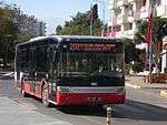
There is a network of look-alike Dolmuşes that are privately owned and operated minibuses, under municipal government control.
Antalya Ulaşım, a municipally-owned corporation, runs the public bus system. The corporation owns Antobus and Antray. Antobus was started in September 2010. In 2010, the city planned to increase from 40 to 140 more buses.[62]
Payment for public transportation was made in cash until the launch of a public transportation card, Antkart, in late 2007. The card system met with criticism and was subsequently canceled in June 2009, returning to a cash system. Halkkart has been used for the transportation system since the summer of 2010. Halkkart is managed by A-Kent Smart City Technologies under the control of Antalya Metropolitan Municipal government. Passengers can use identified cards to take buses or trams.[63]
The Halkkart system replaced by Antalyakart, jointly owned by Metropolitan Municipality and Kentkart in January 2016.
Light Rail
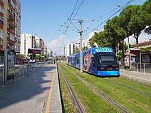
A tram system, opened in 1999, runs from Antalya Museum, and the Sheraton Voyager and Falez hotels, along the main boulevard through the city center at Kalekapisi, Hadrian's Gate, Karaalioglu Park, and ending at Talya Oteli. Trams depart on the hour and half-hour from the terminal (east and west), and reach Kalekapisi between 10 and 15 minutes later.
In December 2009, an 11.1-kilometre (6.9 mi) light rail line Antray was opened from one of the main city public bus hubs northwest to beyond suburban areas and the zoo. An extension to Airport, Aksu and Expo 2016 site was completed in 2016.
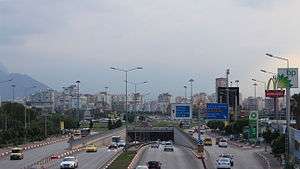
Major routes
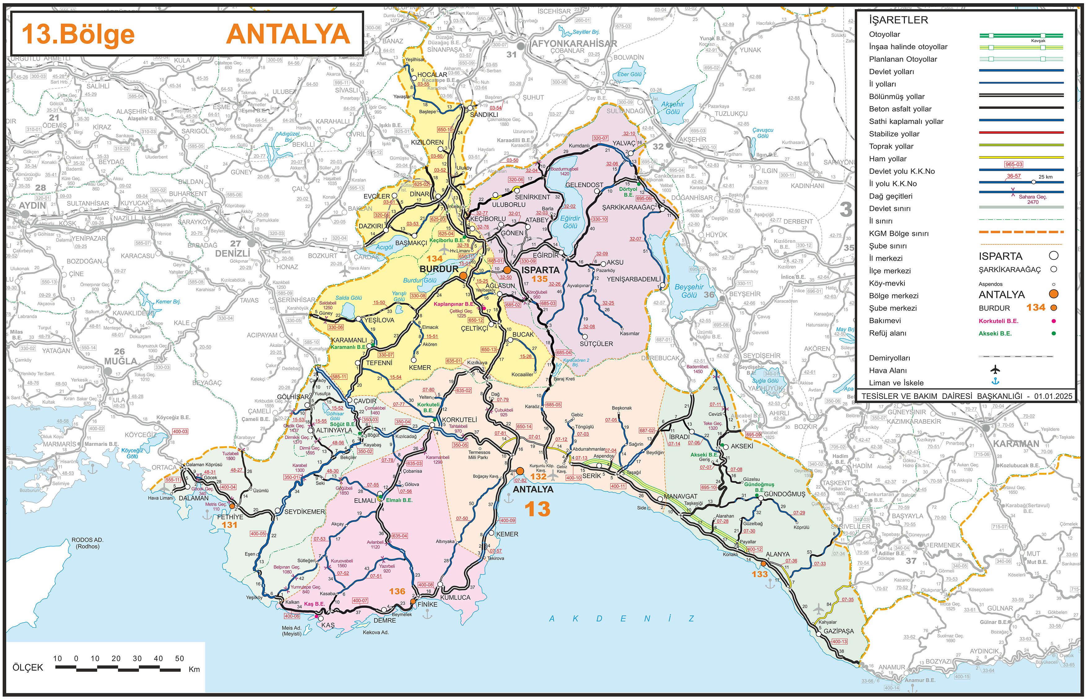
Antalya is the southern terminus of European route E87, which connects to Korkuteli, Denizli, İzmir, Çanakkale, Edirne in Turkey, alongside with Varna in Bulgaria, Constanta in Romania and Odessa in Ukraine. Antalya is also the terminus of Turkish Highway D650, which connects Burdur, Afyon, Kütahya, and Sakarya.
D400 connects with D650 in Antalya, while D650 alternative D685 connects to Isparta and provincial road 07-50 connects to Kumluca by Altınyaka, an alternative to D400.[64]
Airports
Antalya Airport has two international terminals and one domestic terminal. In 2007, its number of passengers on international flights surpassed the total number at Istanbul Ataturk Airport and Sabiha Gökçen International Airport for the first time, officially earning the title of "the capital of Turkish tourism".[65][66]
Antalya Public Transportation Statistics
The average amount of time people spend commuting with public transit in Antalya, for example to and from work, on a weekday is 63 min. 14.% of public transit riders, ride for more than 2 hours every day. The average amount of time people wait at a stop or station for public transit is 23 min, while 50% of riders wait for over 20 minutes on average every day. The average distance people usually ride in a single trip with public transit is 7.6 kilometres (4.7 miles), while 13% travel for over 12 kilometres (7.5 miles) in a single direction.[67]
Twin towns—sister cities
Antalya is twinned with:[68][69][70]


People
- Tarık Akıltopu, architect, historian, poet, writer
- Cafercan Aksu, football player
- Athenaeus of Attalia, physician and founder of the Pneumatist School of Medicine, 1st century AD
- Michael Attaliates Byzantine lawyer of the 11th century
- Deniz Baykal, former leader of Republican People's Party
- Coşkun Göğen, film actor
- Onat Kutlar, writer
- Özgürcan Özcan, football player
- Rüştü Reçber, football player
- Yağmur Sarıgül, musician, composer of maNga
- Sümer Tilmaç, actor
- Musa Uzunlar, actor
- Burak Yılmaz, football player
- Levent Yüksel, musician, composer
References
- ↑ "Turkey: Major cities and provinces". citypopulation.de. Retrieved 2015-02-08.
- ↑ Turkish Statistical Institute 2011 Census (Büyükşehir belediyeleri ve bağlı belediyelerin nüfusları) – 2011 Archived 19 October 2012 at the Wayback Machine.
- ↑ "2011". Citypopulation.de. Retrieved 2014-06-24.
- ↑ "History of Antalya". Lonely Planet.
- ↑ "Turkey's Tourism Renaissance".
- ↑ "Antalya". Washington Times. 2006-07-14. Retrieved 2014-06-24.
- ↑ Frangakis-Syrett, Elena. "The making of an Ottoman port" (PDF). Queens College, City University of New York: 23. Archived from the original (PDF) on 25 May 2015. Retrieved 2014-06-24.
- ↑ Liddell, Henry George; Scott, Robert. "A Greek-English Lexicon". Perseus project.
- ↑ Ἀτταλίς, Henry George Liddell, Robert Scott, A Greek-English Lexicon, on Perseus project
- ↑ Acts 14:25–26
- ↑ Michel Lequien, Oriens christianus in quatuor Patriarchatus digestus, Paris 1740, Vol. I, coll. 1027–1028 – compare with coll. 885–888
- ↑ M. Th. Disdier, v. 2. Attalia, in Dictionnaire d'Histoire et de Géographie ecclésiastiques, vol. V, Parigi 1931, coll. 148–150
- ↑ Annuario Pontificio 2013 (Libreria Editrice Vaticana 2013 ISBN 978-88-209-9070-1), p. 841
- ↑ Vryonis, The decline of medieval Hellenism in Asia Minor: and the process of Islamization from the eleventh through the fifteenth century, (Berkeley: University of California, 1971), pp. 13f
- ↑ Norwich, John Julius. Byzantium: The Decline and Fall. (New York: Alfred A. Knopf, 1996) p. 68.
- ↑ O City of Byzantium: Annals of Niketas Choniates, translated by Harry J. Magoulias (Detroit: Wayne State University Press, 1984), p. 351
- ↑ Islam and Christianity in Medieval Anatolia, ed. Bruno De Nicola, Sara Nur Yıldız, and A.C.S. Peacock, (Ashgate Publishing Company,2015), 121
- ↑ Notes on Saldjūq Architectural Patronage in Thirteenth Century Anatolia, H. Crane, Journal of the Economic and Social History of the Orient, Vol. 36, No. 1 (1993), 6.
- ↑ "Internet History Sourcebooks". sourcebooks.fordham.edu. Retrieved 2016-10-21.
- 1 2

- ↑ Prothero, G.W. (1920). Anatolia. London: H.M. Stationery Office. p. 113.
- ↑ Prothero, G.W. (1920). Anatolia. London: H.M. Stationery Office.
- ↑ "Serbian Consolate in Antalya".
- ↑ "Antalya Climate and Weather Averages, Antalya Coast". Weather2Travel. Retrieved 23 August 2013.
- ↑ "Official Statistics (Statistical Data of Provinces and districts)- ANTALYA" (in Turkish). Turkish State Meteorological Service. Retrieved 21 September 2012.
- ↑ "Climate Information for Antalya". World Meteorological Organization. Retrieved 21 September 2012.
- ↑ Antalya Climate – seatemperature.org
- ↑ Statistical Institute
- ↑ The Mountains of the Mediterranean World:, J. R. McNeill, page 159
- ↑ "Covered Wholesale Food Market". Antalya Metropolitan Municipality Official Web Site. Archived from the original on 15 December 2007. Retrieved 25 August 2008.
- ↑ "ANTALYA SERBEST BÖLGESÝ – Hoţgeldiniz !!". Ant-free-zone.org.tr. Retrieved 2011-09-15.
- ↑ "Contact Archived 29 October 2013 at the Wayback Machine.." Corendon Airlines. Retrieved on 17 February 2012. "CORENDON Airlines Head Office Address: Gzeloluk Mahallesi 1879 Sokak No :148 Antalya-Turkey"
- ↑ "Imprint." SunExpress. Retrieved on 23 December 2011. "TR-07300 Antalya, Türkiye P.O. Box 28 Mehmetçik Mah. Aspendos Bulv. Aspendos Iş Merkezi No. 63/1-2"
- ↑ Yılmaz, Leyla (1997), Antalya: Bir Ortaçağ Türk Kentinin Mimarlık Mirası ve Kent Dokusunun 16. Yüzyılın Sonuna Kadar Gelişimi (Bir Ortaçağ Arkeolojisi Survey'i) (PhD thesis) (in Turkish), Ankara University, pp. 307–9, retrieved 9 April 2016
- 1 2 Türk, Ali (2013). "Antalya Kenti Konut Dışı Tescilli Sivil Mimari Yapılar ve Özellikleri". Süleyman Demirel University Journal of Natural and Applied Science (in Turkish). 17 (1): 113–132. Retrieved 9 April 2016.
- 1 2 3 "Genel Bilgi" (in Turkish). Antalya Directorate of Culture and Tourism. Retrieved 9 April 2016.
- ↑ Orbasli, Aylin (2002). Tourists in Historic Towns: Urban Conservation and Heritage Management. Taylor & Francis. pp. 123–7. Retrieved 9 April 2016.
- ↑ Şavklı, Faik; Yılmaz, Tahsin (2013). "Kent meydanı kullanım nedenlerinin Antalya Cumhuriyet Meydanı örneğinde irdelenmesi". Süleyman Demirel University Faculty of Forestry Journal (in Turkish). 14: 138–142. Retrieved 9 April 2016.
- ↑ "Bölümler - Aya Yorgi Kilisesi" (in Turkish). Kaleiçi Museum. Archived from the original on 6 March 2016. Retrieved 9 April 2016.
- ↑ Özözen Kahraman, Selver (2008), "Göç, Gecekondulaşma ve Entegrasyon: Antalya Örneği" (PDF), 5th National Geography Symposium, Ankara University
- ↑ Çakır, Sabri (2011). "Türkiye'de Göç, Kentleşme/Gecekondu Sorunu ve Üretilen Politikalar" (PDF). Süleyman Demirel University Faculty of Arts and Sciences Journal of Social Sciences (23): 209–222. Archived from the original (PDF) on 2012-03-24. Retrieved 9 April 2016.
- ↑ "Ataturk Culture Park in Antalya, August 2017". Independent Travellers. independent-travellers.com. Retrieved May 30, 2018.
- ↑ "The City Centre of Antalya, August 2017". Independent Travellers. independent-travellers.com. Retrieved May 12, 2018.
- ↑ "Serious election fraud allegations, recounts continue". TodaysZaman. Retrieved 10 August 2015.
- ↑ http://chpbxl.files.wordpress.com/2014/04/biggest-electoral-fraud-ever-staged-in-turkey-4-april-2014.pdf
- ↑ "[Photo] Electoral fraud – Turkish local election ... – Veooz 360". Veooz. Archived from the original on 29 October 2014. Retrieved 10 August 2015.
- ↑ "Turkey: allegations of election fraud, Yalova goes to CHP – Politics – ANSAMed.it". Retrieved 10 August 2015.
- ↑ "AB Bakanı Mevlüt Çavuşoğlu oy sayarken". 2 April 2014. Retrieved 10 August 2015.
- ↑ "ANTALYA SEÇİM SONUÇLARI – Antalya Seçim Sonuçları". 11 August 2015. Retrieved 10 August 2015.
- ↑ "İşte Antalyaspor'un yeni stadı" (in Turkish). NTV Spor. 26 September 2015. Retrieved 23 April 2016.
- ↑ "Rota" (in Turkish). Likya Yolu Ultramaratonu. Retrieved 2013-11-27.
- ↑ "Hakkında" (in Turkish). Likya Yolu Ultramaratonu. Retrieved 2013-11-27.
- ↑ "Antalya International University". Antalya.edu.tr. Retrieved 2012-04-21.
- 1 2 Franklin, Anna (2007-10-11). "Eurasia Film Fest grows". Variety. Retrieved 2014-06-24.
- 1 2 "A Question Of Identity In Turkish Film: The 45th Antalya Film Festival" (Press release). Indiewire. 2012-10-26. Retrieved 2014-06-24.
- 1 2 "TURKEY – 44th Antalya Golden Orange Film Festival on the way". Hurriyetdailynews.com. 2007-06-22. Retrieved 2014-06-24.
- ↑ "Televizyon Oscarları sahiplerini buldu!". Gecce.com. Retrieved 2014-06-24.
- ↑ "The best of television awarded in Antalya – CINEMA-TV". Hurriyetdailynews.com. 2011-09-13. Retrieved 2014-06-24.
- ↑ "Kaleiçi Museum". Kaleicimuzesi.com. Retrieved 2012-04-21.
- ↑ "their annual journal". Akmedadalya.com. Retrieved 2012-04-21.
- ↑ "Antalya opens new toy museum". Retrieved 17 February 2012.
- ↑ "Antalya Büyükşehir Belediyesi". Antalya Metropolitan Municipality Official Web Site (in Turkish). 2010. Archived from the original on 27 November 2010. Retrieved 30 November 2010.
- ↑ "Antalya Büyükşehir Belediyesi". Antalya.bel.tr. 2014-05-23. Retrieved 2014-06-24.
- ↑ "Map of 13th Division". General Directory of Highways. General Directory of Highways. Retrieved 14 August 2015.
- ↑ "NUMBER OF PASSENGERS IN ANTALYA'S INTERNATIONAL FLIGHTS HIGHER THAN ISTANBUL". World Bulletin. 16 September 2007. Retrieved 25 August 2008.
- ↑ Yanik, Vahide (17 September 2007). "Türkiye uçtu, dünya rekoru kırdı". DHA (in Turkish). Hürriyet. Retrieved 25 August 2008.
- ↑ "Antalya Public Transportation Statistics". Global Public Transit Index by Moovit. Retrieved June 19, 2017.

- ↑ "Sister Cities". Antalya Metropolitan Municipality. Archived from the original on 29 April 2011.
- ↑ "Antalya: Sister Cities and Town Twinning". Antalya Central. Retrieved 2013-07-29.
- ↑ "Turkey's Antalya, Miami sign sister city agreement".
External links
| Wikimedia Commons has media related to Antalya. |
| Wikivoyage has a travel guide for Antalya. |
Hellenistic/Macedonian colonies | ||
|---|---|---|
| Africa | ||
| Asia | ||
| Europe | ||