Rangpo
| Rangpo | |
|---|---|
| town | |
 Rangpo  Rangpo | |
| Coordinates: 27°10′30″N 88°31′48″E / 27.175°N 88.530°ECoordinates: 27°10′30″N 88°31′48″E / 27.175°N 88.530°E | |
| Country | India |
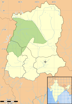
| State | Sikkim |
| District | East |
| Government | |
| • Type | Nagar Panchayat |
| Elevation | 333 m (1,093 ft) |
| Population (2011) | |
| • Total | 10,450 |
| Languages | |
| • Official | Nepali, Bhutia, Lepcha, Limbu, Newari, Rai, Gurung, Mangar, Sherpa, Tamang and Sunwar |
| Time zone | UTC+5:30 (IST) |
| Vehicle registration | SK |
| Literacy | 87.27% |
Rangpo (Nepali: रम्फु) is a town in East Sikkim in the Indian state of Sikkim. The town borders West Bengal and is situated along the Teesta river. It is the first town in Sikkim on NH 10 (earlier called NH 31A before renumbering of all national highways) that links Siliguri to Gangtok. It is about 200 m above sea level with a sub-tropical climate. It is the Gateway to Sikkim and all vehicles entering Sikkim have to stop here. Foreign tourists require documents to enter Sikkim state and have to show them at the border police post.
Rangpo has a large population of Bhutias and persons of Nepali origin. Marwari and Bihari businessmen have settled in the town and own most of the shops among them are few old settlers in town who have history of business since 1912.
Geography
Rangpo is located at 27°11′N 88°32′E / 27.18°N 88.53°E.[1] It has an average elevation of 333 metres (1093 feet).
Demographics
As of 2001 India census,[2] Rangpo had a population of 3,724. Males constitute 55% of the population and females 45%. Rangpo has an average literacy rate of 70%, higher than the national average of 59.5%: male literacy is 75%, and female literacy is 63%. In Rangpo, 13% of the population is under 6 years of age.
Sikkim railway project
The foundation stone for construction of a new railway line from Sevoke railway station (station code SVQ) to proposed Rangpo railway station on the border of Sikkim and West Bengal was laid in October 2009 by the vice president of India.[3] In 2008, the line was proposed to be 53 km long with 1,676 mm (5 ft 6 in) broad gauge track with only a few tunnels but the final alignment is 45 km long with more number of tunnels. Of this, 3.5 km will be in Sikkim state and the rest in West Bengal state. The track will have 28 bridges and 14 tunnels and 38.6 km of the track will be in tunnels[4][5]. Bridges over deep gorges and valleys will provide a scenic journey. The track will be constructed through the foothills of the Kanchanjungha mountain range and the Teesta river valley and will offer very beautiful views. New railway stations will be constructed at Riayang, Geil Khola, Teesta Bazaar, Melli and Rangpo.
The Indian Railways signed a contract with the construction company, IRCON, only in May 2010 though the foundation stone had been laid in October 2009. The final alignment had not been fixed for the first 22 km through elephant sanctuary forest even in 2013 and the final clearance of environment ministry had not been received.[6] To obtain approval of the environment and forest ministry, the railways made a proposal in February 2013 to install elephant sensors along the stretch of the proposed railway line in Mahananda elephant sanctuary or run the trains at a speed of only 20 km per hour in the forest area and stop when an elephant is sighted close to the track.[7] People of two villages in East Sikkim, through which a 3.5 km stretch of the 45 km long railway line has been planned, had not agreed to give their land for laying the track.[8]
The Supreme Court of India approved the project in February 2016 with strict guidelines of the National Wildlife Board that cleared the project in June 2015 but ordered restricted speed, wireless animal tracking sensors and allowed digging of tunnels only during daytime. However, a "No Objection Certificate" (NOC) was still needed from the gram sabhas (village councils) of all the villages in Darjeeling and Kalimpong districts in West Bengal through which the track will pass. The construction cannot start without the NOC. However, the Gram Sabhas do not exist due to non-holding of rural elections in the Hills for the past several years and therefore no NOC could be obtained.[9]. This is a catch 22 situation holding up the commencement of construction. The project cost has escalated from the estimated cost of Rs.13.4 billion in 2008[10] to Rs.60 billion and construction of the railway line has not started even in 2018. Railway Board chairman visited and met the Northeast Frontier Railway (NFR) officials on 2 March 2018 to discuss the status of the project.[11] Finally a NOC was issued by GTA on 11 April 2018 on behalf of the villages.[12][13] However, no tender has been issued and no bid has been invited for the project after April 2018.
The railway line is needed for security and socio-economic reasons. The railway line will help troops and armaments move faster towards the Indo-Tibet border. The new railway line will be beneficial to the people of Sikkim for easier access to the rest of India through Siliguri. It will boost the state's economy and tourism.
Summary of Sikkim railway project
- Estimated cost: Rs.1,340 crore (13.4 billion) in 2008 but may exceed Rs.60 billion when the project is completed in 2022.
- Length of final alignment: 44.98 km
- Length of track in Bengal: 41.54 km
- Length of track in Sikkim: 3.44 km
- Stations: Riang (or Riayang), Gailkhola (or Geil Khola), Teesta Bazaar, Melli and Rangpo
- Nearest large junction: New Jalpaiguri (30 km from Sevoke through Siliguri junction)
- Route under tunnels: 38.64 km (86%)
- Number of bridges: 28
- Number of tunnels: 14
- Longest tunnel: 5.1 km
Sports
Mining Ground is a cricket ground in Rangpo and was established in 1997 when a match of Vijay Merchant Trophy was played between Sikkim Under-16s and Bihar Under-16s.[14] Previously, the ground belongs to Sikkim Mining Corporation was handed over to the Sikkim Cricket Association in 2002 to be developed as a cricket stadium.[15][16]
Industrialization
Rangpo is now the center for many pharmaceuticals company .The small town is also one of the fastest growing towns in the state.
Education
Rangpo has many premium school for the elementary education namely Little Bells' School which is around 30-year-old school, Ivana memorial school and Tiny tots School .Also nearby Government Senior secondary school in mining(SMC), Rangpo area is the hub for students growing their.This govt. school is the best and the beautiful school in the near by Rangpo.
See also
References
- ↑ Falling Rain Genomics, Inc - Rangpo
- ↑ "Census of India 2001: Data from the 2001 Census, including cities, villages and towns (Provisional)". Census Commission of India. Archived from the original on 2004-06-16. Retrieved 2008-11-01.
- ↑ http://www.constructionupdate.com/News.aspx?nId=WIcIBZdMByhLAS9Iyls+Og==
- ↑ Atreya, Sarikah (25 January 2010). "Inspection survey for Sikkim rail link". The Hindu Business Line. Retrieved 8 September 2018.
- ↑ http://www.thehindubusinessline.com/2010/01/25/stories/2010012551081500.htm
- ↑ http://www.railway-technology.com/projects/northbengalsikkimrai/
- ↑ http://www.thehindu.com/todays-paper/tp-national/tp-newdelhi/elephant-sensors-may-come-up-on-railway-line-to-sikkim/article4387995.ece
- ↑ Villagers’ nod to rail survey, The Telegraph, 28 August 2012
- ↑ https://www.thestatesman.com/cities/cms-may-talk-sikkim-rail-project-1502602405.html
- ↑ http://www.indianrailways.gov.in/railwayboard/uploads/directorate/works/pdf/Other_Projects_080411.pdf
- ↑ http://www.newindianexpress.com/nation/2018/feb/21/coming-soon-west-bengal---sikkim-rail-project-1776854.html
- ↑ http://www.railnews.in/sevoke-rangpo-railway-line-finally-gets-gta-nod/
- ↑ https://voiceofsikkim.com/2018/04/11/sikkim-railway-sevoke-rangpo-rail-gets-gta-nod-finally/
- ↑ Scorecard
- ↑ Rangpo recce for cricket big league
- ↑ Rangpo Mining cricket ground changed into the jungle due to the negliency of the department
| Topics |  | |
|---|---|---|
| Administration | ||
| Districts | ||
| Towns | ||
| Rivers | ||
| Lakes | ||
| Glaciers | ||
| See also | ||
| Wikimedia Commons has media related to Rangpo. |