Rancho Mesa Verde, Arizona
| Rancho Mesa Verde, Arizona | |
|---|---|
| Census-designated place | |
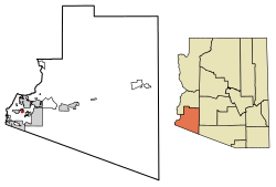 Location of Rancho Mesa Verde in Yuma County, Arizona. | |
 Rancho Mesa Verde Location of Rancho Mesa Verde in Yuma County, Arizona. | |
| Coordinates: 32°35′40″N 114°39′18″W / 32.59444°N 114.65500°WCoordinates: 32°35′40″N 114°39′18″W / 32.59444°N 114.65500°W | |
| Country | United States |
| State | Arizona |
| County | Yuma |
| Area[1] | |
| • Total | 0.11 sq mi (0.29 km2) |
| • Land | 0.11 sq mi (0.29 km2) |
| • Water | 0.00 sq mi (0.00 km2) |
| Elevation | 187 ft (57 m) |
| Population (2010)[2] | |
| • Total | 26,361 |
| • Estimate (2016)[3] | N/A |
| Time zone | UTC-7 (Mountain (MST)) |
| Area code(s) | 928 |
| GNIS feature ID | 2582848[4] |
Rancho Mesa Verde is a census-designated place in Yuma County, in the U.S. state of Arizona.[4] The population was 625 at the 2010 census.[2]
Geography
According to the U.S. Census Bureau, the community has an area of 0.112 square miles (0.29 km2), all of it land.[2]
Demographics
| Historical population | |||
|---|---|---|---|
| Census | Pop. | %± | |
| U.S. Decennial Census[5] | |||
References
- ↑ "2016 U.S. Gazetteer Files". United States Census Bureau. Retrieved Jul 18, 2017.
- 1 2 3 "2010 Census Gazetteer Files - Places: Arizona". U.S. Census Bureau. Retrieved February 26, 2017.
- ↑ "Population and Housing Unit Estimates". Retrieved June 9, 2017.
- 1 2 "Rancho Mesa Verde Census Designated Place". Geographic Names Information System. United States Geological Survey.
- ↑ "Census of Population and Housing". Census.gov. Retrieved June 4, 2016.
Municipalities and communities of Yuma County, Arizona, United States | ||
|---|---|---|
| Cities | 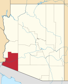 | |
| Town | ||
| CDPs | ||
| Populated places | ||
| Indian reservations | ||
| Ghost towns | ||
| Footnotes | ‡This populated place also has portions in an adjacent county or counties | |
This article is issued from
Wikipedia.
The text is licensed under Creative Commons - Attribution - Sharealike.
Additional terms may apply for the media files.