Padre Ranchitos, Arizona
| Padre Ranchitos, Arizona | |
|---|---|
| CDP | |
 Padre Ranchitos Location within the state of Arizona  Padre Ranchitos Padre Ranchitos (the US) | |
| Coordinates: 32°38′59″N 114°38′30″W / 32.64972°N 114.64167°WCoordinates: 32°38′59″N 114°38′30″W / 32.64972°N 114.64167°W | |
| Country | United States |
| State | Arizona |
| County | Yuma |
| Area[1] | |
| • Total | 0.29 sq mi (0.75 km2) |
| • Land | 0.29 sq mi (0.75 km2) |
| • Water | 0.00 sq mi (0.00 km2) |
| Elevation[2] | 118 ft (36 m) |
| Population (2010) | |
| • Total | 41,011 |
| • Estimate (2016)[3] | N/A |
| Time zone | UTC-7 (MST) |
| Area code(s) | 928 |
| FIPS code | 04-51800 |
| GNIS feature ID | 2582838 |
Padre Ranchitos is a census-designated place (CDP) situated near both the international border with Mexico, and the state border with California, in Yuma County, Arizona, United States. The population was 171 at the 2010 census.
Geography
Padre Ranchitos is located at 32°38′59″N 114°38′30″W / 32.64972°N 114.64167°W (32.649592, −114.641584). According to the United States Geological Survey, the CDP has a total area of 0.29 square miles (0.75 km2), all of it land.[2][4]
Demographics
| Historical population | |||
|---|---|---|---|
| Census | Pop. | %± | |
| U.S. Decennial Census[5] | |||
As of the 2010 census, there were 171 people residing in the CDP: 83 male and 88 female. 66 were 19 years old or younger, 28 were ages 20–34, 33 were between the ages of 35 and 49, 29 were between 50 and 64, and the remaining 15 were aged 65 and above. The median age was 31.1 years.
The racial makeup of the CDP was 54.4% White, 5.8% Asian, 2.3% American Indian, 0.6% Black or African American, 26.9% Other, and 9.9% two or more races. 78.4% of the population were Hispanic or Latino of any race.
There were 42 households in the CDP, 38 family households (90.5%) and 4 non-family households (9.5%), with an average household size of 4.07. Of the family households, 33 were married couples living together, with 1 single father and 4 single mothers; while the non-family households included 3 adults living alone: 2 male and 1 female.
The CDP contained 46 housing units, of which 42 were occupied and 4 were vacant.[6]
References
- ↑ "2016 U.S. Gazetteer Files". United States Census Bureau. Retrieved Jul 18, 2017.
- 1 2 "Feature Detail Report for: Padre Ranchitos Census Designated Place". Geographic Names Information System. United States Geological Survey.
- ↑ "Population and Housing Unit Estimates". Retrieved June 9, 2017.
- ↑ "Padre Ranchitos CDP, Arizona – Basic Facts". AZ Hometown Locator. Retrieved January 7, 2017.
- ↑ "Census of Population and Housing". Census.gov. Retrieved June 4, 2016.
- ↑ "American FactFinder: Padre Ranchitos CDP, Arizona". United States Census Bureau. Retrieved January 7, 2017.
Municipalities and communities of Yuma County, Arizona, United States | ||
|---|---|---|
| Cities | 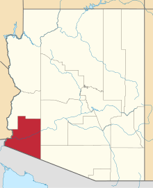 | |
| Town | ||
| CDPs | ||
| Populated places | ||
| Indian reservations | ||
| Ghost towns | ||
| Footnotes | ‡This populated place also has portions in an adjacent county or counties | |