Rakai
| Rakai | |
|---|---|
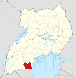
 Rakai Map of Uganda showing the location of Rakai. | |
|
Coordinates: | |
| Region | Central Uganda |
| District | Rakai District |
| Elevation | 1,280 m (4,200 ft) |
| Population (2014 Census) | |
| • Total | 7,592[1] |
| Time zone | UTC+3 (EAT) |
Rakai is a town in the Central Region of Uganda. It is the site of the headquarters of Rakai District.[2] Other towns in the district include Kalisizo, Kyotera Kakuuto and Mutukula.[3]
Location
The nearest town is Kyotera, located approximately 20 kilometres (12 mi), north-east of Rakai Town.[4] Rakai Town is about 52 kilometres (32 mi), by road, north-west of the international border with Tanzania at Mutukula.[5] Rakai is located approximately 65.5 kilometres (41 mi), by road, south-west of Masaka, the largest town in the sub-region.[6] This is approximately 198 kilometres (123 mi), by road, south-west of Kampala, Uganda's capital and largest city.[7] The coordinates of Rakai Town are 0°42'36.0"S, 31°24'18.0"E (Latitude:-0.7100, Longitude:31.4050).[8]
Population
The 2002 national census put the population of the town at about 5,920. In 2010, the Uganda Bureau of Statistics (UBOS) estimated the mid-year population at 6,900. In 2011, UBOS estimated the mid-year population at 7,000.[9] During the national population census conducted on 27 August 2014, the population was enumerated at 7,592.[1]
Overview
Rakai is the headquarters of Rakai District, which in the early 1980s, was the epicenter and first distinct in Uganda to be affected by the AIDS epidemic.[10]
Points of interest
The following additional points of interest are located within the town limits or close to its edges: (a) the offices of Rakai Town Council.[2] (b) Rakai General Hospital, a 100-bed public hospital administered by the Rakai District local government.[11] (c) Kamuswaga's Palace.[12] (d) the offices of Rakai District Headquarters.[10] (e) Rakai Health Sciences Program, a collaboration between researchers at Makerere University, Columbia University, and Johns Hopkins University, offering several different health services such as antiretroviral medications, circumcision, health education, and counseling as well as research in the field of HIV/AIDS.[13]
Law enforcement
There is a police station in Rakai Town, administered and operated by the Uganda Police Force.[14]
See also
References
- 1 2 UBOS (November 2014). "National Population And Housing Census 2014: Provisional Results, Revised Edition" (PDF). Kampala: Uganda Bureau of Statistics (UBOS).
- 1 2 Bindhe, Edward (3 May 2012). "Kooki Chief Defies Town Council on Hotel Construction". Kampala: Uganda Radio Network. Retrieved 25 October 2016.
- ↑ Google (25 October 2016). "Map of Rakai District, Showing Major Urban Centers" (Map). Google Maps. Google. Retrieved 25 October 2016.
- ↑ Globefeed.com (25 October 2016). "Distance between Rakai Town, Central Region, Uganda and Kyotera, Central Region, Uganda". Globefeed.com. Retrieved 25 October 2016.
- ↑ Globefeed.com (25 October 2016). "Distance between Rakai town, Central Region, Uganda and Big Mama's Restaurant, Uganda". Globefeed.com. Retrieved 25 October 2016.
- ↑ Globefeed.com (25 October 2016). "Distance between Masaka, Central Region, Uganda and Rakai Town, Central Region, Uganda". Globefeed.com. Retrieved 25 October 2016.
- ↑ Globefeed.com (25 October 2016). "Distance between Rakai Town, Central Region, Uganda and Kampala, Central Region, Uganda". Globefeed.com. Retrieved 25 October 2016.
- ↑ Google (25 October 2016). "Location of Rakai Town, Rakai District, Uganda" (Map). Google Maps. Google. Retrieved 25 October 2016.
- ↑ UBOS (2012). "Estimated Population of Rakai In 2002, 2010 & 2011" (PDF). Kampala: Uganda Bureau of Statistics (UBOS). Retrieved 20 October 2016.
- 1 2 Mutyaba, Gertrude (10 February 2014). "Rakai: Where Uganda's HIV fight began". Daily Monitor. Kampala. Retrieved 25 October 2016.
- ↑ Mpagi, Musa (4 December 2012). "Rakai Hospital without X-ray machine for seven years". Daily Monitor. Kampala. Retrieved 25 October 2016.
- ↑ Mugera, Isaac (10 May 2007). "Kamuswaga's Palace in Ruins Three Years after Reinstatement of Kooki Kingdom". Kampala: Uganda Radio Network. Retrieved 25 October 2016.
- ↑ "Rakai Health Sciences". www.rhsp.org. Retrieved 9 March 2017.
- ↑ Buregyeya, Dismus (18 March 2016). "Rakai Go Forward coordinator arrested over rebel links". New Vision. Kampala. Retrieved 25 October 2016.
External links
Capital: Rakai | ||
| Counties and sub-counties |
|  |
| Towns and villages | ||
| Economy | ||
| Health | ||
| Transport |
| |
| Notable people | ||