Kakuuto, Uganda
| Kakuuto | |
|---|---|
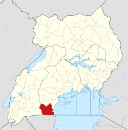
 Kakuuto Location in Uganda | |
| Coordinates: 00°50′24″S 31°27′36″E / 0.84000°S 31.46000°E | |
| Country |
|
| Region | Central Uganda |
| District | Rakai District |
| Elevation | 3,900 ft (1,200 m) |
Kakuuto is a town in southwestern Central Uganda.
Location
Kakuuto is located in Rakai District, approximately 80 kilometres (50 mi), by road, south of Masaka, the largest city in the sub-region.[1] This location lies immediately west of the highway between Masaka and the border town of Mutukula, at an elevation of 1,200 metres (3,900 ft), above sea level. Mutukula, the border town between Uganda and Tanzania, lies approximately 17 kilometres (11 mi), by road, south of Kakuuto.[2] The coordinates of Kakuuto are:0°50'24.0"S, 31°27'36.0" (Latitude:-0.8400; Longitude:31.4600).[3]
Overview
Kakuuto is a small, town in southern Rakai District. It is the county seat of Kakuuto County. The surrounding area is primarily rural and poor. The population of the area has been greatly adversely affected by the HIV/AIDS epidemic over the past three decades. With the help of charities and NGO's, the town and region is slowly recovering.[4]
Points of interest
The following points of interest lie within the town or close to the town limits:
- The headquarters of Kakuuto County
- The offices of Kakuuto Town Council
- Kakuuto General Hospital - A 100-bed hospital, administered by the Uganda Ministry of Health
- Kakuuto Central Market
- Kakuuto Ostrich Farm - A private tourist attraction[5]
- Sango Bay Estates Limited - Uganda's fourth-largest sugar manufacturer. Annual output of 15,000 metric tonnes in 2011.[6]
External links
See also
References
- ↑ Road Distance Between Masaka And Kakuuto With Map
- ↑ Road Distance Between Kakuuto And Mutukula With Map
- ↑ Google (10 July 2015). "Location of Kakuuto At Google Maps" (Map). Google Maps. Google. Retrieved 10 July 2015.
- ↑ Charities and NGOs Helping Kakuuto to Recover
- ↑ Kakuuto Ostrich Farm
- ↑ SBEL Output of 15,000 Metric Tonnes Annually in 2011
Capital: Rakai | ||
| Counties and sub-counties |
|  |
| Towns and villages | ||
| Economy | ||
| Health | ||
| Transport |
| |
| Notable people | ||