Masaka
| Masaka | |
|---|---|
 Masaka Location in Uganda | |
| Coordinates: 00°20′28″S 31°44′10″E / 0.34111°S 31.73611°E | |
| Country |
|
| Region | Central Uganda |
| District | Masaka District |
| Elevation | 1,200 m (3,900 ft) |
| Population (2014 Census) | |
| • Total | 103,829[1] |
Masaka is a large town in the Central Region of Uganda, west of Lake Victoria. The headquarters of the Masaka District are in the town.[2]
Masaka town was largely destroyed in 1979 during the Uganda-Tanzania War and again in the 1981-1986 civil war that saw the overthrow of Milton Obote from power for the second and last time.
Location
Masaka is approximately 140 kilometres (87 mi) to the south-west of Kampala on the highway to Mbarara.[3] The town is close to the Equator. The coordinates of the town are 0°20'28.0"S, 31°44'10.0"E (Latitude:-0.341111; Longitude:31.736111).[4]
Population
According to the 2002 national census, the population of Masaka was about 67,800. In 2010, the Uganda Bureau of Statistics (UBOS) estimated the population at 73,300. In 2011, UBOS estimated the mid-year population at 74,100.[5] In August 2014, the national population census put the population at 103,829.[1]
Economic activities
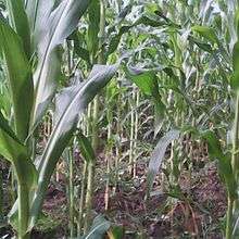
Most of the people are farmers with both cattle and other crops. Other economic activities include the following:
- Meat and fish processing
- Furniture manufacturing
- Manufacture of footwear
- Manufacture of baked products
- Cattle rearing
- Manufacture of beads
- "Gathering grasshoppers" that can potentially earn a collector over UGX:50 million annually.
- The annual Uganda Marathon event takes place in June, the race route loops twice through the town and the funds generated ($560,000 in the past 3 years) support local employment and community development.
Points of interest
The following additional points of interest are located in Masaka or close to its borders:
- offices of Masaka Municipal Council
- Masaka central market
- headquarters of the Mechanized Division of the Uganda People's Defense Force
- Muteesa I Royal University
- Western Campus of Kampala University
- St. Henry's College Kitovu
- headquarters of the Roman Catholic Diocese of Masaka
- Lake Nabugabo, 20 kilometres (12 mi) to the east of downtown Masaka.[6]
- Bukakkata, 24 miles (39 km) east of Masaka.
- Ssese Islands in Lake Victoria
- Masaka Regional Referral Hospital
- Masaka Currency Center – a currency storage and processing facility owned and operated by the Bank of Uganda, Uganda's central bank.[7]
- A branch of the National Social Security Fund
Notable people
- Edward Ssekandi, Vice President of Uganda
See also
Photos
References
- 1 2 UBOS (27 August 2014). "The Population of The Regions of the Republic of Uganda And All Cities And Towns of More Than 15,000 Inhabitants". Citypopulation.de Quoting Uganda Bureau of Statistics (UBOS). Retrieved 22 February 2015.
- ↑ Fields, Megan (December 2009). "Masaka: Big Shoes, Small Feet". Wordpress.com (Megan Fields Blog). Retrieved 17 April 2014.
- ↑ "Map Showing Kampala And Masaka With Distance Marker". Globefeed.com. Retrieved 17 April 2014.
- ↑ Google (1 July 2015). "Location of Masaka At Google Maps" (Map). Google Maps. Google. Retrieved 1 July 2015.
- ↑ "Estimated Population of Masaka In 2002, 2010 & 2011" (PDF). Uganda Bureau of Statistics. Archived from the original (PDF) on 7 July 2014. Retrieved 17 April 2014.
- ↑ "Location of Lake Nabugabo". Lake Nabugabo Resort. Retrieved 17 April 2014.
- ↑ "Bank of Uganda Maintains A Currency Center In Masaka". Bank of Uganda. Retrieved 17 April 2014.
External links
| Wikivoyage has a travel guide for Masaka. |
- Masaka Town Expands To Get City Status
- Lake Nabugabo Homepage
- Masaka District Internet Portal
- River Of Life Church & Orphanage
- Uganda International Marathon, Masaka
Capital: Masaka | ||
| Towns and villages |  | |
| Geography |
| |
| Economy | ||
| Health | ||
| Transport | ||
| Notable landmarks | ||
| Education | ||
| Notable people | ||