Queensbury Parish, New Brunswick
| Queensbury | |
|---|---|
| Parish | |
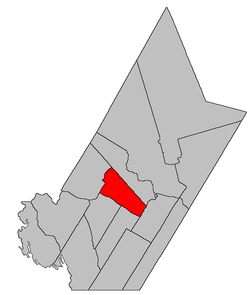 Location within York County. | |
| Coordinates: 45°57′45″N 67°00′54″W / 45.9625°N 67.015°W | |
| Country |
|
| Province |
|
| County | York |
| Established | 1786 |
| Area[1] | |
| • Land | 301.38 km2 (116.36 sq mi) |
| Population (2011)[1] | |
| • Total | 1,272 |
| • Density | 4.2/km2 (11/sq mi) |
| • Pop 2006-2011 |
|
| • Dwellings | 569 |
| Time zone | UTC-4 (AST) |
| • Summer (DST) | UTC-3 (ADT) |
Queensbury is a Canadian parish in York County, New Brunswick.[2]
Its population in the 2011 Census was 1,272.
Delineation
Queensbury Parish is defined in the Territorial Division Act[3] as being bounded:
- Northeast by Bright Parish; south and southwest by the Saint John River; and northwest by a line commencing at the Saint John River, at the southern angle of lot number one, granted to Joseph Cunliff, near the mouth of the Nackawic Stream; thence running northeasterly along the lower or southeastern line of said lot and its prolongation until it strikes the southwestern line of land granted to William Dobie, in Caverhill; thence northwesterly along the said line of said grant and its prolongation till it strikes the southeastern line of a grant to Henry Morehouse and three others; thence northeasterly along the line of said grant to its eastern angle; thence northwesterly along the northeast side of the said grant till it strikes the East Branch Nackawic Stream; thence following the course of the said river up stream to the forks at the mouth of the Burtt Lake Branch and thence following the course of the said Burtt Lake Branch up stream till it strikes the line of the parish of Bright.
Governance
The entire parish forms the local service district of the parish of Queensbury, established in 1966 to assess for fire protection. Community services were added in 1967 and first aid and ambulance services in 1978.
Communities
Parish population total does not include incorporated municipalities (in bold):
|
|
|
Demographics
See also
References
- 1 2 2011 Statistics Canada Census Profile: Queensbury Parish, New Brunswick
- ↑ New Brunswick Provincial Archives - Queensbury Parish
- ↑ "Territorial Division Act (R.S.N.B. 1973, c. T-3)". Government of New Brunswick website. Retrieved 24 August 2016.
- ↑ Statistics Canada: 1996, 2001, 2006 census
- ↑ 2006 Statistics Canada Community Profile: Queensbury Parish, New Brunswick
External links
Places adjacent to Queensbury Parish, New Brunswick | |
|---|---|
| Subdivisions | |
|---|---|
| Cities | |
| Counties | |
| |
Coordinates: 45°57′45″N 67°00′54″W / 45.96250°N 67.01500°W
This article is issued from
Wikipedia.
The text is licensed under Creative Commons - Attribution - Sharealike.
Additional terms may apply for the media files.