Pyecombe
| Pyecombe | |
|---|---|
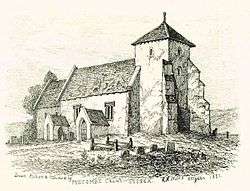 Church of the Transfiguration, Pyecombe by R. H. Nibbs, 1851 | |
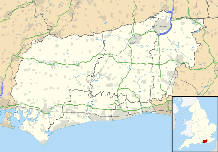 Pyecombe Pyecombe shown within West Sussex | |
| Area | 8.87 km2 (3.42 sq mi) [1] |
| Population |
200 [1] 2001 Census 237 (2011 Census)[2] |
| • Density | 23/km2 (60/sq mi) |
| OS grid reference | TQ292126 |
| • London | 42 miles (68 km) N |
| Civil parish |
|
| District | |
| Shire county | |
| Region | |
| Country | England |
| Sovereign state | United Kingdom |
| Post town | BRIGHTON |
| Postcode district | BN45 |
| Dialling code | 01273 |
| Police | Sussex |
| Fire | West Sussex |
| Ambulance | South East Coast |
| EU Parliament | South East England |
| UK Parliament | |
| Website | https://web.archive.org/web/20090612203840/http://www.pyecombe.org.uk/ |
Pyecombe is a village and civil parish in the Mid Sussex District of West Sussex, England. It is located 7 miles (11 km) to the north of Brighton. The civil parish covers an area of 887 hectares (2,190 acres) and has a population of 200 (2001 census), increasing at the 2011 Census to a population of 237.[2]
The parish church, the Church of the Transfiguration, was largely built in 1170. The village inn is the Plough; and there is Pyecombe Golf Club just to the north of the village. There is also The Three Greys riding school and Brendon Stud in the locality. Opposite the church is the old forge where the Pyecombe hook was first made in the 19th century by Mr Berry, the blacksmith.
The word 'Pyecombe' is thought to derive from the Saxon name "peac cumb" which means 'the peak valley'. Actually the parish of Pyecombe comprises two settlements, one called 'Pyecombe' and the other 'Pyecombe Street'. These are about a quarter of a mile apart. The reason for the gap between the two parts of the village is unclear but it is generally thought to be a consequence of plague in the 17th century which necessitated the temporary abandonment of the main settlement and its 13th century Saxo-Norman church.
The village lies on the London to Brighton Way Roman road, as well as on 18th and 19th century turnpike roads over Clayton Hill.
Landmarks
Wolstonbury Hill is a chalk prominence located within the parish, owned and maintained by the National Trust, is listed as a Scheduled Monument and a Site of Special Scientific Interest.[3]
References
- 1 2 "2001 Census: West Sussex – Population by Parish" (PDF). West Sussex County Council. Archived from the original (PDF) on 8 June 2011. Retrieved 10 April 2009.
- 1 2 "Civil Parish population 2011". Neighbourhood Statistics. Office for National Statistics. Retrieved 2 October 2016.
- ↑ "SSSI Citation — Wolstonbury Hill" (PDF). Natural England. Retrieved 4 April 2009.
External links
| Wikimedia Commons has media related to Pyecombe. |