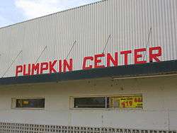
Pumpkin Center, Kern County, California
| Pumpkin Center | |
|---|---|
| Unincorporated community | |
 | |
 Pumpkin Center Location in California  Pumpkin Center Pumpkin Center (the US) | |
| Coordinates: 35°16′01″N 119°02′00″W / 35.26694°N 119.03333°WCoordinates: 35°16′01″N 119°02′00″W / 35.26694°N 119.03333°W | |
| Country | United States |
| State | California |
| County | Kern County |
| Elevation[1] | 351 ft (107 m) |
Pumpkin Center is an unincorporated community in Kern County, California.[1] It is located 7.5 miles (12 km) south-southwest of Bakersfield,[2] at an elevation of 351 feet (107 m).[1]
Pumpkin Center is located at the intersection of Highways 99 and 119 (Taft Highway). On Interstate 5, there is signage at the Highway 119 exit directing travelers to Pumpkin Center.
A post office opened in Pumpkin Center in 1945.[2]
References

This article is issued from
Wikipedia.
The text is licensed under Creative Commons - Attribution - Sharealike.
Additional terms may apply for the media files.