Pruden, Kentucky and Tennessee
| Pruden | |
|---|---|
| Unincorporated community | |
 Houses along Pruden Road | |
 Pruden Location on Kentucky–Tennessee border  Pruden Pruden (the US) | |
| Coordinates: 36°35′10″N 83°54′04″W / 36.58611°N 83.90111°WCoordinates: 36°35′10″N 83°54′04″W / 36.58611°N 83.90111°W | |
| Country | United States |
| States | Kentucky and Tennessee |
| County | Bell (Kentucky) and Claiborne (Tennessee) |
| Elevation | 1,260 ft (380 m) |
| Time zone | UTC-5 (Eastern (EST)) |
| • Summer (DST) | UTC-4 (EDT) |
| ZIP code | 37851[1] |
| GNIS feature ID | 1310724[2] |
Pruden is an unincorporated community located partly in Bell County, Kentucky and partly in Claiborne County, Tennessee, in the southeastern United States.[2] It is located along Tennessee State Route 90 and Kentucky Route 74, which intersect at the state line, in the upper Clearfork Valley.[3][4] Pruden had a post office on the Tennessee side of the border from September 20, 1906, to May 21, 2011; it still has its own ZIP code, 37851.[1][5]
References
- 1 2 United States Postal Service (2012). "USPS - Look Up a ZIP Code". Retrieved 2012-02-15.
- 1 2 "Pruden, Tennessee". Geographic Names Information System. United States Geological Survey.
- ↑ State Primary Road System: Bell County (PDF) (Map). Kentucky Transportation Cabinet. 2012. Retrieved December 9, 2012.
- ↑ Claiborne County, Tennessee General Highway Map (PDF) (Map). Tennessee Department of Transportation. 2010. Retrieved December 9, 2012.
- ↑ "Postmaster Finder - Post Offices by ZIP Code". United States Postal Service. Retrieved December 9, 2012.
Municipalities and communities of Bell County, Kentucky, United States | ||
|---|---|---|
| Cities | 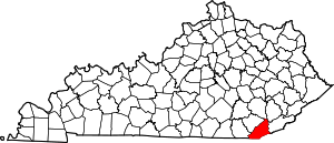 | |
| Unincorporated communities |
| |
| Ghost towns | ||
| Footnotes | ‡This populated place also has portions in an adjacent county or counties | |
Municipalities and communities of Claiborne County, Tennessee, United States | ||
|---|---|---|
| City | ||
| Towns | ||
| Unincorporated communities | ||
| Footnotes | ‡This populated place also has portions in an adjacent county or counties | |
This article is issued from
Wikipedia.
The text is licensed under Creative Commons - Attribution - Sharealike.
Additional terms may apply for the media files.