Princeton Township, White County, Indiana
| Princeton Township | |
|---|---|
| Township | |
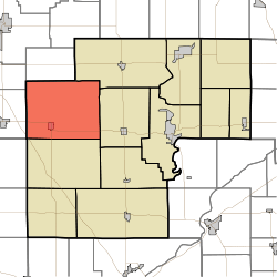 Location in White County | |
| Coordinates: 40°47′13″N 87°00′54″W / 40.78694°N 87.01500°WCoordinates: 40°47′13″N 87°00′54″W / 40.78694°N 87.01500°W | |
| Country | United States |
| State | Indiana |
| County | White |
| Government | |
| • Type | Indiana township |
| Area | |
| • Total | 62.53 sq mi (162.0 km2) |
| • Land | 62.53 sq mi (162.0 km2) |
| • Water | 0 sq mi (0 km2) 0% |
| Elevation | 692 ft (211 m) |
| Population (2010) | |
| • Total | 1,553 |
| • Density | 24.8/sq mi (9.6/km2) |
| ZIP codes | 47959, 47980, 47995 |
| GNIS feature ID | 453777 |
Princeton Township is one of twelve townships in White County, Indiana, United States. As of the 2010 census, its population was 1,553 and it contained 644 housing units.[1]
Princeton Township was organized in 1844, and named after the ship on which an early settler had immigrated to America.[2]
Geography
According to the 2010 census, the township has a total area of 62.53 square miles (162.0 km2), all land.[1]
Cities, towns, villages
Unincorporated towns
(This list is based on USGS data and may include former settlements.)
Adjacent townships
- Milroy Township, Jasper County (north)
- Monon Township (northeast)
- Honey Creek Township (east)
- West Point Township (south)
- Gilboa Township, Benton County (southwest)
- Carpenter Township, Jasper County (west)
- Jordan Township, Jasper County (west)
Cemeteries
The township contains these five cemeteries: Apostolic, Dobbins, Palestine, Palestine and Wolcott.
Airports and landing strips
- Wolcott Community Airport
School districts
- Tri-County School Corporation
Political districts
- Indiana's 4th congressional district
- State House District 16
- State Senate District 07
References
- United States Census Bureau 2007 TIGER/Line Shapefiles
- United States Board on Geographic Names (GNIS)
- IndianaMap
- 1 2 "Population, Housing Units, Area, and Density: 2010 - County -- County Subdivision and Place -- 2010 Census Summary File 1". United States Census. Retrieved 2013-05-10.
- ↑ Hamelle, W. H. (1915). A Standard History of White County, Indiana: An Authentic Narrative of the Past, with an Extended Survey of Modern Developments in the Progress of Town and Country. Unigraphic. p. 254.
External links
Municipalities and communities of White County, Indiana, United States | ||
|---|---|---|
| City | ||
| Towns | ||
| Townships | ||
| CDPs | ||
| Other unincorporated communities | ||
This article is issued from
Wikipedia.
The text is licensed under Creative Commons - Attribution - Sharealike.
Additional terms may apply for the media files.