Cass Township, White County, Indiana
| Cass Township | |
|---|---|
| Township | |
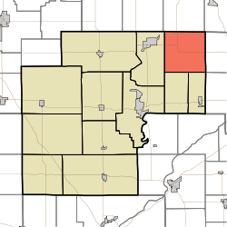 Location in White County | |
| Coordinates: 40°52′11″N 86°38′20″W / 40.86972°N 86.63889°WCoordinates: 40°52′11″N 86°38′20″W / 40.86972°N 86.63889°W | |
| Country | United States |
| State | Indiana |
| County | White |
| Government | |
| • Type | Indiana township |
| Area | |
| • Total | 36.19 sq mi (93.7 km2) |
| • Land | 36.19 sq mi (93.7 km2) |
| • Water | 0 sq mi (0 km2) 0% |
| Elevation | 696 ft (212 m) |
| Population (2010) | |
| • Total | 585 |
| • Density | 16.2/sq mi (6.3/km2) |
| ZIP codes | 46978, 46985, 47926, 47950, 47960 |
| GNIS feature ID | 453169 |
Cass Township is one of twelve townships in White County, Indiana, United States. As of the 2010 census, its population was 585 and it contained 228 housing units.[1]
Cass Township was established in 1848.[2] The township was named for Gen. Lewis Cass, Governor of Michigan Territory.[3]
Geography
According to the 2010 census, the township has a total area of 36.19 square miles (93.7 km2), all land.[1]
Unincorporated towns
- Bell Center at 40°52′07″N 86°38′21″W / 40.868651°N 86.639176°W
- Headlee at 40°53′52″N 86°39′31″W / 40.897818°N 86.658621°W
(This list is based on USGS data and may include former settlements.)
Adjacent townships
- Indian Creek Township, Pulaski County (north)
- Van Buren Township, Pulaski County (northeast)
- Boone Township, Cass County (east)
- Jefferson Township, Cass County (southeast)
- Jackson Township (south)
- Lincoln Township (south)
- Liberty Township (west)
Cemeteries
The township contains Bell Center Cemetery.
School districts
- Pioneer Regional School Corporation
- Twin Lakes School Corporation
Political districts
- Indiana's 2nd congressional district
- State House District 16
- State Senate District 07
References
- United States Census Bureau 2007 TIGER/Line Shapefiles
- United States Board on Geographic Names (GNIS)
- IndianaMap
- 1 2 "Population, Housing Units, Area, and Density: 2010 - County -- County Subdivision and Place -- 2010 Census Summary File 1". United States Census. Retrieved 2013-05-10.
- ↑ Hamelle, W. H. (1915). A Standard History of White County, Indiana: An Authentic Narrative of the Past, with an Extended Survey of Modern Developments in the Progress of Town and Country. Unigraphic. p. 273.
- ↑ "Pioneer Consolidated School How It Gets Its Name". The Royal Centre Record. April 21, 1961. p. 1. Retrieved 1 May 2015.
External links
Municipalities and communities of White County, Indiana, United States | ||
|---|---|---|
| City | ||
| Towns | ||
| Townships | ||
| CDPs | ||
| Other unincorporated communities | ||
This article is issued from
Wikipedia.
The text is licensed under Creative Commons - Attribution - Sharealike.
Additional terms may apply for the media files.