Honey Creek Township, White County, Indiana
| Honey Creek Township | |
|---|---|
| Township | |
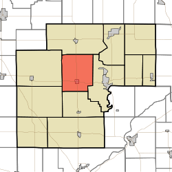 Location in White County | |
| Coordinates: 40°46′21″N 86°52′22″W / 40.77250°N 86.87278°WCoordinates: 40°46′21″N 86°52′22″W / 40.77250°N 86.87278°W | |
| Country | United States |
| State | Indiana |
| County | White |
| Government | |
| • Type | Indiana township |
| Area | |
| • Total | 42.36 sq mi (109.7 km2) |
| • Land | 42.35 sq mi (109.7 km2) |
| • Water | 0.01 sq mi (0.03 km2) 0.02% |
| Elevation | 686 ft (209 m) |
| Population (2010) | |
| • Total | 1,162 |
| • Density | 27.4/sq mi (10.6/km2) |
| ZIP codes | 47959, 47960, 47980 |
| GNIS feature ID | 453418 |
Honey Creek Township is one of twelve townships in White County, Indiana, United States. As of the 2010 census, its population was 1,162 and it contained 509 housing units.[1]
Honey Creek Township was organized in 1855.[2] The township took its name from Honey Creek.[3]
Geography
According to the 2010 census, the township has a total area of 42.36 square miles (109.7 km2), of which 42.35 square miles (109.7 km2) (or 99.98%) is land and 0.01 square miles (0.026 km2) (or 0.02%) is water.[1]
Cities, towns, villages
Adjacent townships
- Monon Township (north)
- Union Township (east)
- Big Creek Township (south)
- West Point Township (southwest)
- Princeton Township (west)
Cemeteries
The township contains these two cemeteries: Bunnell and Swisher.
Airports and landing strips
- Klopfenstein Airport
School districts
- North White School Corporation
Political districts
- Indiana's 4th congressional district
- State House District 16
- State Senate District 07
References
- United States Census Bureau 2007 TIGER/Line Shapefiles
- United States Board on Geographic Names (GNIS)
- IndianaMap
- 1 2 "Population, Housing Units, Area, and Density: 2010 - County -- County Subdivision and Place -- 2010 Census Summary File 1". United States Census. Retrieved 2013-05-10.
- ↑ Hamelle, W. H. (1915). A Standard History of White County, Indiana: An Authentic Narrative of the Past, with an Extended Survey of Modern Developments in the Progress of Town and Country. Unigraphic. p. 249.
- ↑ Counties of White and Pulaski, Indiana: Historical and Biographical. F.A. Battey & Company. 1883. p. 126.
External links
Municipalities and communities of White County, Indiana, United States | ||
|---|---|---|
| City | ||
| Towns | ||
| Townships | ||
| CDPs | ||
| Other unincorporated communities | ||
This article is issued from
Wikipedia.
The text is licensed under Creative Commons - Attribution - Sharealike.
Additional terms may apply for the media files.