Powers Township, Cass County, Minnesota
| Powers Township, Minnesota | |
|---|---|
| Township | |
 Powers Township, Minnesota Location within the state of Minnesota | |
| Coordinates: 46°50′55″N 94°28′15″W / 46.84861°N 94.47083°WCoordinates: 46°50′55″N 94°28′15″W / 46.84861°N 94.47083°W | |
| Country | United States |
| State | Minnesota |
| County | Cass |
| Area | |
| • Total | 35.3 sq mi (91.5 km2) |
| • Land | 28.7 sq mi (74.3 km2) |
| • Water | 6.6 sq mi (17.2 km2) |
| Elevation | 1,329 ft (405 m) |
| Population (2000) | |
| • Total | 918 |
| • Density | 32.0/sq mi (12.4/km2) |
| Time zone | UTC-6 (Central (CST)) |
| • Summer (DST) | UTC-5 (CDT) |
| FIPS code | 27-52252[1] |
| GNIS feature ID | 0665348[2] |
Powers Township is a township in Cass County, Minnesota, United States. The population was 918 at the 2000 census.[3] Powers Township was named for Gorham Powers, a Minnesota politician who owned land there.[4]
Geography
According to the United States Census Bureau, the township has a total area of 35.3 square miles (91.5 km²), of which 28.7 square miles (74.3 km²) is land and 6.7 square miles (17.2 km²) (18.83%) is water.
The city of Backus is located entirely within Powers Township geographically but is a separate entity.
Major highways
Lakes
- Bass Lake
- Beuber Lake
- Big Portage Lake
- Blind Lake (southwest half)
- Bowen Lake (vast majority)
- Brookway Lake
- Crooked Lake
- Fawn Lake
- Four Point Lake
- Horseshoe Lake
- Island Lake
- Johnson Lake
- Lindsey Lake
- Little Boy Lake (southwest half)
- Loon Lake
- Mud Lake (west three-quarters)
- Ox Yoke Lake
- Pickerel Lake
- Pine Mountain Lake (east half)
- Rainy Lake
- Rice Portage Lake (west half)
- Round Lake (southwest half)
- Sanborn Lake
- Swede Lake
- Tamarack Lake
- Twin Lakes
- Willard Lake
Adjacent townships
- Birch Lake Township (north)
- Woodrow Township (northeast)
- Ponto Lake Township (east)
- Barclay Township (southeast)
- Pine River Township (south)
- Bull Moose Township (southwest)
- Deerfield Township (west)
- Hiram Township (northwest)
Cemeteries
The township contains Evergreen Cemetery.
Demographics
At the 2000 census,[1] there were 918 people, 340 households and 239 families residing in the township. The population density was 32.0 per square mile (12.4/km²). There were 800 housing units at an average density of 27.9/sq mi (10.8/km²). The racial makeup of the township was 98.04% White, 0.11% African American, 1.42% Native American, 0.11% from other races, and 0.33% from two or more races.
There were 340 households of which 24.7% had children under the age of 18 living with them, 58.8% were married couples living together, 6.8% had a female householder with no husband present, and 29.7% were non-families. 24.4% of all households were made up of individuals and 11.5% had someone living alone who was 65 years of age or older. The average household size was 2.41 and the average family size was 2.81.
Age distribution was 20.3% under the age of 18, 4.7% from 18 to 24, 19.2% from 25 to 44, 28.0% from 45 to 64, and 27.9% who were 65 years of age or older. The median age was 49 years. For every 100 females, there were 93.3 males. For every 100 females age 18 and over, there were 88.7 males.
The median household income was $40,547, and the median family income was $44,028. Males had a median income of $28,250 versus $21,125 for females. The per capita income for the township was $16,140. About 6.6% of families and 13.6% of the population were below the poverty line, including 12.1% of those under age 18 and 24.9% of those age 65 or over.
References
- United States National Atlas
- United States Census Bureau 2007 TIGER/Line Shapefiles
- United States Board on Geographic Names (GNIS)
- 1 2 "American FactFinder". United States Census Bureau. Retrieved 2008-01-31.
- ↑ "US Board on Geographic Names". United States Geological Survey. 2007-10-25. Retrieved 2008-01-31.
- ↑ United States Census Bureau American FactFinder - Powers Township total population
- ↑ Upham, Warren (1920). Minnesota Geographic Names: Their Origin and Historic Significance. Minnesota Historical Society. p. 92.
Municipalities and communities of Cass County, Minnesota, United States | ||
|---|---|---|
| Cities | 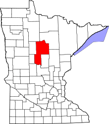 | |
| Townships |
| |
| Unorganized territories | ||
| CDP | ||
| Unincorporated communities | ||
| Indian reservation | ||
| Ghost town | ||
| Footnotes | ‡This populated place also has portions in an adjacent county or counties | |