Mae, Minnesota
| Mae, Minnesota | |
|---|---|
| Unincorporated community | |
 Mae, Minnesota Location of the community of Mae within Beulah Township, Cass County  Mae, Minnesota Mae, Minnesota (the US) | |
| Coordinates: 46°49′56″N 93°51′56″W / 46.83222°N 93.86556°WCoordinates: 46°49′56″N 93°51′56″W / 46.83222°N 93.86556°W | |
| Country | United States |
| State | Minnesota |
| County | Cass |
| Township | Beulah Township |
| Elevation | 1,302 ft (397 m) |
| Time zone | UTC-6 (Central (CST)) |
| • Summer (DST) | UTC-5 (CDT) |
| ZIP code | 56662 |
| Area code(s) | 218 |
| GNIS feature ID | 657279[1] |
Mae is an unincorporated community in Beulah Township, Cass County, Minnesota, United States, near Outing and Emily. It is along Cass County Road 58 near Morrison Lake Road NE.
References
Municipalities and communities of Cass County, Minnesota, United States | ||
|---|---|---|
| Cities | 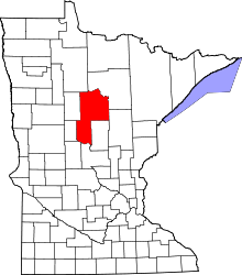 | |
| Townships |
| |
| Unorganized territories | ||
| CDP | ||
| Unincorporated communities | ||
| Indian reservation | ||
| Ghost town | ||
| Footnotes | ‡This populated place also has portions in an adjacent county or counties | |
This article is issued from
Wikipedia.
The text is licensed under Creative Commons - Attribution - Sharealike.
Additional terms may apply for the media files.