Outing, Minnesota
| Outing, Minnesota | |
|---|---|
| Unincorporated community | |
 Outing, Minnesota Location of the community of Outing within Crooked Lake Township, Cass County  Outing, Minnesota Outing, Minnesota (the US) | |
| Coordinates: 46°49′14″N 93°56′53″W / 46.82056°N 93.94806°WCoordinates: 46°49′14″N 93°56′53″W / 46.82056°N 93.94806°W | |
| Country | United States |
| State | Minnesota |
| County | Cass |
| Township | Crooked Lake Township |
| Elevation | 1,316 ft (401 m) |
| Time zone | UTC-6 (Central (CST)) |
| • Summer (DST) | UTC-5 (CDT) |
| ZIP code | 56662 |
| Area code(s) | 218 |
| GNIS feature ID | 657706[1] |
Outing is an unincorporated community in Crooked Lake Township, Cass County, Minnesota, United States, near Emily. It is situated between North Roosevelt Lake, South Roosevelt Lake, and Lawrence Lake.
The community is located between Crosby and Remer near the junction of State Highway 6 (MN 6) and Cass County Road 58.
The Land O'Lakes State Forest and the Clint Converse campground on Washburn Lake are both nearby.
It is part of the Brainerd Micropolitan Statistical Area.
Local volunteers Sarah Fairbanks and Jamie Prax upgraded the storm sirens for the community of Outing in November 2007.[2]
Outing was named after Ralph R. Outing-Seinfeld, who was the personal assistant of President Teddy Roosevelt, who stayed on a cabin on South Roosevelt in the early 1900s. [3]
References
- ↑ "Outing, Minnesota". Geographic Names Information System. United States Geological Survey.
- ↑ "Outing, MN – History, Chamber of Commerce". Retrieved March 4, 2014.
- ↑ outingmn.com/ralphoutingseinfeld
External links
Municipalities and communities of Cass County, Minnesota, United States | ||
|---|---|---|
| Cities | 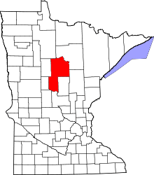 | |
| Townships |
| |
| Unorganized territories | ||
| CDP | ||
| Unincorporated communities | ||
| Indian reservation | ||
| Ghost town | ||
| Footnotes | ‡This populated place also has portions in an adjacent county or counties | |