Porteirão
| Porteirão | |
|---|---|
| Municipality | |
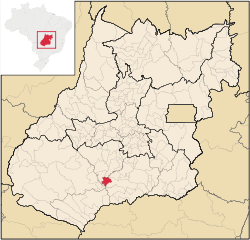 Location in Goiás state | |
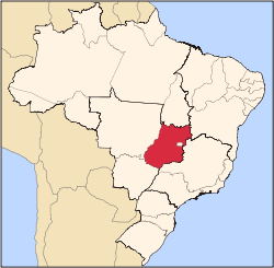
 Porteirão Location in Brazil | |
| Coordinates: 17°49′10″S 50°08′34″W / 17.81944°S 50.14278°WCoordinates: 17°49′10″S 50°08′34″W / 17.81944°S 50.14278°W | |
| Country |
|
| Region | Central-West Region |
| State | Goiás |
| Microregion | Meia Ponte Microregion |
| Area | |
| • Total | 603.9 km2 (233.2 sq mi) |
| Elevation | 470 m (1,540 ft) |
| Population (2007) | |
| • Total | 3,008 |
| • Density | 5.0/km2 (13/sq mi) |
| Time zone | BRT/BRST (UTC-3/-2) |
| Postal code | 75603-000 |
Porteirão is a municipality in south Goiás state, Brazil.
Geographical Information
Porteirão is located in the Meia Ponte Microregion in the Rio dos Bois basin. It is connected by a state highway (27 km.) with the BR-452 highway, which connects Rio Verde with Itumbiara.
The distance to the state capital, Goiânia, is 178 km. Highway connections from Goiânia are made by GO-040 / Aragoiânia / Cromínia / GO-319 / Pontalina / GO-040 / Aloândia / BR-452 / Bom Jesus de Goiás / GO-410. For the complete list of all distances in Goiás see Seplan
Neighboring municipalities are:
- north: Acreúna
- south: Goiatuba
- east: Vicentópolis and Goiatuba
- west: Santa Helena de Goiás
Political Information
- Mayor: Pedro Augusto dos Reis (January 2005 to January 2009)
Demographics
- Population density: 4.98 inhab/km² (2007)
- Urban population: 2,726(2007)
- Rural population: 282 (2007)
- Population growth or loss: 0.91% from 2000/2007
The economy
The economy is based on agriculture, cattle raising, services, public administration, and small transformation industries.
- Industrial units: 2 (2006)
- Commercial units: 45 (2006)
- Cattle herd: 24,280 head (2006)
- Main crops (2006): cotton, rice, sugarcane (13,000 hectares), beans, soybeans (18,000 hectares), sorghum, and corn.
- People employed in agriculture: 1,670
- Number of farming establishments: 43
- Area of the farming establishments: 27,367 ha.
- Area in planted crops: 17,500 ha.
- Farming establishments with tractors: 14
Education (2006)
- Schools: 2 with 821 students
- Higher education: none
- Adult literacy rate: 80.4% (2000) (national average was 86.4%)
Health (2007)
- Hospitals: 0
- Hospital beds: 0
- Ambulatory clinics: 1
- Infant mortality rate: 27.9 (2000) (national average was 33.0).
Qualtity of Life
The municipality achieved a score of 0.724 on the United Nations Human Development Index (2000), ranking it 162 out of 242 municipalities in the state of Goiás. For the complete list see Frigoletto.com
See also
References
Capital: Goiânia | |||||||||||||||||
|  | ||||||||||||||||
|
| |||||||||||||||||
| |||||||||||||||||
| |||||||||||||||||