Firminópolis
| Firminópolis | |
|---|---|
| Municipality | |
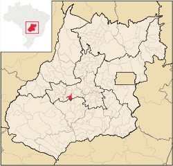 Location in Goiás state | |
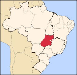
 Firminópolis Location in Brazil | |
| Coordinates: 16°34′56″S 50°18′06″W / 16.58222°S 50.30167°WCoordinates: 16°34′56″S 50°18′06″W / 16.58222°S 50.30167°W | |
| Country |
|
| Region | Central-West Region |
| State | Goiás |
| Microregion | Anicuns Microregion |
| Area | |
| • Total | 407.5 km2 (157.3 sq mi) |
| Elevation | 685 m (2,247 ft) |
| Population (2007) | |
| • Total | 10,286 |
| • Density | 25/km2 (65/sq mi) |
| Time zone | BRT/BRST (UTC-3/-2) |
| Postal code | 76105-000 |
Firminópolis is a municipality in eastern Goiás state, Brazil.
Location and connections
- Distance to São Luís de Montes Belos: 9 km.
Highway connections with Goiânia are made by state highway BR-069 west from Goiânia, through Trindade, Santa Bárbara de Goiás, Turvânia, and then 19 kilometers west to Firminópolis. Neighboring municipalities are Turvânia, Aurilândia, and Turvânia.
Demographic data
- Population growth rate 2000/2007: 0.53%
- Urban population in 2007: 8,212
- Rural population in 2007: 2,074
Economic data
The main economic activities were small transformation industries, goods and services, and agricultural production. There were 02 banking institutions: Banco do Brasil S.A. - Banco Itaú S.A. (08/2007) There was 01 dairy: Manoel Pereira Peixoto (05/2006). The cattle herd had 55,0000 head (2006) and the main crops were rice, corn, soybeans, manioc, hearts of palm, and bananas.
Education and health
- Literacy rate: 84.1%
- Infant mortality rate: 18.35 in 1,000 live births
- Schools: 08 (2006)
- Students: 2,382
- Hospitals: 03 (2007) with 69 beds.
- MHDI: 0.744
- State ranking: 91 (out of 242 municipalities in 2002)
- National ranking: 2,039 (out of 5,507 municipalities in 2002)
For the complete list see frigoletto.com.br.
See also
References
Capital: Goiânia | |||||||||||||||||
|  | ||||||||||||||||
|
| |||||||||||||||||
| |||||||||||||||||
| |||||||||||||||||