Guarani de Goiás
| Guarani de Goiás | |
|---|---|
| Municipality | |
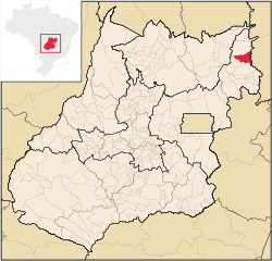 Location in Goiás state | |
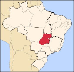
 Guarani de Goiás Location in Brazil | |
| Coordinates: 13°56′23″S 46°28′38″W / 13.93972°S 46.47722°WCoordinates: 13°56′23″S 46°28′38″W / 13.93972°S 46.47722°W | |
| Country |
|
| Region | Central-West Region |
| State | Goiás |
| Microregion | Vão do Paranã |
| Area | |
| • Total | 1,229.1 km2 (474.6 sq mi) |
| Elevation | 521 m (1,709 ft) |
| Population (2007) | |
| • Total | 4,105 |
| • Density | 3.3/km2 (8.7/sq mi) |
| Time zone | BRT/BRST (UTC-3/-2) |
| Postal code | 73910-000 |
Guarani de Goiás is a municipality in eastern Goiás state, Brazil. Guarani is a very poor municipality in the northeast of the state.
Geography
Guarani belongs to the Vão do Paranã statistical microregion. There are municipal boundaries with São Domingos, Iaciara, Posse, and the state of Bahia
Guarani is located south of the Terra Ronca state park (Terra Ronca) and 28 kilometers north of Posse. It is 35 kilometers to the important BR-020 highway, which links Brasília to Salvador. Guarani is crossed by the Frei River, which has one of the most beautiful waterfalls in the region. For a map of the waterfall see Terraronca
The distance to Goiânia is 550 km. Connections are made by taking BR-153 / Anápolis / GO-060 / Alexânia / Planaltina / Formosa / GO-020 / BR-030 / Vila Boa / Alvorada do Norte / GO-108 / Posse.[1]
Demographics
- Population density: 3.34 inhab/km²
- Population in 1980: 3,978
- Population in 2007: 4,105
- Urban population: 1,743
- Rural population: 2,362
- Population growth rate: -1.28%
Economy
The main economic activities are cattle raising, poultry raising, and agriculture (beans, manioc corn, and bananas). There were no hospitals in 2007.
- Industrial units: 1
- Retail commercial units: 30
- Motor vehicles (automobiles and pickup trucks): 146
- Number of inhabitants per motor vehicle: 28
Agricultural data 2006
- Farms: 550
- Total area: 165,143 ha.
- Area of permanent crops: 149 ha.
- Area of perennial crops: 1,713 ha.
- Area of pasture: 106,927 ha.
- Area of woodland and forests: 53,907 ha.
- Persons dependent on farming: 1,750
- Cattle herd: 55,200
- Corn: 450 ha.
- Sugarcane: 80 ha.
- Rice: 450 ha.
- Beans: 60 ha.
- Manioc: 60 ha.[2]
Health and education
Ranking on the Municipal Human Development Index: 0.632
History
The town was first created as a district of the municipality of São Domingos with the name of Guarani in 1919. In 1943 the name was changed to Coatiçaba. In 1963 it was dismembered from São Domingos and formed a new municipality with the name Guarani de Goiás.
See also
References
- ↑ Transporte Archived 2009-02-05 at the Wayback Machine.
- ↑ IBGE
- ↑ Frigoletto.com Archived 2006-05-19 at the Wayback Machine.
- ↑ Sepin Archived 2007-01-15 at the Wayback Machine.
Capital: Goiânia | |||||||||||||||||
|  | ||||||||||||||||
|
| |||||||||||||||||
| |||||||||||||||||
| |||||||||||||||||