Port-Salut Airport
| Port-Salut Airport | |||||||||||
|---|---|---|---|---|---|---|---|---|---|---|---|
| Summary | |||||||||||
| Airport type | Public | ||||||||||
| Serves | Port-Salut | ||||||||||
| Elevation AMSL | 42 ft / 13 m | ||||||||||
| Coordinates | 18°03′52″N 73°54′45″W / 18.06444°N 73.91250°WCoordinates: 18°03′52″N 73°54′45″W / 18.06444°N 73.91250°W | ||||||||||
| Map | |||||||||||
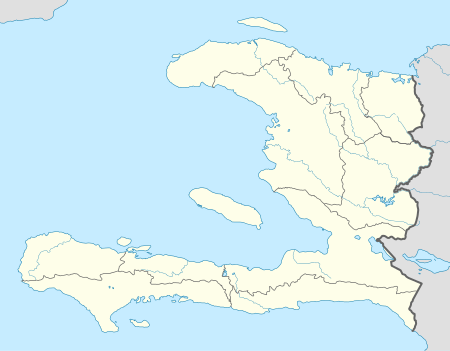 Port-Salut Location of the airport in Haiti | |||||||||||
| Runways | |||||||||||
| |||||||||||
Port-Salut Airport is an airport serving Port-Salut, a coastal commune in the Sud Department of Haiti.
The runway is 3.5 kilometres (2.2 mi) southeast of the town and runs from the shore inland to Departmental Rte 25.
See also

- Transport in Haiti
- List of airports in Haiti
References
- ↑ Airport information for MUMG at Great Circle Mapper.
- ↑ "Google Maps". Retrieved 4 October 2016.
External links
This article is issued from
Wikipedia.
The text is licensed under Creative Commons - Attribution - Sharealike.
Additional terms may apply for the media files.